Category:September 2005 in North Yorkshire
Jump to navigation
Jump to search
Ceremonial counties of England: Bedfordshire · Berkshire · Buckinghamshire · Cambridgeshire · Cheshire · Cornwall · Cumbria · Derbyshire · Devon · Dorset · Durham · East Riding of Yorkshire · East Sussex · Essex · Gloucestershire · Greater London · Greater Manchester · Hampshire · Herefordshire · Hertfordshire · Isle of Wight · Kent · Lancashire · Leicestershire · Lincolnshire · Merseyside · Norfolk · North Yorkshire · Northamptonshire · Northumberland · Nottinghamshire · Oxfordshire · Rutland · Shropshire · Somerset · South Yorkshire · Staffordshire · Suffolk · Surrey · Tyne and Wear · Warwickshire · West Midlands · West Sussex · West Yorkshire · Wiltshire · Worcestershire
City-counties: Bristol ·
Former historic counties:
Other former counties:
City-counties: Bristol ·
Former historic counties:
Other former counties:
Deutsch: Bilder, die im September 2005 in North Yorkshire aufgenommen worden sind. Bitte beachten Sie, dass dies weder das Datum des Uploads noch das Datum des Scannens eines Fotos ist.
English: Images/pictures taken in North Yorkshire during September 2005. Note this is not the date of the upload, nor the date a photo was scanned.
Español: Fotografías o imágenes tomadas en North Yorkshire durante septiembre 2005. No es la fecha de subida ni escaneo, sino la fecha en que las fotografías o imágenes se crearon.
Esperanto: Bildoj faritaj en North Yorkshire en septembro 2005. Tio ne estas la dato, kiam la bildoj estis alŝutitaj aŭ skanitaj.
Français : Photographies ou images prises en North Yorkshire durant septembre 2005. Ce n'est pas la date du téléchargement ou du scan.
Galego: Fotografías ou imaxes tomadas en North Yorkshire durante setembro 2005. Non é a data de subida nin escaneamento, senón a data na que se crearon as fotografías ou imaxes.
Italiano: Fotografie o immagini scattate a North Yorkshire nel settembre 2005. Nota bene: la data non si riferisce né a quella di upload né a quella in cui la foto è stata digitalizzata.
Norsk bokmål: Bilder tatt i North Yorkshire i løpet av september 2005. Merk at dette ikke er datoen for opplasting, eller når et bilde har blitt skannet.
Norsk nynorsk: Bilete teke i North Yorkshire i løpet av september 2005. Merk at dette ikkje er datoen for opplasting, eller når eit bilete har vorte skanna.
Русский: Изображения, сделанные в North Yorkshire в течение сентябрь 2005 (не дата загрузки изображения).
Українська: Зображення, зроблені в North Yorkshire протягом вересень 2005. Зауважте, що це не дата завантаження чи дата сканування фотографії.
| September 2004 | ← | September 2005 | → | September 2006 | |||||||
| Jan | Feb | Mar | Apr | May | Jun | Jul | Aug | Sep | Oct | Nov | Dec |
| 7 | 14 | 23 | 48 | 49 | 93 | 85 | 121 | 72 | 74 | 62 | 71 |
|---|---|---|---|---|---|---|---|---|---|---|---|
Subcategories
This category has only the following subcategory.
Y
Media in category "September 2005 in North Yorkshire"
The following 71 files are in this category, out of 71 total.
-
 Scargill House, balcony - geograph.org.uk - 888209.jpg 640 × 480; 74 KB
-
 Scargill House, courtyard - geograph.org.uk - 888211.jpg 640 × 480; 83 KB
-
 A64 near Fulford - geograph.org.uk - 414575.jpg 640 × 479; 145 KB
-
 Abandoned Railway at Threshfield - geograph.org.uk - 49242.jpg 640 × 480; 75 KB
-
 Airton Green - geograph.org.uk - 48818.jpg 640 × 451; 106 KB
-
 Boundary stone on Weston Moor - geograph.org.uk - 55986.jpg 640 × 480; 131 KB
-
 Boundary Stone, Green Howe - geograph.org.uk - 54643.jpg 640 × 480; 83 KB
-

-
 Carr Top trig point, Weston Moor - geograph.org.uk - 55985.jpg 640 × 480; 130 KB
-
 Dead tree - geograph.org.uk - 414579.jpg 640 × 479; 114 KB
-

-
 Fangdale Beck - geograph.org.uk - 54167.jpg 640 × 480; 87 KB
-

-
 Filey brig - panoramio.jpg 2,048 × 1,536; 736 KB
-
 Fir Tree Farm - geograph.org.uk - 59049.jpg 640 × 479; 128 KB
-
 Fountains Abbey - geograph.org.uk - 332962.jpg 640 × 471; 87 KB
-
 Fountains Abbey - geograph.org.uk - 332966.jpg 600 × 424; 93 KB
-
 Foxton Bridge, River Leven - geograph.org.uk - 52665.jpg 640 × 480; 158 KB
-
 Harrogate Station - geograph.org.uk - 57339.jpg 640 × 480; 95 KB
-
 Hellifield Station at Sunset. - geograph.org.uk - 54781.jpg 640 × 480; 79 KB
-
 Heslington Tillmire - geograph.org.uk - 59047.jpg 640 × 479; 116 KB
-
 HighBentham.jpg 640 × 480; 130 KB
-
 Holy Trinity Church, Skipton - geograph.org.uk - 609067.jpg 640 × 480; 99 KB
-
 Improved Pasture, Low Thwaites - geograph.org.uk - 54151.jpg 640 × 480; 67 KB
-
 Kilburn white horse, the classic view - geograph.org.uk - 269113.jpg 640 × 480; 80 KB
-
 Lambert Lane - geograph.org.uk - 53103.jpg 640 × 480; 126 KB
-
 Large farmhouse - geograph.org.uk - 54602.jpg 640 × 480; 97 KB
-
 Lone tree - geograph.org.uk - 414582.jpg 640 × 479; 98 KB
-

-
 Lovely Countryside - geograph.org.uk - 56578.jpg 640 × 480; 146 KB
-
 The footpath to Middlesmoor - geograph.org.uk - 50145.jpg 640 × 466; 83 KB
-
 Myers Garage - geograph.org.uk - 56608.jpg 640 × 480; 124 KB
-
 Nappa Cross - geograph.org.uk - 53094.jpg 640 × 480; 118 KB
-
 Old and Tatty - geograph.org.uk - 56581.jpg 480 × 640; 156 KB
-
 ParcevallHall(JohnSTurner)Sep2005.jpg 586 × 425; 166 KB
-
 Pasture west of Denton - geograph.org.uk - 55994.jpg 640 × 480; 152 KB
-
 Pathside Plaque - geograph.org.uk - 50162.jpg 480 × 640; 98 KB
-
 Phone Box, Gayle - geograph.org.uk - 76811.jpg 640 × 480; 95 KB
-
 Plantation Corner from Barker's Ridge - geograph.org.uk - 54647.jpg 640 × 480; 77 KB
-
 Ploughing, Mark Hill - geograph.org.uk - 54178 (cropped).jpg 571 × 214; 30 KB
-
 Ploughing, Mark Hill - geograph.org.uk - 54178.jpg 640 × 480; 76 KB
-
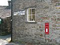 Post Box and Road Sign, Gayle - geograph.org.uk - 76810.jpg 640 × 480; 90 KB
-
 Radar Station, RAF Fylingdales - geograph.org.uk - 384147.jpg 640 × 480; 63 KB
-
 RAF Menwith Hill - geograph.org.uk - 56587.jpg 640 × 480; 76 KB
-
 Raisdale - geograph.org.uk - 67225.jpg 640 × 480; 64 KB
-
 Richmond Station in 2005 (1) (geograph 2625603).jpg 1,024 × 683; 201 KB
-
 Richmond Station in 2005 (2) (geograph 2625619).jpg 1,024 × 683; 201 KB
-
 River Derwent, Buttercrambe - geograph.org.uk - 238320.jpg 640 × 480; 105 KB
-
 RiverSkirfare.jpg 640 × 480; 124 KB
-

-
 St Helen's parish church, Denton - geograph.org.uk - 55992.jpg 640 × 480; 178 KB
-
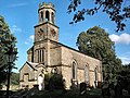
 St Mary's church in Kettlewell - geograph.org.uk - 347645.jpg 600 × 450; 74 KB
-
 Stackyard Staddle Stones, Dale Head - geograph.org.uk - 55068.jpg 640 × 480; 87 KB
-
 Straw bales - geograph.org.uk - 414557.jpg 640 × 479; 116 KB
-
 Straw Bales - Lime Field Farm - geograph.org.uk - 52476.jpg 640 × 479; 126 KB
-
 Surveying Tower, Hardcastle Moor - geograph.org.uk - 51411.jpg 480 × 640; 93 KB
-
 Towards Fulford - geograph.org.uk - 53291.jpg 640 × 479; 111 KB
-
 Towards the A64 - geograph.org.uk - 1559059.jpg 640 × 479; 117 KB
-
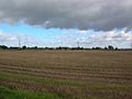
 Tractors working - geograph.org.uk - 414553.jpg 640 × 479; 120 KB
-
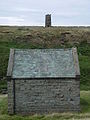
 Triangulation Point - geograph.org.uk - 57100.jpg 640 × 480; 89 KB
-

-
 Village Pond, Rylstone.jpg 640 × 467; 95 KB
-
 Walling, Green Side - geograph.org.uk - 52937.jpg 640 × 480; 101 KB
-
 Weets Top cross - geograph.org.uk - 49017.jpg 480 × 640; 99 KB
-
 Wheat Beck - geograph.org.uk - 52939.jpg 640 × 480; 71 KB
-
 Whitby - geograph.org.uk - 292847.jpg 640 × 429; 98 KB
-
 Whitby Harbour entrance - geograph.org.uk - 385415.jpg 640 × 480; 66 KB
-
 Wood's Farm - geograph.org.uk - 57118.jpg 640 × 480; 52 KB
-
 Bookil Gill - geograph.org.uk - 53081.jpg 640 × 480; 104 KB
-
 Pinchinthorp Cycleway - geograph.org.uk - 57606.jpg 640 × 480; 94 KB
-


Sep2005.jpg)


_(geograph_2625603).jpg)
_(geograph_2625619).jpg)


.jpg)