Category:Selmar Siebert
Jump to navigation
Jump to search
German engraver | |||||
| Upload media | |||||
| Date of birth | 4 September 1808 Lehnin | ||||
|---|---|---|---|---|---|
| Date of death | 1885 | ||||
| Occupation | |||||
| Child | |||||
| Work location | |||||
| |||||
Media in category "Selmar Siebert"
The following 45 files are in this category, out of 45 total.
-

-

-
 Amtlicher Stadtplan von Hamburg 1868 detail.jpg 5,210 × 3,525; 4.23 MB
-
 Amtlicher Stadtplan von Hamburg 1868.jpg 3,900 × 2,700; 6.73 MB
-

-

-

-

-
 From Fort Smith to the Rio Grande - from explorations and surveys LOC 98688420.jpg 16,160 × 7,040; 12.68 MB
-
 From Fort Smith to the Rio Grande - from explorations and surveys LOC 98688420.tif 16,160 × 7,040; 325.49 MB
-
 From Great Salt Lake to the Humboldt Mountains. LOC 98688430.jpg 5,521 × 6,283; 4.41 MB
-
 From Great Salt Lake to the Humboldt Mountains. LOC 98688430.tif 5,521 × 6,283; 99.24 MB
-

-

-
 From the Humboldt Mountains to the Mud Lakes. LOC 98688431.jpg 5,567 × 6,319; 5.13 MB
-
 From the Humboldt Mountains to the Mud Lakes. LOC 98688431.tif 5,567 × 6,319; 100.64 MB
-

-

-
 From the Rio Grande to the Pacific Ocean - from explorations and surveys LOC 98688421.jpg 15,389 × 6,949; 13.28 MB
-
 From the Rio Grande to the Pacific Ocean - from explorations and surveys LOC 98688421.tif 15,389 × 6,949; 305.95 MB
-

-
 From the valley of Green River to the Great Salt Lake. LOC 98688429.jpg 5,490 × 6,308; 5.31 MB
-
 From the valley of Green River to the Great Salt Lake. LOC 98688429.tif 5,490 × 6,308; 99.08 MB
-
 From the valley of the Mud Lakes to the Pacific Ocean. LOC 98688432.jpg 5,513 × 6,369; 4.75 MB
-
 From the valley of the Mud Lakes to the Pacific Ocean. LOC 98688432.tif 5,513 × 6,369; 100.46 MB
-
 General map of explorations and surveys in California LOC 98688416.jpg 22,446 × 7,774; 20.62 MB
-
 General map of explorations and surveys in California LOC 98688416.tif 22,446 × 7,774; 499.24 MB
-
 Map and profile of the Cañada de las Uvas - from explorations and surveys LOC 98688417.jpg 9,227 × 6,750; 6.03 MB
-
 Map and profile of the Cañada de las Uvas - from explorations and surveys LOC 98688417.tif 9,227 × 6,750; 178.19 MB
-
 Map and profile of the Tejon Pass - from explorations and surveys LOC 98688419.jpg 6,616 × 6,075; 5.03 MB
-
 Map and profile of the Tejon Pass - from explorations and surveys LOC 98688419.tif 6,616 × 6,075; 114.99 MB
-

-

-

-

-
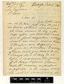 Correspondence ?Siebert (Selmar) and Engelmann (George), (IA mobot31753004064785).pdf 8,860 × 11,525, 2 pages; 9.32 MB
-
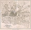 PPN610751190 Hamburg Nebst Dessen Nächster Umgebung Und Altona.jpg 5,695 × 5,641; 7.78 MB
-
 PPN610751190 Hamburg Nebst Dessen Nächster Umgebung Und Altona.tif 6,271 × 6,965; 20.13 MB
-
 PPN612292940 Altona Im Jahre 1836 (1839).jpg 5,639 × 6,510; 8.28 MB
-
 PPN612292940 Altona Im Jahre 1836 (1839).tif 5,830 × 7,067; 17.7 MB
-
 Riviere des Lacs to the Rocky Mountains - from explorations and surveys LOC 98688423.jpg 11,520 × 7,776; 9.17 MB
-
 Riviere des Lacs to the Rocky Mountains - from explorations and surveys LOC 98688423.tif 11,520 × 7,776; 256.29 MB
-
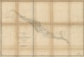
 Rocky Mountains to Puget Sound - from explorations and surveys LOC 98688424.tif 11,406 × 7,683; 250.72 MB
-
 St. Paul to Riviere des Lacs - from explorations and surveys LOC 98688422.jpg 11,488 × 7,792; 8.29 MB
-
 St. Paul to Riviere des Lacs - from explorations and surveys LOC 98688422.tif 11,488 × 7,792; 256.1 MB


.jpg)

