Category:Screenshots for tutorial for additional data from Demis map
Jump to navigation
Jump to search
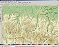
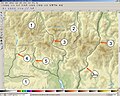
- English: Screenshots made for the French speaking Atelier graphique showing steps of a tutorial made to learn how to use the Demis add-on for NASA World Wind to complete maps with the additional data (rivers and roads) displayed by their layer (see the approval e-mail from Demis on the WP-de and the Demis forum).
- Français : Captures d'écran réalisées dans le cadre de l´Atelier graphique montrant les étapes d'un didacticiel destiné à apprendre à utiliser l'add-on de Demis pour NASA World Wind afin de compléter une carte avec les informations (cours d'eau et routes) contenues dans leur couche (voir le courriel d'autorisation de Demis sur la WP-de et le forum de Demis).
Media in category "Screenshots for tutorial for additional data from Demis map"
The following 5 files are in this category, out of 5 total.
-
 Tutorial rivers for maps 01.jpg 1,280 × 1,024; 314 KB
-
 Tutorial rivers for maps 02.jpg 1,280 × 1,024; 251 KB
-
 Tutorial rivers for maps 03.jpg 1,280 × 1,024; 245 KB
-
 Tutorial roads for maps 01.jpg 1,280 × 1,024; 291 KB
-
 Tutorial roads for maps 02.jpg 1,280 × 1,024; 268 KB


