Category:Schule Renngasse 20, Innere Stadt
Jump to navigation
Jump to search
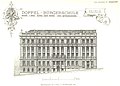
Deutsch: das Haus Renngasse 20 im 1. Bezirk, in Wien
| This category shows the protected monument with the number 50492 in Austria. (Commons, de, Wikidata) |
| Object location | | View all coordinates using: OpenStreetMap |
|---|
building in Innere Stadt, Austria  | |||||
| Upload media | |||||
| Instance of | |||||
|---|---|---|---|---|---|
| Location | Innere Stadt, Vienna, Austria | ||||
| Street address |
| ||||
| Heritage designation | |||||
 | |||||
Media in category "Schule Renngasse 20, Innere Stadt"
The following 4 files are in this category, out of 4 total.
-
 Berichte der Wiener Stadtverwaltung, 1873ff, div. Pläne und Ansichten 01.jpg 2,689 × 1,926; 2.21 MB
-
 Berichte der Wiener Stadtverwaltung, 1873ff, div. Pläne und Ansichten 03.jpg 604 × 1,024; 290 KB
-
 Haus-Renngasse 20-01.jpg 2,100 × 1,671; 1.48 MB
-
 Renngasse 20 Detail.JPG 4,501 × 3,159; 3.66 MB


