Category:Schuddegeest (The Hague)
Jump to navigation
Jump to search
| Object location | | View all coordinates using: OpenStreetMap |
|---|
 | |||||
| Upload media | |||||
| Instance of | |||||
|---|---|---|---|---|---|
| Part of | |||||
| Location | The Hague, South Holland, Netherlands | ||||
| Street address |
| ||||
| Heritage designation |
| ||||
 | |||||
Nederlands: Schuddegeesthofje
|
This is a category about rijksmonumentcomplex number 476058
|
Schuddegeest 40-56, 86-102
|
This is a category about rijksmonument number 477001
|
Schuddegeest 58-84
|
This is a category about rijksmonument number 477002
|
Schuddegeest 150-184
|
This is a category about rijksmonument number 477003
|
Schuddegeest 186-196, Mallemolen 75-77
|
This is a category about rijksmonument number 477004
|
| Address |
|
Media in category "Schuddegeest (The Hague)"
The following 7 files are in this category, out of 7 total.
-
 58-70 - 's-Gravenhage - 20087809 - RCE.jpg 1,195 × 1,200; 340 KB
-
 70-58 - 's-Gravenhage - 20087808 - RCE.jpg 1,195 × 1,200; 325 KB
-
 86-102 - 's-Gravenhage - 20087812 - RCE.jpg 1,199 × 1,200; 316 KB
-
 Den Haag - Mallemolen 75.JPG 2,223 × 2,967; 3.04 MB
-
 Loek Bos- De lantaarnaansteker.JPG 2,112 × 2,816; 2.11 MB
-
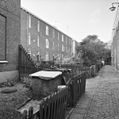
 Schuddegeest hofje in Den Haag.JPG 2,816 × 2,112; 1.86 MB
-
 Voordeuren - 's-Gravenhage - 20087811 - RCE.jpg 1,188 × 1,200; 365 KB


