Category:Schneerosenkirche Hermagor
Jump to navigation
Jump to search
| Object location | | View all coordinates using: OpenStreetMap |
|---|
church building in Hermagor-Pressegger See, Austria   | |||||
| Upload media | |||||
| Instance of | |||||
|---|---|---|---|---|---|
| Location | Hermagor-Pressegger See, Hermagor District, Carinthia, Austria | ||||
| Street address |
| ||||
| Heritage designation | |||||
 | |||||
Media in category "Schneerosenkirche Hermagor"
The following 8 files are in this category, out of 8 total.
-
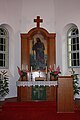 Hermagor - Evangelische Kirche - Altar.jpg 2,848 × 4,272; 3.5 MB
-
 Hermagor - Evangelische Kirche - Lutherrose.jpg 1,748 × 1,450; 453 KB
-
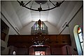
 Hermagor - Evangelische Kirche.jpg 2,848 × 4,272; 2.84 MB
-
 Hermagor 037 (31585778236).jpg 1,635 × 1,099; 674 KB
-
 Hermagor 043 (31623001875).jpg 1,635 × 1,028; 1.39 MB
-
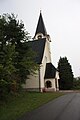
 Hermagor Radniger Strasse 4 evangelische Pfarrkirche 25092011 388.jpg 2,848 × 4,288; 2.07 MB
-
 Hermagor, Evangelische Pfarrkirche A.B. Kärnten.jpg 1,500 × 997; 650 KB
-
 Hermagor, Luther Rose Evangelische Kirche, Kärnten.jpg 787 × 931; 360 KB


.jpg)
.jpg)
