Category:Schlossturm (Cottbus)
Jump to navigation
Jump to search
| Object location | | View all coordinates using: OpenStreetMap |
|---|
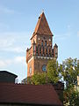
This is the category of the Brandenburger Baudenkmal (cultural heritage monument) with the ID 09100285 (Wikidata)
|
former castle tower in Cottbus, Brandenburg, Germany -01.jpg) | |||||
| Upload media | |||||
| Instance of | |||||
|---|---|---|---|---|---|
| Made from material | |||||
| Location | Cottbus, Brandenburg, Germany | ||||
| Heritage designation | |||||
| Height |
| ||||
 | |||||
Media in category "Schlossturm (Cottbus)"
The following 12 files are in this category, out of 12 total.
-
 115. Schlossturm.JPG 1,920 × 2,560; 2.26 MB
-
 Burgturm, Cottbus - geo-en.hlipp.de - 13371.jpg 640 × 426; 52 KB
-
 Cottbus - Blick von dem Spremberger Turm - 0034.jpg 5,913 × 3,400; 11.18 MB
-
 Cottbus - Blick von der Oberkirche - 0016.jpg 5,736 × 3,885; 10.64 MB
-
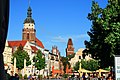 Cottbus Altmarkt - panoramio (1).jpg 1,944 × 1,296; 2 MB
-
 Cottbus E-Werk, Gerichtsberg.jpg 1,024 × 767; 662 KB
-
 Schlossturm (Cottbus)-01.jpg 1,200 × 1,600; 940 KB
-
 Schlossturm (Cottbus)-02.jpg 3,240 × 4,320; 5.32 MB
-
 Schlossturm (Cottbus)-03-Detailaufnahme.jpg 4,320 × 3,240; 3.91 MB
-
 Schlossturm, Cottbus.jpg 2,448 × 3,264; 1.29 MB
-
 Spremberger Turm-05-Aussicht Nordost.jpg 4,320 × 3,240; 5.37 MB
-
 View from Oberkirche St. Nikolai (Cottbus).jpg 4,608 × 3,456; 6.46 MB


.jpg)

-02.jpg)
-03-Detailaufnahme.jpg)


.jpg)