Category:Schlachtkapelle Stoss
Jump to navigation
Jump to search
| Object location | | View all coordinates using: OpenStreetMap |
|---|
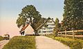
chapel in Gais in the canton of Appenzell Ausserrhoden, Switzerland .jpg) | |||||
| Upload media | |||||
| Instance of | |||||
|---|---|---|---|---|---|
| Location |
| ||||
| Street address |
| ||||
| Heritage designation | |||||
 | |||||
Media in category "Schlachtkapelle Stoss"
The following 14 files are in this category, out of 14 total.
-
 AG Stosskapelle.jpg 845 × 500; 201 KB
-

-
 CH-NB - Stoss, Schlachtkapelle mit Blick gegen das Rheintal von Westen - Collection Gugelmann - GS-GUGE-FÜSSLI-H-E-3.tif 5,275 × 4,167, 2 pages; 43.12 MB
-
 CH-NB Photoglob-Wehrli EAD-WEHR-12542-B.tif 5,671 × 7,494, 2 pages; 81.12 MB
-
 CH-NB Photoglob-Wehrli EAD-WEHR-12543-B.tif 7,494 × 5,671, 2 pages; 81.12 MB
-
 ETH-BIB-Appenzell Ausserrhoden, Stoss, Stosskapelle-Com LC1988-018-001.tif 5,358 × 3,552; 54.48 MB
-
 ETH-BIB-Appenzell Ausserrhoden, Stoss, Stosskapelle-Com LC1988-018-002.tif 5,358 × 3,552; 54.49 MB
-
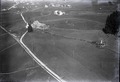 ETH-BIB-Gais, Schlachtkapelle, Stoos v. O. aus 500 m-Inlandflüge-LBS MH01-004139.tif 5,823 × 3,999; 66.76 MB
-

-

-
 Gasthaus Stoss AR.JPG 3,853 × 2,747; 6.26 MB
-
 Stoss AR Kapelle (aussen).jpg 1,148 × 1,554; 402 KB
-
 Stoss-AR-Kapelle.jpg 1,200 × 800; 1.24 MB
-
 Stoss-Kapelle.jpg 1,016 × 700; 1,001 KB


