Category:Scheemda
Jump to navigation
Jump to search
town and former municipality in the province of Groningen, the Netherlands    | |||||
| Upload media | |||||
| Pronunciation audio | |||||
|---|---|---|---|---|---|
| Instance of | |||||
| Named after | |||||
| Location | |||||
| Population |
| ||||
 | |||||
Subcategories
This category has the following 9 subcategories, out of 9 total.
Media in category "Scheemda"
The following 44 files are in this category, out of 44 total.
-
 Coat of arms of Scheemda.png 336 × 390; 47 KB
-
 Scheemda wapen.svg 321 × 394; 134 KB
-
 Flag of Scheemda.svg 600 × 400; 653 bytes
-
 Scheemdavlag.PNG 326 × 217; 4 KB
-
 Scheemda wapen 1904.svg 458 × 532; 176 KB
-
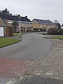
 Achterlaan.jpg 4,608 × 3,456; 4.63 MB
-
 Bevolkingspiramide - Gemeente Scheemda (2007).png 350 × 370; 7 KB
-
 Dollardlaan.jpg 3,456 × 4,608; 4.28 MB
-
 Donellenlaan.jpg 3,456 × 4,608; 3.5 MB
-
 Esbörgstraat.jpg 4,608 × 3,456; 4.53 MB
-
 Fietspad "over het spoor" - panoramio.jpg 2,592 × 1,952; 2.42 MB
-
 Gasthuislaan.jpg 3,456 × 4,608; 3.93 MB
-
 Graf van Joseph Berry (RAF officier).jpg 3,024 × 4,032; 6.85 MB
-
 Hoflaan.jpg 3,456 × 4,608; 6.3 MB
-
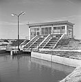 Inpoldering en bemaling, gemalen, waterschappen, 'de Munte', Bestanddeelnr 159-1095.jpg 2,603 × 2,649; 1.29 MB
-
 Jachthaven Scheemda.jpg 2,272 × 1,704; 986 KB
-
 Kerkpad.jpg 3,456 × 4,608; 7.37 MB
-
 Laan 1509.jpg 3,456 × 4,608; 3.48 MB
-
 LocatieScheemda.png 280 × 130; 8 KB
-
 Molenstraat 2.jpg 3,456 × 4,608; 5.46 MB
-
 Molenstraat.jpg 3,456 × 4,608; 6.16 MB
-
Nl-Scheemda.oga 2.3 s; 40 KB
-
Nl-Scheemda.ogg 1.5 s; 18 KB
-
 Ockeweer.jpg 4,608 × 3,456; 4.33 MB
-
 Oosterstraat.jpg 3,456 × 4,608; 3.83 MB
-
 Palmarlaan.jpg 3,456 × 4,608; 4.36 MB
-
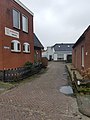 Pastoriegang.jpg 3,456 × 4,608; 5.12 MB
-
 Scheemda Object 01.JPG 2,816 × 2,112; 2.74 MB
-
 Scheemda Object 02.JPG 2,112 × 2,816; 1.72 MB
-
 Scheemda Object 03.JPG 2,816 × 2,112; 3 MB
-
 Scheemda, straatzicht met ophaalbrug 2012-09-01 15.18.jpg 4,416 × 3,312; 11.2 MB
-
 Scheemda, straatzicht Torenstraat foto1 2012-09-01 15.26.JPG 4,416 × 3,312; 7.46 MB
-
 Scheuvellopertje Scheemda.jpg 1,704 × 2,272; 984 KB
-
 Schoolstraat 2.jpg 3,456 × 4,608; 5.1 MB
-
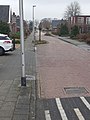
 Stationsstraat Scheemda Netherlands.JPG 2,304 × 1,728; 1.72 MB
-
 Stationsstraat2 Scheemda Netherlands.JPG 2,304 × 1,728; 1.78 MB
-
 Tijsweer.jpg 4,608 × 3,456; 4.19 MB
-
 Torenstraat 2.jpg 4,608 × 3,456; 4.2 MB
-
 Torenstraat.jpg 4,608 × 3,456; 4.4 MB
-
 Torum.jpg 4,608 × 3,456; 6.8 MB
-
 Vredenhovenplein Scheemda.jpg 2,272 × 1,704; 1,015 KB
-
 Wijkstraat Scheemda Netherlands.JPG 2,304 × 1,728; 1.7 MB
-
 Wilhelminalaan.jpg 3,456 × 4,608; 6.15 MB
-
 Winschoterdiep Scheemda.jpg 2,272 × 1,704; 1.2 MB


.png)


.jpg)


