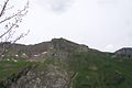
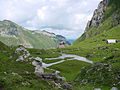
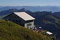
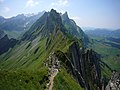
Category:Schäfler
Jump to navigation
Jump to search
| Object location | | View all coordinates using: OpenStreetMap |
|---|

mountain  | |||||
| Upload media | |||||
| Instance of | |||||
|---|---|---|---|---|---|
| Location | Appenzell Innerrhoden, Switzerland | ||||
| Mountain range | |||||
| Topographic isolation |
| ||||
| Elevation above sea level |
| ||||
 | |||||
![]() Switzerland
Switzerland ![]() Appenzell Innerrhoden 1.912 m ü. M.
Appenzell Innerrhoden 1.912 m ü. M.
Media in category "Schäfler"
The following 34 files are in this category, out of 34 total.
-
 Altmann Säntis Panorama.jpg 5,448 × 3,227; 11.38 MB
-
 Appenzell schaeffler.jpeg 1,279 × 853; 100 KB
-
 Crazy night up in the Swiss Mountains.jpg 4,056 × 3,040; 5.18 MB
-
 Ebenalp - panoramio (102).jpg 2,848 × 4,272; 7.08 MB
-
 Ebenalp - panoramio (111).jpg 2,848 × 4,272; 8.33 MB
-
 Ebenalp - panoramio (137).jpg 4,272 × 2,848; 7.74 MB
-
 Ebenalp - panoramio (142).jpg 4,272 × 2,848; 6.14 MB
-
 Ebenalp - panoramio (143).jpg 2,848 × 4,272; 6.16 MB
-
 ETH-BIB-Ebenalp, Blick nach Südwesten, Säntis-LBS H1-012682.tif 6,128 × 4,200; 73.82 MB
-
 ETH-BIB-Schäfler, Berggasthaus, Altenalptürme, Ohrli-LBS H1-012683.tif 5,198 × 3,740; 55.72 MB
-
 ETH-BIB-Schäfler, Blick nach Südwesten, Säntis-LBS H1-012684.tif 6,065 × 4,192; 72.9 MB
-
 ETH-BIB-Schäfler, Blick nach Westsüdwesten, Säntis-LBS H1-012685.tif 6,112 × 4,200; 73.62 MB
-
 GasthausSchaefler.jpg 4,000 × 3,000; 5.78 MB
-
 Kaman K-1200 K-Max mit Bagger am Haken.jpg 2,656 × 3,980; 947 KB
-
 Kaman K-1200 K-Max mit leerem Haken.jpg 2,428 × 4,317; 756 KB
-
 Kaman K-1200 K-Max von schräg hinten.jpg 3,207 × 2,138; 584 KB
-
 Kaman K-1200 K-Max von schräg unten-seitlich.jpg 5,472 × 3,648; 1.46 MB
-
 Meglisalp Aufstieg 3450.JPG 2,240 × 1,680; 1.55 MB
-
 Picswiss AI-06-07.jpg 500 × 333; 42 KB
-
 Picswiss AI-06-08.jpg 500 × 333; 34 KB
-
 Picswiss AI-06-09.jpg 500 × 333; 48 KB
-
 Picswiss AI-06-10.jpg 500 × 333; 60 KB
-
 Picswiss AI-06-11.jpg 500 × 333; 47 KB
-
 Picswiss AI-06-12.jpg 500 × 333; 56 KB
-
 Rotsteinpass 5317.jpg 1,600 × 1,200; 779 KB
-
 Schaefler 100 4071.JPG 2,160 × 1,440; 301 KB
-
 Schaefler above Seealpsee.jpg 889 × 1,100; 369 KB
-
 Schaefler to Saentis ( West).jpg 1,300 × 975; 390 KB
-
 Schäfler Hoher Kasten.jpg 1,600 × 1,200; 566 KB
-
 Schäfler-Wegweiser.jpg 3,456 × 1,944; 1.03 MB
-
 Sprüng-NO.jpg 3,072 × 2,048; 2.64 MB
-
 Stockegg-NW.jpg 6,000 × 3,376; 9.67 MB
-
 Säntis-Nord-Panorama beschriftet.jpg 648 × 486; 90 KB
-
 Säntis-Nord-Panorama.jpg 1,296 × 972; 281 KB


.jpg)
.jpg)
.jpg)
.jpg)
.jpg)


.jpg)


