Category:Satellite pictures of volcanoes in the United States
Jump to navigation
Jump to search
Countries of the Americas: Argentina · Bolivia · Canada · Chile · Colombia · Costa Rica · Ecuador · El Salvador · Guatemala · Mexico · Nicaragua · Peru · United States of America
Subcategories
This category has the following 4 subcategories, out of 4 total.
Media in category "Satellite pictures of volcanoes in the United States"
The following 21 files are in this category, out of 21 total.
-
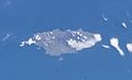 Aleuten-Seguam.JPG 2,396 × 1,456; 544 KB
-
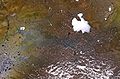
 Bogoslof 1.24.2017.png 1,180 × 813; 1.33 MB
-
 Cabezon Peak NM airphoto.jpg 1,659 × 1,244; 476 KB
-
 Capulin oli 2016095 lrg.jpg 3,000 × 3,000; 5.15 MB
-
 Carrizozo Lava Flow.jpg 2,400 × 2,400; 4.77 MB
-
 Craters of the Moon from space.jpg 650 × 950; 158 KB
-
 Imuruk volcanic field.jpg 640 × 422; 107 KB
-
 Ingakslugwat Hills.jpg 640 × 444; 106 KB
-
 Katmai NP and Valley of Ten Thousand Smokes from space.jpg 639 × 639; 338 KB
-
 KatmaiNP L5 03sep95.jpg 540 × 540; 96 KB
-
 LANDSAT Potrillo Volcanic Field.jpg 1,935 × 1,888; 2.39 MB
-
 MedicineLkHighlands09272017-50.tif 1,916 × 1,023; 7.48 MB
-
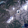
 Mount Cleveland 2010-06-01 lrg.jpg 2,701 × 2,701; 931 KB
-
 NASA Makushin 1.JPG 515 × 512; 22 KB
-
 NASA Makushin 2.JPG 899 × 630; 138 KB
-
 Ship Rock NASA.jpg 500 × 522; 404 KB
-
 Shiprock from ASTER.jpg 1,500 × 1,500; 1.49 MB
-
 Sunset Crater ARLSUCR00040007.jpg 2,600 × 2,300; 2.6 MB
-
 Tlevak Strait-Suemez Island.jpg 640 × 419; 61 KB
-
 Umnak oli 2014123 detail.jpg 720 × 480; 334 KB
-
 Valle Caldera, New Mexico.jpg 2,000 × 2,000; 3.01 MB


