Category:Satellite pictures of the Southland Region
Jump to navigation
Jump to search
Subcategories
This category has only the following subcategory.
F
- Satellite pictures of Fiordland (17 F)
Media in category "Satellite pictures of the Southland Region"
The following 22 files are in this category, out of 22 total.
-
 Awarua Bay, New Zealand, looking east (ISS018-E-7779).jpg 3,072 × 2,040; 326 KB
-
 Bluff, New Zealand, looking east (ISS018-E-7780).jpg 3,072 × 2,040; 355 KB
-
 Bluff, New Zealand, looking east (ISS018-E-7781).jpg 3,072 × 2,040; 299 KB
-
 Bunker Islets, Sentinel-2.png 228 × 181; 121 KB
-
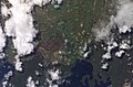
 Crop of blizzard NASA photo of Southern South Island.jpg 1,417 × 1,042; 451 KB
-
 Fiordland, New Zealand, looking east (ISS016-E-25879).jpg 3,032 × 2,008; 1.28 MB
-
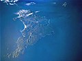
 Foveaux Strait, New Zealand by Sally Ride EarthKAM.jpg 4,312 × 2,868; 4.96 MB
-
 Hollyford Valley and upper Lake Wakatipu, New Zealand (ISS017-E-10658).jpg 3,072 × 2,040; 928 KB
-
 ISS Invercargill.jpg 1,024 × 679; 156 KB
-
 Lake Manapouri, New Zealand, looking east (ISS016-E-12650).jpg 3,032 × 2,008; 924 KB
-
 Lake Wakatipu, New Zealand (ISS017-E-10659).jpg 3,072 × 2,040; 883 KB
-
 Lake Wakatipu, New Zealand, looking southeast (ISS030-E-7700).jpg 4,288 × 2,848; 1.4 MB
-
 Mararoa and Oreti Rivers near Mavora, New Zealand (ISS016-E-12653).jpg 3,032 × 2,008; 996 KB
-
 Mararoa River near Mavora, New Zealand (ISS016-E-12654).jpg 3,032 × 2,008; 1.05 MB
-
 NASA-SLakes.png 289 × 263; 57 KB
-
 NZ-Southland-satellite.png 856 × 699; 1.15 MB
-
 Southern South Island, New Zealand, looking east (ISS016-E-25880).jpg 3,032 × 2,008; 1.27 MB
-
 Southern South Island, New Zealand, looking east (ISS016-E-25881).jpg 3,032 × 2,008; 1.18 MB
-
 Stewart Island STS102.jpg 4,000 × 3,000; 1.21 MB
-
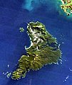 Stewart Island.jpg 330 × 393; 20 KB
-
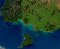
 The Catlins.jpg 392 × 309; 30 KB
-
 Upukerora River, New Zealand, looking southeast (ISS016-E-12652).jpg 3,032 × 2,008; 966 KB
.jpg)
.jpg)
.jpg)


.jpg)

.jpg)

.jpg)
.jpg)
.jpg)
.jpg)
.jpg)


.jpg)
.jpg)


.jpg)