Category:Satellite pictures of the Manawatū-Whanganui Region
Jump to navigation
Jump to search
Subcategories
This category has only the following subcategory.
S
Media in category "Satellite pictures of the Manawatū-Whanganui Region"
The following 15 files are in this category, out of 15 total.
-
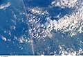
 ISS-37 Ruapehu volcano and Tongariro volcanic complex in New Zealand.jpg 4,256 × 2,832; 2.59 MB
-
 Kai-iwi Stream and South Taranaki Bight coast, New Zealand (STS112-E-5916).jpg 3,032 × 2,064; 1.66 MB
-
 Kai-iwi Stream and South Taranaki Bight coast, New Zealand (STS112-E-5917).jpg 3,032 × 2,064; 1.46 MB
-
 Lake Taupō.jpg 5,568 × 3,712; 3.97 MB
-
 Levin, New Zealand, looking southeast (ISS015-E-10488).jpg 3,032 × 2,008; 1.57 MB
-
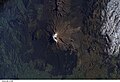 Mount Ruapehu, New Zealand (ISS014-E-13796).jpg 3,032 × 2,064; 1.14 MB
-
 Mount Ruapehu, New Zealand (ISS014-E-13797).jpg 3,032 × 2,064; 1.12 MB
-
 Mount Ruapehu, New Zealand, looking east (ISS016-E-12622).jpg 3,032 × 2,008; 1.11 MB
-
 Mount Ruapehu, New Zealand, looking east (ISS016-E-12623).jpg 3,032 × 2,008; 1.15 MB
-
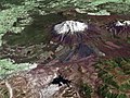 MtRuapehu 23oct2002.jpg 4,500 × 3,375; 3.2 MB
-
 South Taranaki Bight coast, New Zealand (STS112-E-5915).jpg 3,032 × 2,064; 1.29 MB
-
 South Taranaki Bight coast, New Zealand (STS112-E-5918).jpg 3,032 × 2,064; 1.34 MB
-
 South Taranaki Bight coast, New Zealand (STS112-E-5919).jpg 3,032 × 2,064; 1.44 MB
-
 Taupo.Volcanic.Zone.North.Island.NZ.JPG 616 × 864; 104 KB
-
 Tongariro NP satellite.jpg 656 × 692; 348 KB

.jpg)
.jpg)

.jpg)
.jpg)
.jpg)
.jpg)
.jpg)

.jpg)
.jpg)
.jpg)

