Category:Satellite pictures of Seychelles
Jump to navigation
Jump to search
Countries of Africa: Algeria · Angola · Benin · Botswana · Burkina Faso · Burundi · Cameroon · Cape Verde · Central African Republic · Chad · Comoros · Democratic Republic of the Congo · Republic of the Congo · Djibouti · Egypt‡ · Equatorial Guinea · Eritrea · Eswatini · Ethiopia · Gabon · The Gambia · Ghana · Guinea · Guinea-Bissau · Ivory Coast · Kenya · Lesotho · Liberia · Libya · Madagascar · Malawi · Mali · Mauritania · Mauritius · Morocco · Mozambique · Namibia · Niger · Nigeria · Rwanda · São Tomé and Príncipe · Senegal · Seychelles · Sierra Leone · Somalia · South Africa · South Sudan · Sudan · Tanzania · Togo · Tunisia · Uganda · Zambia · Zimbabwe
Limited recognition: Somaliland – Other areas: Canary Islands · Ceuta · Madeira · Mayotte · Melilla · Réunion · Saint Helena, Ascension and Tristan da Cunha · Western Sahara
‡: partly located in Africa
Limited recognition: Somaliland – Other areas: Canary Islands · Ceuta · Madeira · Mayotte · Melilla · Réunion · Saint Helena, Ascension and Tristan da Cunha · Western Sahara
‡: partly located in Africa
Subcategories
This category has the following 2 subcategories, out of 2 total.
I
- Photos of Seychelles from ISS (357 F)
S
Media in category "Satellite pictures of Seychelles"
The following 46 files are in this category, out of 46 total.
-
 Aldabra Atoll and Assumption Island.jpg 430 × 470; 18 KB
-
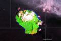
 Alphonse Group.png 532 × 989; 703 KB
-
 Amirantes-Sat.png 894 × 1,897; 2.87 MB
-
 Aride-55.66828E 4.21153S.png 1,022 × 690; 449 KB
-
 Assumption Island (rotated 45 degrees clockwise).jpg 2,461 × 2,461; 1 MB
-
 Assumption Island (rotated 45 degrees clockwise, cropped, corners filled).jpg 1,150 × 1,727; 224 KB
-
 Assumption Island.JPG 1,600 × 2,000; 380 KB
-
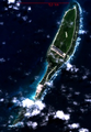
 Astove Island.JPG 1,636 × 1,536; 477 KB
-
 Bertaut Reef1040.png 392 × 252; 290 KB
-
 Coetivy.png 420 × 608; 750 KB
-
 Cosmoledo and Astove.jpg 380 × 400; 12 KB
-
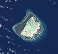
 Cosmoledo Atoll.JPG 2,600 × 1,600; 307 KB
-
 Cosmoledo.png 1,022 × 722; 2.12 MB
-
 Farquhar Group.jpg 400 × 350; 19 KB
-
 Guyot Correira - Seychelles.jpg 4,288 × 2,848; 613 KB
-
 NASA Aldabra Atoll.jpg 400 × 300; 17 KB
-
 NASA Farquhar Atoll.jpg 2,600 × 1,600; 356 KB
-
 NASA-Saint-Joseph-Darros.jpg 3,060 × 2,024; 956 KB
-
 North Island 55.24963E 4.39147S.png 1,022 × 690; 489 KB
-
 Platte Total 5050.png 480 × 605; 517 KB
-
 Platte-Ile.png 307 × 381; 239 KB
-
 Platte.jpg 2,000 × 2,592; 292 KB
-
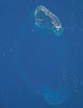
 Providence Atoll.JPG 2,400 × 1,600; 417 KB
-
 Remire.png 326 × 252; 241 KB
-
 Republic of Seychelles (ASTER).jpg 3,624 × 4,475; 2 MB
-
 Silhouette 55.23504E 4.48511S.png 1,022 × 690; 628 KB
-
 STS005-40-1198 - View of Seychelles (Raw scan).tif 4,393 × 4,600; 57.82 MB
-
 STS005-40-1198 - View of Seychelles.jpg 4,393 × 4,600; 1.52 MB
-
 STS007-24-1332 - View of Seychelles (Raw scan).tif 4,393 × 4,600; 57.82 MB
-
 STS007-24-1332 - View of Seychelles.jpg 4,393 × 4,600; 1.41 MB
-
 STS007-24-1333 - View of Seychelles (Raw scan).tif 4,393 × 4,600; 57.82 MB
-
 STS007-24-1333 - View of Seychelles.jpg 4,393 × 4,600; 1.38 MB
-
 STS007-24-1334 - View of Seychelles (Raw scan).tif 4,393 × 4,600; 57.82 MB
-
 STS007-24-1334 - View of Seychelles.jpg 4,393 × 4,600; 1.35 MB
-
 STS007-24-1335 - View of Seychelles (Raw scan).tif 4,393 × 4,600; 57.82 MB
-
 STS007-24-1335 - View of Seychelles.jpg 4,393 × 4,600; 1.48 MB
-
 STS007-24-1336 - View of Seychelles (Raw scan).tif 4,393 × 4,600; 57.82 MB
-
 STS007-24-1336 - View of Seychelles.jpg 4,393 × 4,600; 1.35 MB
-
 STS007-24-1337 - View of Seychelles (Raw scan).tif 4,393 × 4,600; 57.82 MB
-
 STS007-24-1337 - View of Seychelles.jpg 4,393 × 4,600; 1.27 MB
-
 STS007-24-1338 - View of Seychelles (Raw scan).tif 4,393 × 4,600; 57.82 MB
-
 STS007-24-1338 - View of Seychelles.jpg 4,393 × 4,600; 1.32 MB
-
 STS007-24-1339 - View of Seychelles (Raw scan).tif 4,393 × 4,600; 57.82 MB
-
 STS007-24-1339 - View of Seychelles.jpg 4,393 × 4,600; 1.22 MB
-
 STS007-4-153 - View of Seychelles (Raw scan).tif 4,393 × 4,600; 57.82 MB
-
 STS007-4-153 - View of Seychelles.jpg 4,393 × 4,600; 1.07 MB


.jpg)
.jpg)


.jpg)


