Category:Satellite pictures of Norway
Jump to navigation
Jump to search
Countries of Europe: Albania · Andorra · Armenia‡ · Austria · Azerbaijan‡ · Belarus · Belgium · Bosnia and Herzegovina · Bulgaria · Croatia · Cyprus‡ · Czech Republic · Denmark · Estonia · Finland · France‡ · Georgia‡ · Germany · Greece · Hungary · Iceland · Republic of Ireland · Italy · Kazakhstan‡ · Latvia · Lithuania · Luxembourg · Malta · Moldova · Monaco · Montenegro · Netherlands‡ · North Macedonia · Norway · Poland · Portugal‡ · Romania · Russia‡ · San Marino · Serbia · Slovakia · Slovenia · Spain‡ · Sweden · Switzerland · Turkey‡ · Ukraine · United Kingdom
Specific status: Faroe Islands · Gibraltar · Bailiwick of Guernsey · Isle of Man · Jersey · Svalbard – Limited recognition: Kosovo
‡: partly located in Europe
Specific status: Faroe Islands · Gibraltar · Bailiwick of Guernsey · Isle of Man · Jersey · Svalbard – Limited recognition: Kosovo
‡: partly located in Europe
Subcategories
This category has the following 7 subcategories, out of 7 total.
B
F
J
L
- Landsat images of Norway (4 F)
O
- Satellite pictures of Oslo (11 F)
S
- Photos of Norway by Sentinel-2 (68 F)
Media in category "Satellite pictures of Norway"
The following 73 files are in this category, out of 73 total.
-
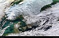
 A snowy southern Norway ESA240171.tiff 1,602 × 1,524; 5.05 MB
-
 A snowy southern Norway.jpg 1,602 × 1,524; 1.07 MB
-
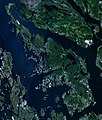 Askøy.jpg 749 × 883; 506 KB
-
 Baltic Sea (MODIS 05062009).jpg 4,400 × 5,600; 4.51 MB
-
 Coastlines of the Southern Baltic Sea (15038945334).jpg 1,440 × 960; 365 KB
-
 Extent of fire damage in Norway.jpg 500 × 500; 557 KB
-
 Fjords and glaciers.jpg 1,024 × 956; 1.02 MB
-
 Fjords of Norway 2.jpg 19,560 × 11,560; 119.54 MB
-
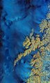
 Hardangerfjord bloom 2020.jpg 720 × 480; 125 KB
-
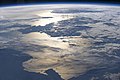
 ISS-43 Northern Europe.jpg 4,928 × 3,280; 1.58 MB
-
 ISS007-E-17392 - View of Norway.jpg 3,032 × 2,064; 590 KB
-
 ISS007-E-17393 - View of Norway.jpg 3,032 × 2,064; 612 KB
-
 ISS007-E-17394 - View of Norway.jpg 3,032 × 2,064; 591 KB
-
 ISS007-E-17395 - View of Norway.jpg 3,032 × 2,064; 583 KB
-
 ISS007-E-17396 - View of Norway.jpg 3,032 × 2,064; 591 KB
-
 ISS007-E-17397 - View of Norway.jpg 3,032 × 2,064; 584 KB
-
 ISS008-E-20978 - View of Norway.jpg 3,032 × 2,064; 806 KB
-
 ISS008-E-20979 - View of Norway.jpg 3,032 × 2,064; 757 KB
-
 ISS008-E-20980 - View of Norway.jpg 3,032 × 2,064; 784 KB
-
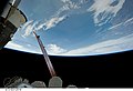
 ISS059-E-121408 - View of Norway.jpg 5,568 × 3,712; 1.6 MB
-
 Istinden Mountain, Troms County Norway - Planet Labs satellite image.jpg 1,200 × 900; 324 KB
-
 Jærstrender satellitt.jpg 784 × 1,587; 206 KB
-
 Karmoy Haugesund 5.19379E 59.27570N.png 780 × 938; 1.33 MB
-
 Karmoy Karmsund Haugesund 5.19379E 59.27570N.png 780 × 938; 1.49 MB
-
 Lofoten, Norway ESA23991695.jpeg 8,337 × 13,895; 47.16 MB
-
 Lofoten, Norway ESA23991695.tiff 8,337 × 13,895; 331.45 MB
-
 Luftbild Skandinavien.jpg 888 × 736; 132 KB
-
 NASA NorthSea1.jpg 5,200 × 6,800; 4.08 MB
-
 Nordfjord 2017 03 03 (33283560345).jpg 5,175 × 2,776; 4.56 MB
-
 Nordfjord 2017 03 03 crop.png 2,755 × 1,839; 9.79 MB
-
 North Sea bloom ESA399165.jpg 4,654 × 4,091; 3.52 MB
-
 Northeastern Europe ESA381348.jpg 1,300 × 1,802; 3.15 MB
-
 Northern Europe ESA393950.tiff 4,727 × 4,091; 42.15 MB
-
 Norway (MODIS 2018-11-20).jpg 3,234 × 2,491; 1.44 MB
-
 Norway 2017 06 28 (35834505240).jpg 3,385 × 2,322; 2.04 MB
-
 Norway and Sweden.jpg 3,712 × 5,568; 3.85 MB
-
 Norway by Proba-V ESA373385.tiff 8,111 × 7,930; 184.04 MB
-
 Norwegian Sea - MERIS - 22 March 2002 ESA194721.jpg 1,500 × 1,500; 427 KB
-
 OsHordaland.jpg 615 × 700; 276 KB
-
 Padjelanta National Park hybrid map-fr.jpg 3,657 × 3,180; 2.33 MB
-
 Plankton bloom off the coast of Norway ESA204317.jpg 2,157 × 2,104; 961 KB
-
 Plankton bloom off the coast of Norway ESA204317.tiff 2,157 × 2,104; 11.18 MB
-
 Radar map of southern Norway ESA211680.jpg 985 × 974; 825 KB
-
 Saltfjellet-Svartisen Park, Norway (ASTER).jpg 3,804 × 3,450; 1.52 MB
-
 Satellitbild över Sverige 15 mars 2002.jpg 540 × 597; 161 KB
-
 Satellite image of Norway in February 2003 crop.jpg 2,033 × 2,361; 1.9 MB
-
 Satellite image of Norway in February 2003 crop2.jpg 917 × 429; 147 KB
-
 Satellite image of Norway in February 2003 crop3.jpg 1,477 × 2,038; 1.13 MB
-
 Satellite image of Norway in February 2003.jpg 4,960 × 5,820; 5.81 MB
-
 Satellittbilde av Lyngdal.jpg 804 × 558; 439 KB
-
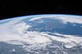
 Scandinavia 2017 01 16 (31539316553).jpg 4,537 × 2,990; 3.11 MB
-
 Scandinavia M2002074 lrg.jpg 6,800 × 8,800; 10.8 MB
-
 Scandinavian snows ESA286292.tiff 2,657 × 1,752; 13.42 MB
-
 Scandinavian snows.jpg 2,657 × 1,752; 3.06 MB
-
 Sentinel-3B-Aufnahme von Nordeuropa ESA393981.jpg 2,000 × 1,731; 1.73 MB
-
 Skagerrak 2 ubt.jpg 416 × 433; 67 KB
-
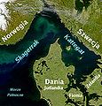
 Skagerrak copy.jpg 1,280 × 944; 248 KB
-
 Stavanger, Norway ESA363429.jpg 3,826 × 3,314; 2.19 MB
-
 STS131-E-12518 - View of Norway.jpg 4,256 × 2,913; 873 KB
-
 STS131-E-12519 - View of Norway.jpg 4,256 × 2,913; 861 KB
-
 STS131-E-12520 - View of Norway.jpg 4,256 × 2,913; 849 KB
-
 STS131-E-12521 - View of Norway.jpg 4,256 × 2,913; 839 KB
-
 STS131-E-12522 - View of Norway.jpg 4,256 × 2,913; 824 KB
-
 STS131-E-12523 - View of Norway.jpg 4,256 × 2,913; 811 KB
-
 STS131-E-12524 - View of Norway.jpg 4,256 × 2,913; 799 KB
-
 STS131-E-12525 - View of Norway.jpg 4,256 × 2,913; 799 KB
-
 STS131-E-12526 - View of Norway.jpg 4,256 × 2,913; 806 KB
-
 STS131-E-12527 - View of Norway.jpg 4,256 × 2,913; 814 KB
-
 Telemarkkanal 1.jpg 723 × 513; 134 KB
-
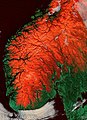 Terrain of Norway with red snow.jpg 2,091 × 2,873; 1.93 MB
-
 TromsøSat.png 558 × 548; 367 KB
-
 Tustna NASA World Wind gamma 1.7.png 988 × 589; 913 KB
-
 United Kingdom ESA361630.jpg 4,000 × 3,496; 13.18 MB


.jpg)
.jpg)


.jpg)


.jpg)
.jpg)


.jpg)


.jpg)


