Category:Satellite pictures of Delaware Bay
Jump to navigation
Jump to search
Media in category "Satellite pictures of Delaware Bay"
The following 10 files are in this category, out of 10 total.
-
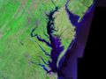
 Delaware and Chesapeake Bays satellite image.jpg 600 × 750; 218 KB
-
 Delawarebaymodis.jpg 701 × 658; 99 KB
-
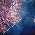
 AS09-20-3129 (21948065701).jpg 4,400 × 4,600; 1.29 MB
-
 Cape henlopen.jpeg 5,280 × 5,280; 9.76 MB
-
 Cape may satellite map.jpg 581 × 847; 54 KB
-
 Chesapeakelandsat.jpeg 1,024 × 768; 164 KB
-
 Delaware Bay S2A 432 10 (31815315530).jpg 10,980 × 10,980; 103.83 MB
-
 Delaware Bay S2A 432 8lum 10 (31814983460).jpg 10,980 × 10,980; 99.07 MB
-
 ISS-55 Chesapeake Bay, Delaware.jpg 5,568 × 3,712; 2.14 MB
-
 The Chesapeake Bay - NOAA Monitors a Critical Habitat (NESDIS 2017-11-17).png 1,920 × 1,080; 1.05 MB


.jpg)


.jpg)
.jpg)

.png)