Category:Satellite pictures by NOAA-20
Jump to navigation
Jump to search
Media in category "Satellite pictures by NOAA-20"
The following 13 files are in this category, out of 13 total.
-
 Bushfire on Kangaroo Island Jan 6, 2020.jpg 1,280 × 720; 438 KB
-
 Deadly Tornadoes Tear Through Tennessee (NESDIS 2020-03-03).jpg 1,920 × 1,080; 1.84 MB
-
 Dust Blows from Sahara Desert, 2020 (50700827372).png 5,800 × 4,015; 48.26 MB
-
 First image from NOAA-20 CrIS (NESDIS 2018-01-08).jpg 1,920 × 1,080; 839 KB
-
 Full-Earth NOAA-20 (NESDIS 2020-02-13).png 1,920 × 1,080; 4.11 MB
-
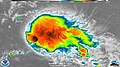 Infrared imagery of Hurricane BeryI (NESDIS 2018-08-03).jpg 1,280 × 720; 504 KB
-
 Japan Braces for Super Typhoon Hagibis (NESDIS 2019-10-10).jpg 1,920 × 1,080; 989 KB
-
 NOAA-20 Watches Sandstorm Blow Over Canary Islands (NESDIS 2020-02-24).png 1,920 × 1,080; 1.85 MB
-
 Rose 2021-09-20 1457Z.jpg 5,966 × 8,018; 3.5 MB
-
 Slightly Weakened Yutu to Threaten the Philippines (NESDIS 2018-10-26).png 1,920 × 1,080; 4.71 MB
-
 Strong Winds Sweep Desert Dust Across the Persian Gulf (NESDIS 2020-03-09).png 1,920 × 1,080; 2.36 MB
-
 Thick Smog Blankets India’s Capital City (NESDIS 2019-11-01).jpg 1,920 × 1,080; 1.97 MB
-
 Two Cyclones Swirl in the North Pacific (NESDIS 2020-04-21).png 1,920 × 1,080; 3.59 MB

.jpg)
.png)
.jpg)
.png)
.jpg)
.jpg)
.png)

.png)
.png)
.png)
.jpg)