Category:Satellite maps of the world
Jump to navigation
Jump to search
Media in category "Satellite maps of the world"
The following 52 files are in this category, out of 52 total.
-
 The earth at night.jpg 13,500 × 6,750; 7.45 MB
-
ASTER VNIR 1 black ocean.webm 14 s, 600 × 600; 7.9 MB
-
 BlackMarble20161km.jpg 43,200 × 21,600; 266.4 MB
-
 Blue Marble 2002 Azimuthal Highres.png 10,800 × 10,800; 74.54 MB
-
 Blue Marble 2002 bg21600.png 21,600 × 10,800; 140.95 MB
-
 Blue Marble 2002.jpg 43,200 × 21,600; 316.49 MB
-
 Blue Marble 2002.png 43,200 × 21,600; 529.58 MB
-
 Carbon Monoxide concentrations in spring..jpg 2,402 × 1,801; 1.43 MB
-
 Clerbaux-spring NASA-f.jpg 1,200 × 900; 446 KB
-
 Composite map of the world 2012.jpg 3,600 × 1,800; 776 KB
-
 Earth .jpg 3,600 × 1,800; 524 KB
-
 Envisat mosaic May - November 2004 ESA211604.png 3,002 × 1,501; 4.88 MB
-
 Flinn-Engdahl regionalization.png 9,484 × 7,113; 55.9 MB
-
 Large World Map unmodified.jpg 21,600 × 10,800; 83.31 MB
-
 Large World Physica Map Bright.png 21,600 × 10,800; 316.43 MB
-
 Large World Physical Map.png 21,600 × 10,800; 344.38 MB
-
 Large World Topo Map 1.png 21,600 × 10,800; 296.71 MB
-
 Large World Topo Map 2.png 21,600 × 10,800; 296.89 MB
-
 Map of Australia night sky 2016.jpg 5,717 × 4,250; 7.41 MB
-
 Mosaicwebsite (ASTER).jpg 2,772 × 1,252; 729 KB
-
 Night on Earth.jpg 1,160 × 580; 107 KB
-
 Paint by Particle (8189069758).jpg 1,024 × 576; 179 KB
-
 PAT - World satellite with borders.jpg 4,200 × 2,160; 1.84 MB
-
 PAT - World satellite.jpg 4,200 × 2,160; 1.74 MB
-
 PathfinderMap hires (4996917742).jpg 4,096 × 2,048; 642 KB
-
 Satellite map of ozone about Antartica.png 1,446 × 1,472; 2.77 MB
-
 Sydney, Australia 1 (46671984964).jpg 1,500 × 911; 582 KB
-
 Whole world (Comprossed).jpg 1,024 × 512; 57 KB
-
 Whole world - land and oceans.jpg 8,192 × 4,096; 5.84 MB
-
 Whole world - time-lapse from 2004-01 to 2004-12.gif 1,000 × 500; 1.45 MB
-
World False Color Mosaic Time-lapse 2019 (50896108512).webm 3.0 s, 1,920 × 692; 1.19 MB
-
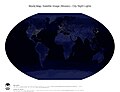
 World Map - city night lights (Winkel Tripel Projection - Americas).jpg 3,220 × 2,480; 1.45 MB
-
 World Map - city night lights (Winkel Tripel Projection - Pacific).jpg 3,220 × 2,480; 1.45 MB
-
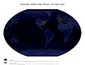
 World Map - city night lights (Winkel Tripel Projection).jpg 3,220 × 2,480; 1.44 MB
-
 World Map - city night lights and national borders (Winkel Tripel Projection - Americas).jpg 3,220 × 2,480; 1.59 MB
-
 World Map - city night lights and national borders (Winkel Tripel Projection - Pacific).jpg 3,220 × 2,480; 1.58 MB
-
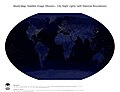 World Map - city night lights and national borders (Winkel Tripel Projection).jpg 3,220 × 2,480; 1.57 MB
-
 World Map - surface, bathymetry and topography (Winkel Tripel Projection - Americas).jpg 3,220 × 2,480; 2.46 MB
-
 World Map - surface, bathymetry and topography (Winkel Tripel Projection - Pacific).jpg 3,220 × 2,480; 2.45 MB
-
 World Map - surface, bathymetry and topography (Winkel Tripel Projection).jpg 3,220 × 2,480; 2.44 MB
-

-

-

-
 World map in 3 hemispheres.png 1,460 × 484; 1.39 MB
-
World Mosaic Time-lapse 2019 (50895278653).webm 3.0 s, 1,920 × 742; 1.09 MB
-
World Mosaic Time-lapse 2019 Blue Marble Background (50896108307).webm 4.0 s, 1,920 × 960; 1.29 MB
-
World Mosaic Time-lapse 2020 (51496080583).webm 3.0 s, 1,920 × 960; 1.07 MB
-
-
World Vegetation Mosaic Time-lapse 2019 (50908254646).webm 3.0 s, 1,920 × 692; 1.17 MB
-
World Vegetation Mosaic Time-lapse 2019 - Alternative Visualization (50896108622).webm 3.0 s, 1,920 × 742; 725 KB
-
 Year 2017 in 30 seconds (25538283698).jpg 1,800 × 900; 187 KB
-
 ߟߌ߲ߓߊ߲.jpg 2,048 × 2,048; 274 KB


.jpg)

.jpg)


.jpg)

.jpg)
.jpg)


.jpg)
.jpg)
.jpg)
.jpg)
.jpg)
.jpg)
.jpg)
.jpg)
.jpg)
.jpg)
.jpg)
.jpg)
.jpg)
