Category:Sanborn maps of Georgia (U.S. state)
Jump to navigation
Jump to search
States of the United States: Alabama · Alaska · Arizona · Arkansas · California · Colorado · Connecticut · Delaware · Florida · Georgia · Hawaii · Idaho · Illinois · Indiana · Iowa · Kansas · Kentucky · Louisiana · Maine · Maryland · Massachusetts · Michigan · Minnesota · Mississippi · Missouri · Montana · Nebraska · Nevada · New Hampshire · New Jersey · New Mexico · New York · North Carolina · North Dakota · Ohio · Oklahoma · Oregon · Pennsylvania · Rhode Island · South Carolina · South Dakota · Tennessee · Texas · Utah · Vermont · Virginia · Washington · West Virginia · Wisconsin · Wyoming – District of Columbia: Washington, D.C.
Subcategories
This category has the following 60 subcategories, out of 60 total.
A
B
C
D
E
F
G
M
P
R
S
T
W
Media in category "Sanborn maps of Georgia (U.S. state)"
The following 26 files are in this category, out of 26 total.
-
-
 Atlanta Machine Works on Sanborn Fire Map 1911.JPG 827 × 1,086; 216 KB
-

-
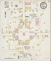
 Sanborn Fire Insurance Map from Camilla, Mitchell County, Georgia. LOC sanborn01396 002.jpg 6,450 × 7,650; 2.99 MB
-
-
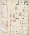
 Sanborn Fire Insurance Map from Conyers, Rockdale County, Georgia. LOC sanborn01409 002.jpg 6,450 × 7,650; 3.66 MB
-

-
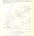
 Digital Library of Georgia dlg sanb augusta-1884.jpg 2,063 × 2,443; 1,003 KB
-
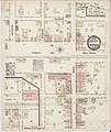
 Sanborn Fire Insurance Map from Portal, Bulloch County, Georgia. LOC sanborn01488 001.jpg 8,822 × 10,418; 7.54 MB
-

-
 Sanborn Fire Insurance Map from Camilla, Mitchell County, Georgia. LOC sanborn01396 001.jpg 6,450 × 7,650; 2.95 MB
-
-
 Sanborn Fire Insurance Map from Cedartown, Polk County, Georgia. LOC sanborn01401 001.jpg 6,450 × 7,650; 3.36 MB
-
 Sanborn Fire Insurance Map from Cochran, Bleckley County, Georgia. LOC sanborn01404 001.jpg 6,450 × 7,650; 3.29 MB
-
 Sanborn Fire Insurance Map from Cuthbert, Randolph County, Georgia. LOC sanborn01414 001.jpg 6,450 × 7,650; 3.56 MB
-
 Sanborn Fire Insurance Map from Dawson, Terrell County, Georgia. LOC sanborn01418 001.jpg 6,450 × 7,650; 3.42 MB
-
 Sanborn Fire Insurance Map from Dublin, Laurens County, Georgia. LOC sanborn01425 001.jpg 6,450 × 7,650; 3.46 MB
-
 Sanborn Fire Insurance Map from Eastman, Dodge County, Georgia. LOC sanborn01427 001.jpg 6,450 × 7,650; 3.28 MB
-
 Sanborn Fire Insurance Map from Elberton, Elbert County, Georgia. LOC sanborn01430 001.jpg 6,450 × 7,650; 3.23 MB
-
 Sanborn Fire Insurance Map from Fairburn, Fulton County, Georgia. LOC sanborn01432 001.jpg 6,450 × 7,650; 3.06 MB
-
 Sanborn Fire Insurance Map from Forsyth, Monroe County, Georgia. LOC sanborn01436 001.jpg 6,450 × 7,650; 3.26 MB
-
 Sanborn Fire Insurance Map from Fort Gaines, Clay County, Georgia. LOC sanborn01437 001.jpg 6,450 × 7,650; 3.47 MB
-

-
 Sanborn Fire Insurance Map from Lithonia, Dekalb County, Georgia. LOC sanborn01463 001.jpg 6,450 × 7,650; 3.09 MB
-
 Sanborn Fire Insurance Map from Madison, Morgan County, Georgia. LOC sanborn01469 001.jpg 6,450 × 7,650; 3.72 MB
-
 Sanborn Fire Insurance Map from Montezuma, Macon County, Georgia. LOC sanborn01478 001.jpg 6,450 × 7,650; 3.17 MB
.jpg)


