Category:Sanborn Fire Insurance Map from Exira, Audubon County, Iowa
Jump to navigation
Jump to search
Subcategories
This category has the following 2 subcategories, out of 2 total.
Media in category "Sanborn Fire Insurance Map from Exira, Audubon County, Iowa"
The following 8 files are in this category, out of 8 total.
-
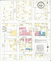 Sanborn Fire Insurance Map from Exira, Audubon County, Iowa. LOC sanborn02655 003-1.jpg 6,450 × 7,650; 3.41 MB
-
 Sanborn Fire Insurance Map from Exira, Audubon County, Iowa. LOC sanborn02655 003-1.tif 6,450 × 7,650; 141.17 MB
-
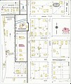 Sanborn Fire Insurance Map from Exira, Audubon County, Iowa. LOC sanborn02655 003-2.jpg 6,450 × 7,650; 3.11 MB
-
 Sanborn Fire Insurance Map from Exira, Audubon County, Iowa. LOC sanborn02655 003-2.tif 6,450 × 7,650; 141.17 MB
-
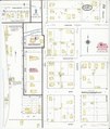
 Sanborn Fire Insurance Map from Exira, Audubon County, Iowa. LOC sanborn02655 004-1.jpg 6,450 × 7,650; 3.84 MB
-
 Sanborn Fire Insurance Map from Exira, Audubon County, Iowa. LOC sanborn02655 004-1.tif 6,450 × 7,650; 141.17 MB
-
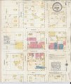
 Sanborn Fire Insurance Map from Exira, Audubon County, Iowa. LOC sanborn02655 004-2.jpg 6,450 × 7,650; 3.67 MB
-
 Sanborn Fire Insurance Map from Exira, Audubon County, Iowa. LOC sanborn02655 004-2.tif 6,450 × 7,650; 141.17 MB


