Category:Sanborn Fire Insurance Map from Durant, Cedar County, Iowa
Jump to navigation
Jump to search
Media in category "Sanborn Fire Insurance Map from Durant, Cedar County, Iowa"
The following 24 files are in this category, out of 24 total.
-
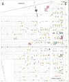
 Sanborn Fire Insurance Map from Durant, Cedar County, Iowa. LOC sanborn02636 001-1.jpg 6,450 × 7,650; 3.48 MB
-
 Sanborn Fire Insurance Map from Durant, Cedar County, Iowa. LOC sanborn02636 001-1.tif 6,450 × 7,650; 141.17 MB
-
 Sanborn Fire Insurance Map from Durant, Cedar County, Iowa. LOC sanborn02636 001-2.jpg 6,450 × 7,650; 2.94 MB
-
 Sanborn Fire Insurance Map from Durant, Cedar County, Iowa. LOC sanborn02636 001-2.tif 6,450 × 7,650; 141.17 MB
-
 Sanborn Fire Insurance Map from Durant, Cedar County, Iowa. LOC sanborn02636 002-1.jpg 8,722 × 10,248; 9.64 MB
-
 Sanborn Fire Insurance Map from Durant, Cedar County, Iowa. LOC sanborn02636 002-1.tif 8,722 × 10,248; 255.73 MB
-
 Sanborn Fire Insurance Map from Durant, Cedar County, Iowa. LOC sanborn02636 002-2.jpg 8,713 × 10,291; 8.95 MB
-
 Sanborn Fire Insurance Map from Durant, Cedar County, Iowa. LOC sanborn02636 002-2.tif 8,713 × 10,291; 256.54 MB
-
 Sanborn Fire Insurance Map from Durant, Cedar County, Iowa. LOC sanborn02636 002-3.jpg 8,698 × 10,257; 9.1 MB
-
 Sanborn Fire Insurance Map from Durant, Cedar County, Iowa. LOC sanborn02636 002-3.tif 8,698 × 10,257; 255.25 MB
-
 Sanborn Fire Insurance Map from Durant, Cedar County, Iowa. LOC sanborn02636 002-4.jpg 8,726 × 10,301; 8.84 MB
-
 Sanborn Fire Insurance Map from Durant, Cedar County, Iowa. LOC sanborn02636 002-4.tif 8,726 × 10,301; 257.17 MB
-
 Sanborn Fire Insurance Map from Durant, Cedar County, Iowa. LOC sanborn02636 002-5.jpg 8,738 × 10,280; 8.97 MB
-
 Sanborn Fire Insurance Map from Durant, Cedar County, Iowa. LOC sanborn02636 002-5.tif 8,738 × 10,280; 257 MB
-
 Sanborn Fire Insurance Map from Durant, Cedar County, Iowa. LOC sanborn02636 004-1.jpg 6,450 × 7,650; 3.33 MB
-
 Sanborn Fire Insurance Map from Durant, Cedar County, Iowa. LOC sanborn02636 004-1.tif 6,450 × 7,650; 141.17 MB
-
 Sanborn Fire Insurance Map from Durant, Cedar County, Iowa. LOC sanborn02636 004-2.jpg 6,450 × 7,650; 2.16 MB
-
 Sanborn Fire Insurance Map from Durant, Cedar County, Iowa. LOC sanborn02636 004-2.tif 6,450 × 7,650; 141.17 MB
-
 Sanborn Fire Insurance Map from Durant, Cedar County, Iowa. LOC sanborn02636 004-3.jpg 6,450 × 7,650; 1.94 MB
-
 Sanborn Fire Insurance Map from Durant, Cedar County, Iowa. LOC sanborn02636 004-3.tif 6,450 × 7,650; 141.17 MB
-
 Sanborn Fire Insurance Map from Durant, Cedar County, Iowa. LOC sanborn02636 004-4.jpg 6,450 × 7,650; 2.28 MB
-
 Sanborn Fire Insurance Map from Durant, Cedar County, Iowa. LOC sanborn02636 004-4.tif 6,450 × 7,650; 141.17 MB
-
 Sanborn Fire Insurance Map from Durant, Cedar County, Iowa. LOC sanborn02636 004-5.jpg 6,450 × 7,650; 2.42 MB
-
 Sanborn Fire Insurance Map from Durant, Cedar County, Iowa. LOC sanborn02636 004-5.tif 6,450 × 7,650; 141.17 MB


