Category:Sanborn Fire Insurance Map from Cedar Falls, Black Hawk County, Iowa
Jump to navigation
Jump to search
Media in category "Sanborn Fire Insurance Map from Cedar Falls, Black Hawk County, Iowa"
The following 116 files are in this category, out of 116 total.
-

-

-

-
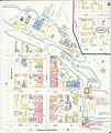
 Sanborn Fire Insurance Map from Cedar Falls, Black Hawk County, Iowa. LOC sanborn02596 001-1.tif 6,450 × 7,650; 141.17 MB
-

-
 Sanborn Fire Insurance Map from Cedar Falls, Black Hawk County, Iowa. LOC sanborn02596 001-2.tif 6,450 × 7,650; 141.17 MB
-

-
 Sanborn Fire Insurance Map from Cedar Falls, Black Hawk County, Iowa. LOC sanborn02596 002-1.tif 6,450 × 7,650; 141.17 MB
-

-
 Sanborn Fire Insurance Map from Cedar Falls, Black Hawk County, Iowa. LOC sanborn02596 002-2.tif 6,450 × 7,650; 141.17 MB
-

-
 Sanborn Fire Insurance Map from Cedar Falls, Black Hawk County, Iowa. LOC sanborn02596 002-3.tif 6,450 × 7,650; 141.17 MB
-

-
 Sanborn Fire Insurance Map from Cedar Falls, Black Hawk County, Iowa. LOC sanborn02596 002-4.tif 6,450 × 7,650; 141.17 MB
-

-
 Sanborn Fire Insurance Map from Cedar Falls, Black Hawk County, Iowa. LOC sanborn02596 002-5.tif 6,450 × 7,650; 141.17 MB
-
-
 Sanborn Fire Insurance Map from Cedar Falls, Black Hawk County, Iowa. LOC sanborn02596 003-1.tif 6,450 × 7,650; 141.17 MB
-
-
 Sanborn Fire Insurance Map from Cedar Falls, Black Hawk County, Iowa. LOC sanborn02596 003-2.tif 6,450 × 7,650; 141.17 MB
-

-
 Sanborn Fire Insurance Map from Cedar Falls, Black Hawk County, Iowa. LOC sanborn02596 003-3.tif 6,450 × 7,650; 141.17 MB
-
-
 Sanborn Fire Insurance Map from Cedar Falls, Black Hawk County, Iowa. LOC sanborn02596 003-4.tif 6,450 × 7,650; 141.17 MB
-
-
 Sanborn Fire Insurance Map from Cedar Falls, Black Hawk County, Iowa. LOC sanborn02596 003-5.tif 6,450 × 7,650; 141.17 MB
-

-
 Sanborn Fire Insurance Map from Cedar Falls, Black Hawk County, Iowa. LOC sanborn02596 003-6.tif 6,450 × 7,650; 141.17 MB
-

-
 Sanborn Fire Insurance Map from Cedar Falls, Black Hawk County, Iowa. LOC sanborn02596 004-1.tif 6,450 × 7,650; 141.17 MB
-

-
 Sanborn Fire Insurance Map from Cedar Falls, Black Hawk County, Iowa. LOC sanborn02596 004-10.tif 6,450 × 7,650; 141.17 MB
-

-
 Sanborn Fire Insurance Map from Cedar Falls, Black Hawk County, Iowa. LOC sanborn02596 004-11.tif 6,450 × 7,650; 141.17 MB
-

-
 Sanborn Fire Insurance Map from Cedar Falls, Black Hawk County, Iowa. LOC sanborn02596 004-12.tif 6,450 × 7,650; 141.17 MB
-

-
 Sanborn Fire Insurance Map from Cedar Falls, Black Hawk County, Iowa. LOC sanborn02596 004-2.tif 6,450 × 7,650; 141.17 MB
-

-
 Sanborn Fire Insurance Map from Cedar Falls, Black Hawk County, Iowa. LOC sanborn02596 004-3.tif 6,450 × 7,650; 141.17 MB
-

-
 Sanborn Fire Insurance Map from Cedar Falls, Black Hawk County, Iowa. LOC sanborn02596 004-4.tif 6,450 × 7,650; 141.17 MB
-

-
 Sanborn Fire Insurance Map from Cedar Falls, Black Hawk County, Iowa. LOC sanborn02596 004-5.tif 6,450 × 7,650; 141.17 MB
-

-
 Sanborn Fire Insurance Map from Cedar Falls, Black Hawk County, Iowa. LOC sanborn02596 004-6.tif 6,450 × 7,650; 141.17 MB
-

-
 Sanborn Fire Insurance Map from Cedar Falls, Black Hawk County, Iowa. LOC sanborn02596 004-7.tif 6,450 × 7,650; 141.17 MB
-

-
 Sanborn Fire Insurance Map from Cedar Falls, Black Hawk County, Iowa. LOC sanborn02596 004-8.tif 6,450 × 7,650; 141.17 MB
-

-
 Sanborn Fire Insurance Map from Cedar Falls, Black Hawk County, Iowa. LOC sanborn02596 004-9.tif 6,450 × 7,650; 141.17 MB
-

-
 Sanborn Fire Insurance Map from Cedar Falls, Black Hawk County, Iowa. LOC sanborn02596 005-1.tif 6,450 × 7,650; 141.17 MB
-

-
 Sanborn Fire Insurance Map from Cedar Falls, Black Hawk County, Iowa. LOC sanborn02596 005-10.tif 6,450 × 7,650; 141.17 MB
-

-
 Sanborn Fire Insurance Map from Cedar Falls, Black Hawk County, Iowa. LOC sanborn02596 005-11.tif 6,450 × 7,650; 141.17 MB
-

-
 Sanborn Fire Insurance Map from Cedar Falls, Black Hawk County, Iowa. LOC sanborn02596 005-12.tif 6,450 × 7,650; 141.17 MB
-

-
 Sanborn Fire Insurance Map from Cedar Falls, Black Hawk County, Iowa. LOC sanborn02596 005-13.tif 6,450 × 7,650; 141.17 MB
-

-
 Sanborn Fire Insurance Map from Cedar Falls, Black Hawk County, Iowa. LOC sanborn02596 005-14.tif 6,450 × 7,650; 141.17 MB
-

-
 Sanborn Fire Insurance Map from Cedar Falls, Black Hawk County, Iowa. LOC sanborn02596 005-15.tif 6,450 × 7,650; 141.17 MB
-

-
 Sanborn Fire Insurance Map from Cedar Falls, Black Hawk County, Iowa. LOC sanborn02596 005-16.tif 6,450 × 7,650; 141.17 MB
-

-
 Sanborn Fire Insurance Map from Cedar Falls, Black Hawk County, Iowa. LOC sanborn02596 005-2.tif 6,450 × 7,650; 141.17 MB
-

-
 Sanborn Fire Insurance Map from Cedar Falls, Black Hawk County, Iowa. LOC sanborn02596 005-3.tif 6,450 × 7,650; 141.17 MB
-

-
 Sanborn Fire Insurance Map from Cedar Falls, Black Hawk County, Iowa. LOC sanborn02596 005-4.tif 6,450 × 7,650; 141.17 MB
-

-
 Sanborn Fire Insurance Map from Cedar Falls, Black Hawk County, Iowa. LOC sanborn02596 005-5.tif 6,450 × 7,650; 141.17 MB
-

-
 Sanborn Fire Insurance Map from Cedar Falls, Black Hawk County, Iowa. LOC sanborn02596 005-6.tif 6,450 × 7,650; 141.17 MB
-

-
 Sanborn Fire Insurance Map from Cedar Falls, Black Hawk County, Iowa. LOC sanborn02596 005-7.tif 6,450 × 7,650; 141.17 MB
-

-
 Sanborn Fire Insurance Map from Cedar Falls, Black Hawk County, Iowa. LOC sanborn02596 005-8.tif 6,450 × 7,650; 141.17 MB
-

-
 Sanborn Fire Insurance Map from Cedar Falls, Black Hawk County, Iowa. LOC sanborn02596 005-9.tif 6,450 × 7,650; 141.17 MB
-

-
 Sanborn Fire Insurance Map from Cedar Falls, Black Hawk County, Iowa. LOC sanborn02596 006-1.tif 6,450 × 7,650; 141.17 MB
-

-
 Sanborn Fire Insurance Map from Cedar Falls, Black Hawk County, Iowa. LOC sanborn02596 006-10.tif 6,450 × 7,650; 141.17 MB
-

-
 Sanborn Fire Insurance Map from Cedar Falls, Black Hawk County, Iowa. LOC sanborn02596 006-11.tif 6,450 × 7,650; 141.17 MB
-

-
 Sanborn Fire Insurance Map from Cedar Falls, Black Hawk County, Iowa. LOC sanborn02596 006-12.tif 6,450 × 7,650; 141.17 MB
-

-
 Sanborn Fire Insurance Map from Cedar Falls, Black Hawk County, Iowa. LOC sanborn02596 006-13.tif 6,450 × 7,650; 141.17 MB
-

-
 Sanborn Fire Insurance Map from Cedar Falls, Black Hawk County, Iowa. LOC sanborn02596 006-14.tif 6,450 × 7,650; 141.17 MB
-

-
 Sanborn Fire Insurance Map from Cedar Falls, Black Hawk County, Iowa. LOC sanborn02596 006-15.tif 6,450 × 7,650; 141.17 MB
-

-
 Sanborn Fire Insurance Map from Cedar Falls, Black Hawk County, Iowa. LOC sanborn02596 006-16.tif 6,450 × 7,650; 141.17 MB
-

-
 Sanborn Fire Insurance Map from Cedar Falls, Black Hawk County, Iowa. LOC sanborn02596 006-2.tif 6,450 × 7,650; 141.17 MB
-

-
 Sanborn Fire Insurance Map from Cedar Falls, Black Hawk County, Iowa. LOC sanborn02596 006-3.tif 6,450 × 7,650; 141.17 MB
-

-
 Sanborn Fire Insurance Map from Cedar Falls, Black Hawk County, Iowa. LOC sanborn02596 006-4.tif 6,450 × 7,650; 141.17 MB
-

-
 Sanborn Fire Insurance Map from Cedar Falls, Black Hawk County, Iowa. LOC sanborn02596 006-5.tif 6,450 × 7,650; 141.17 MB
-

-
 Sanborn Fire Insurance Map from Cedar Falls, Black Hawk County, Iowa. LOC sanborn02596 006-6.tif 6,450 × 7,650; 141.17 MB
-

-
 Sanborn Fire Insurance Map from Cedar Falls, Black Hawk County, Iowa. LOC sanborn02596 006-7.tif 6,450 × 7,650; 141.17 MB
-

-
 Sanborn Fire Insurance Map from Cedar Falls, Black Hawk County, Iowa. LOC sanborn02596 006-8.tif 6,450 × 7,650; 141.17 MB
-

-
 Sanborn Fire Insurance Map from Cedar Falls, Black Hawk County, Iowa. LOC sanborn02596 006-9.tif 6,450 × 7,650; 141.17 MB


