Category:Saint Rupert Church (Staudachhof)
Jump to navigation
Jump to search
| Object location | | View all coordinates using: OpenStreetMap |
|---|
church  | |||||
| Upload media | |||||
| Instance of | |||||
|---|---|---|---|---|---|
| Named after | |||||
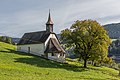
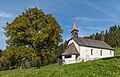
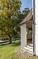
| Location | Friesach, Sankt Veit an der Glan District, Carinthia, Austria | ||||
| Street address |
| ||||
| Architectural style | |||||
| Heritage designation | |||||
 | |||||
Subcategories
This category has only the following subcategory.
Media in category "Saint Rupert Church (Staudachhof)"
The following 25 files are in this category, out of 25 total.
-
 Friesach Staudachhof Filialkirche hl. Rupertus Gitterfenster 09102020 0035.jpg 4,394 × 6,587; 15.76 MB
-
 Friesach Staudachhof Filialkirche hl. Rupertus Gitterfenster 091022020 0037.jpg 6,827 × 4,699; 17.49 MB
-
 Friesach Staudachhof Filialkirche hl. Rupertus NW-Ansicht 091022020 0023.jpg 7,360 × 4,912; 24.26 MB
-
 Friesach Staudachhof Filialkirche hl. Rupertus NW-Ansicht 091022020 0024.jpg 7,360 × 4,912; 27.11 MB
-
 Friesach Staudachhof Filialkirche hl. Rupertus S-Ansicht 091022020 0028.jpg 6,083 × 4,254; 15.73 MB
-
 Friesach Staudachhof Filialkirche hl. Rupertus SO-Ansicht 091022020 0032.jpg 7,360 × 4,912; 24.55 MB
-
 Friesach Staudachhof Filialkirche hl. Rupertus SSO-Ansicht 09102020 0030.jpg 7,360 × 4,912; 24.77 MB
-
 Friesach Staudachhof Filialkirche hl. Rupertus SW-Ansicht 091022020 0043.jpg 6,066 × 3,908; 18.14 MB
-
 Friesach Staudachhof Filialkirche hl. Rupertus Vorhalle 091022020 0026.jpg 6,349 × 4,653; 16.11 MB
-
 Friesach Staudachhof Filialkirche hl. Rupertus Vorhalle 091022020 0027.jpg 7,256 × 4,796; 20.16 MB
-
 Friesach Staudachhof Filialkirche hl. Rupertus Vorhalle 091022020 0041.jpg 4,557 × 7,067; 23.58 MB
-
 Friesach Staudachhof Filialkirche hl. Rupertus W-Ansicht 091022020 0025.jpg 6,926 × 4,572; 28.39 MB
-
 Moserwinklbach 01.jpg 4,421 × 3,316; 3.05 MB
-
 Rupertikirche Staudachhof Dachreiter.jpg 3,456 × 4,608; 5.88 MB
-
 Rupertikirche Staudachhof Fenster 01.jpg 3,456 × 4,608; 5.78 MB
-
 Rupertikirche Staudachhof Fenster 02.jpg 3,456 × 4,608; 6.1 MB
-
 Rupertikirche Staudachhof Fenster 03.jpg 3,456 × 4,608; 6.17 MB
-
 Rupertikirche Staudachhof Portal.jpg 3,456 × 4,608; 6.11 MB
-
 Rupertikirche Staudachhof Südwestecke.jpg 4,608 × 3,456; 6.36 MB
-
 Rupertikirche Staudachhof Vorlaube.jpg 4,608 × 3,456; 5.74 MB
-
 Rupertikirche Staudachhof Westseite.jpg 4,608 × 3,456; 6.11 MB
-
 Rupertikirche Staudachhof.jpg 4,608 × 3,456; 6.33 MB
-
 Staudachhof - Filialkirche Hl Rupertus1.JPG 3,088 × 2,056; 1.25 MB
-
 Staudachhof - Filialkirche Hl Rupertus2.jpg 2,056 × 3,088; 2.01 MB
-
 Staudachhof Friesach.jpg 4,608 × 2,592; 1.83 MB


