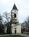
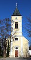
Category:Saint Lawrence Church (Achau)
Jump to navigation
Jump to search
| Object location | | View all coordinates using: OpenStreetMap |
|---|
cemetery in Lower Austria, Austria  | |||||
| Upload media | |||||
| Instance of | |||||
|---|---|---|---|---|---|
| Location | Achau, Mödling District, Lower Austria, Austria | ||||
| Diocese | |||||
| Heritage designation | |||||
 | |||||
Media in category "Saint Lawrence Church (Achau)"
The following 5 files are in this category, out of 5 total.
-
 2010-11-20 0021 Achau Kirche.JPG 3,872 × 2,592; 2.35 MB
-
 Achau Kirche - 1.jpg 3,872 × 2,592; 6.87 MB
-
 Achau Kirche - 2.jpg 3,872 × 2,592; 8.38 MB
-
 GuentherZ 2010-11-20 0023 Achau Kirche.jpg 1,435 × 1,800; 1.36 MB
-
 Pfarrkirche Achau.jpg 2,672 × 5,088; 5.35 MB


