Category:Saint Giles Church (Semriach)
Jump to navigation
Jump to search
| Object location | | View all coordinates using: OpenStreetMap |
|---|
parish church and cemetery in Styria  | |||||
| Upload media | |||||
| Instance of | |||||
|---|---|---|---|---|---|
| Named after | |||||
| Location | Semriach, Graz-Umgebung District, Styria, Austria | ||||
| Street address |
| ||||
| Heritage designation | |||||
 | |||||
Subcategories
This category has the following 2 subcategories, out of 2 total.
Media in category "Saint Giles Church (Semriach)"
The following 10 files are in this category, out of 10 total.
-
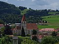 Pfk Semriach Nord.jpg 5,184 × 3,888; 6.51 MB
-
 Pfk. Semriach NE 01.jpg 5,184 × 3,888; 6.92 MB
-
 Pfk. Semriach NE 02.jpg 5,184 × 3,888; 5.77 MB
-
 Pfk. Semriach NE 03.jpg 5,184 × 3,888; 5.84 MB
-
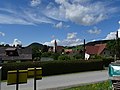
 Semriach Kirche.JPG 2,048 × 1,536; 701 KB
-
 Semriach Pfarrkirche 01.jpg 4,000 × 6,000; 9.18 MB
-
 Semriach-Friedhofskapelle Schmerzhafte Mutter1.jpg 2,592 × 1,552; 869 KB
-
 Semriach-Gattertor.jpg 1,552 × 2,402; 852 KB
-
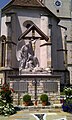 Semriach-Kriegerdenkmal.jpg 1,552 × 2,592; 991 KB
-
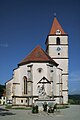
 Semriach-Pfarrkirche.jpg 1,552 × 2,592; 929 KB


