Category:Saint Gall Church (Weer, Tyrol)
Jump to navigation
Jump to search
| Object location | | View all coordinates using: OpenStreetMap |
|---|
church building in Weer, Austria   | |||||
| Upload media | |||||
| Instance of | |||||
|---|---|---|---|---|---|
| Location | Weer, Schwaz District, Tyrol, Austria | ||||
| Heritage designation | |||||
 | |||||
| This category shows the protected monument with the number 64957 in Austria. (Commons, de, Wikidata) |
|
This category shows the remarkable cultural object in the Austrian state of Tyrol listed by the Tyrolean Art Cadastre with the ID
14378. (on tirisMaps, pdf, more images on Commons, Wikidata) |
Subcategories
This category has the following 2 subcategories, out of 2 total.
F
Media in category "Saint Gall Church (Weer, Tyrol)"
The following 8 files are in this category, out of 8 total.
-
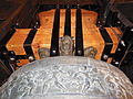 Große Glocke Krone und Reliefs.JPG 4,608 × 3,456; 6.16 MB
-
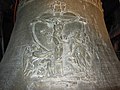 Große Glocke Relief.JPG 4,608 × 3,456; 6.18 MB
-
 Große Glocke-Weer.jpg 3,456 × 4,608; 6.13 MB
-
 Kath. Pfarrkirche hl. Gallus.jpg 3,696 × 2,448; 2.85 MB
-
 Pfarrkirche mit Totenkapelle.JPG 1,600 × 1,200; 447 KB
-
 Pfarrkirche Weer1.JPG 2,592 × 3,872; 3.09 MB
-
 Pfarrkirche Weer2.JPG 3,872 × 2,592; 3.2 MB
-
 Weer, Pfarrkirche Sankt Gallus Dm64957 foto1 2012-08-09 14.48.JPG 4,416 × 3,312; 7.21 MB


