Category:SVG topographic maps of Poland
Jump to navigation
Jump to search
Countries of Europe: Albania · Andorra · Armenia‡ · Austria · Azerbaijan‡ · Belarus · Belgium · Bosnia and Herzegovina · Bulgaria · Croatia · Cyprus‡ · Czech Republic · Denmark · Estonia · Finland · France‡ · Georgia‡ · Germany · Greece · Hungary · Iceland · Republic of Ireland · Italy · Kazakhstan‡ · Latvia · Liechtenstein · Lithuania · Luxembourg · Malta · Moldova · Montenegro · Netherlands‡ · North Macedonia · Norway · Poland · Portugal‡ · Romania · Russia‡ · San Marino · Serbia · Slovakia · Slovenia · Spain‡ · Sweden · Switzerland · Turkey‡ · Ukraine · United Kingdom
‡: partly located in Europe
‡: partly located in Europe
Subcategories
This category has the following 2 subcategories, out of 2 total.
Media in category "SVG topographic maps of Poland"
The following 9 files are in this category, out of 9 total.
-
 KingdomofPoland1815 hu.svg 1,133 × 851; 611 KB
-
 Mapa części Niziny Śląsko Łużyckiej i Wału Trzebnickiego.svg 942 × 567; 782 KB
-
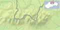
 Mapka pojezierza iławskiego.svg 1,507 × 1,131; 448 KB
-
 POL Tatry.svg 811 × 401; 5.36 MB
-
 Polonia1924-1938MapaTopográfico.svg 581 × 606; 20.92 MB
-
 Polonia1924-1938MapaTopográfico2.svg 581 × 606; 14.73 MB
-
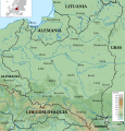
 Relief Map of Poland.svg 861 × 837; 4 MB
-
 SVK Tatry.svg 811 × 401; 5.12 MB
-
 Tatra Mountains location map.svg 938 × 589; 1.44 MB


