Category:SVG maps of the history of the European Union
Jump to navigation
Jump to search
Use the appropriate category for maps showing all or a large part of the European Union. See subcategories for smaller areas:
| If the map shows | Category to use |
|---|---|
| the European Union on a recently created map | Category:Maps of the European Union or its subcategories |
| the European Union on a map created more than 70 years ago | Category:Old maps of the European Union or its subcategories |
| the history of the European Union on a recently created map | Category:Maps of the history of the European Union or its subcategories |
| the history of the European Union on a map created more than 70 years ago | Category:Old maps of the history of the European Union or its subcategories |
Media in category "SVG maps of the history of the European Union"
The following 31 files are in this category, out of 31 total.
-
 Beitrittskandidaten.svg 680 × 520; 261 KB
-
 EC-EU enlargement.svg 680 × 520; 570 KB
-
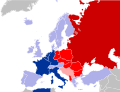 EC06-1957-58 EC and USSR map.svg 680 × 520; 510 KB
-
 EC06-1957-58 European Community map.svg 680 × 520; 511 KB
-
 EC06-1962 (Decolonisation) European Community map.svg 680 × 520; 511 KB
-
 EC09-1973 European Community map enlargement.svg 680 × 520; 511 KB
-
 EC09-1973 European Community map.svg 680 × 520; 511 KB
-
 EC10-1981 European Community map enlargement.svg 680 × 520; 511 KB
-
 EC10-1981 European Community map.svg 680 × 520; 511 KB
-
 EC10-1985 (Greenland withdrawal) European Community map.svg 680 × 520; 511 KB
-
 EC12-1986 EC and USSR map.svg 680 × 520; 511 KB
-
 EC12-1986 European Community map enlargement.svg 680 × 520; 511 KB
-
 EC12-1986 European Community map.svg 680 × 520; 511 KB
-
 EC12-1990 European Community map enlargement.svg 680 × 520; 511 KB
-
 EC12-1990 European Community map.svg 680 × 520; 594 KB
-
 Enlargement of the European Union SMIL.svg 512 × 512; 335 KB
-
 EU accession map.svg 800 × 520; 553 KB
-
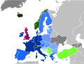
 EU-28 2017 (Brexit)-European Union map.svg 680 × 520; 343 KB
-
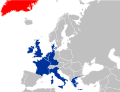
 EU-28 Beitrittskandidaten.svg 680 × 520; 417 KB
-
 EU-Erweiterungsbeschlüsse 1999.svg 680 × 520; 372 KB
-
 EU12-1992-93 European Union map.svg 680 × 520; 515 KB
-
 EU15-1995 European Union map enlargement.svg 680 × 520; 515 KB
-
 EU15-1995 European Union map.svg 680 × 520; 515 KB
-
 EU25-2004 European Union map enlargement.svg 680 × 520; 516 KB
-
 EU25-2004 European Union map.svg 680 × 520; 515 KB
-
 EU25-27-2004-2007 European Union map enlargement.svg 680 × 520; 516 KB
-
 EU27-2007 European Union map enlargement.svg 680 × 520; 516 KB
-
 EU27-2020 (UK withdrawal) European Union.svg 680 × 520; 378 KB
-
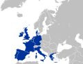
 EU28.svg 680 × 520; 516 KB
-
 Eurointegration (breakaway regions).svg 512 × 374; 331 KB
-
 SchengenAgreement map with dates.svg 810 × 613; 561 KB


_European_Community_map.svg)


_European_Community_map.svg)


-European_Union_map.svg)


_European_Union.svg)

.svg)
