Category:SVG maps of the Second Polish Republic
Jump to navigation
Jump to search
Media in category "SVG maps of the Second Polish Republic"
The following 26 files are in this category, out of 26 total.
-
 Border-Lithuania-Poland-1919-1939.svg 1,476 × 1,558; 641 KB
-
 Carpathian Ruthenia issue, 1938.svg 545 × 385; 116 KB
-
 CuartaParticiónDePolonia1939.svg 622 × 510; 45 KB
-
 Curzon line-fr.svg 516 × 508; 41 KB
-
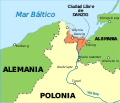
 Danzig 1939 EN.svg 696 × 599; 32 KB
-
 Danzig 1939 ES.svg 696 × 599; 43 KB
-
 FronteraPolaca--timeshistoryofwa21londuoft-p408.svg 2,014 × 2,816; 1.98 MB
-
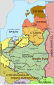
 FronterasDePolonia19201947 de.svg 622 × 510; 13 KB
-
 FronterasDePolonia19201947.svg 622 × 510; 203 KB
-
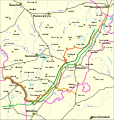
 Kanał Gdynia – Bydgoszcz.svg 255 × 425; 33 KB
-
 Katyn massacres 1940 map-de.svg 1,053 × 825; 191 KB
-
 Katyn massacres 1940 map-fr.svg 1,053 × 825; 194 KB
-
 PL-LT War 1919.svg 1,476 × 1,558; 671 KB
-
 Poland (1923–1937) location map.svg 581 × 606; 1.28 MB
-
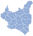
 Poland (1938) location map with voivodeships.svg 1,404 × 1,461; 121 KB
-
 Poland 1930.svg 450 × 456; 484 KB
-
 Poland Voivodeships adminstrative division 1918-1939.svg 390 × 427; 55 KB
-
 Polonia1924-1938MapaTopográfico2.svg 581 × 606; 14.73 MB
-
-
 Rzeczpospolita 1937 noname.svg 2,014 × 1,567; 199 KB
-
 Rzeczpospolita 1937.svg 2,220 × 1,554; 573 KB
-
 Rzeczpospolita 1938 ES.svg 2,220 × 1,554; 1.34 MB
-
 SegundaRepúblicaChecoslovaca19381939-2-pt.svg 2,875 × 1,330; 106 KB
-
 SegundaRepúblicaChecoslovaca19381939-2.svg 2,875 × 1,330; 313 KB
-
 SegundaRepúblicaChecoslovaca19381939-pt.svg 2,875 × 1,330; 154 KB
-
 SegundaRepúblicaChecoslovaca19381939.svg 2,875 × 1,330; 511 KB


_location_map.svg)
_location_map_with_voivodeships.svg)


