Category:SVG maps of Palau
Jump to navigation
Jump to search
Subcategories
This category has the following 2 subcategories, out of 2 total.
Media in category "SVG maps of Palau"
The following 20 files are in this category, out of 20 total.
-
 Fanna (île).svg 6,448 × 5,557; 32 KB
-
 Hatohobei Island-fr.svg 1,591 × 1,414; 64 KB
-
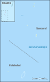
 Hatohobei State map.svg 797 × 849; 156 KB
-
 Hatohobei State-fr.svg 6,399 × 2,625; 153 KB
-
 Koror State map-fr.svg 9,310 × 7,764; 2.37 MB
-
 Koror State map.svg 9,310 × 7,764; 1.08 MB
-
 Merir (Melieli) map-fr.svg 4,278 × 3,748; 56 KB
-
 Pacific-German-Colonie-mk.svg 789 × 516; 791 KB
-
 Pacific-German-Colonie-ru.svg 789 × 516; 791 KB
-
 Pacific-German-Colonies-es.svg 3,057 × 2,000; 249 KB
-
 Pacific-German-Colonies.svg 789 × 516; 66 KB
-
 Palau Koror-Babeldaob bridge map-en.svg 763 × 552; 334 KB
-
 Palau Koror-Babeldaob bridge map-fr.svg 763 × 552; 334 KB
-
 Palau Koror-Babeldaob bridge map-mk.svg 763 × 552; 334 KB
-
 Puro Island (Palau).svg 1,344 × 995; 64 KB
-
 Sonsorol (île).svg 7,751 × 6,527; 57 KB
-
 Sonsorol State map.png 4,150 × 5,824; 554 KB
-
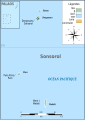 Sonsorol State.svg 4,147 × 5,824; 155 KB
-
 South West Island map-fr.svg 7,045 × 11,600; 138 KB
-
 Un-palau-es.svg 580 × 773; 529 KB
.svg)


_map-fr.svg)


.svg)
.svg)


