Category:SVG maps of Oceania
Jump to navigation
Jump to search

Subcategories
This category has the following 27 subcategories, out of 27 total.
Media in category "SVG maps of Oceania"
The following 52 files are in this category, out of 52 total.
-
 ABU APSC Participation.svg 1,250 × 870; 1.03 MB
-
 Age of Consent - Oceania.svg 512 × 486; 36 KB
-
 Aipysurus foliosquama distribution map.svg 1,984 × 1,780; 1,004 KB
-
 Battle of Santa Cruz map-fr.svg 1,345 × 1,343; 146 KB
-
 Battle Philippine sea map-blank.svg 738 × 675; 80 KB
-
 Blank Map Oceania.svg 738 × 527; 186 KB
-
 Coral Sea battle.svg 868 × 717; 497 KB
-
 Coral Sea blank.svg 942 × 600; 152 KB
-
 Coral Sea es.svg 942 × 600; 198 KB
-
 Coral Sea mk.svg 943 × 600; 210 KB
-
 Coral Sea.svg 943 × 600; 200 KB
-
 Differenciation of Proto-Polynesian map -fr.svg 1,429 × 846; 106 KB
-
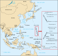
 EEZ Oceania.svg 385 × 215; 201 KB
-
 Japanese air attacks on the Mariana Islands.png 1,035 × 1,001; 128 KB
-
 Map of Eparchies of Serbian Orthodox Church in Oceania-fr.svg 839 × 608; 77 KB
-
 Mariana Islands ru.svg 1,036 × 1,001; 248 KB
-
 Mariannes-be.svg 1,035 × 1,001; 160 KB
-
 Mariannes-blank.svg 1,035 × 1,001; 170 KB
-
 Mariannes.svg 1,036 × 1,001; 233 KB
-
 Mariannes2006.es.svg 1,036 × 1,001; 240 KB
-
 Mariannes2006.svg 1,036 × 1,001; 240 KB
-
 Northern Mariana Islands mk.svg 1,036 × 1,001; 225 KB
-
 NRL Teams map blank map.svg 481 × 623; 78 KB
-
 Oahu blank map.svg 595 × 504; 29 KB
-
 Oahu mk.svg 595 × 504; 49 KB
-
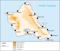 Oahu.svg 595 × 504; 48 KB
-
 Oceania Administrative Divisions with Full Names in Spanish.svg 952 × 610; 159 KB
-
 Oceania continents.svg 800 × 520; 122 KB
-
 Oceania mk.svg 780 × 499; 319 KB
-
 Oceania WorldRugby federations by number of registered players (2019).svg 634 × 452; 1.14 MB
-
 Oceania98.svg 8,000 × 4,733; 1.29 MB
-
 Oceanía en Wikiviajes.svg 1,181 × 1,013; 1.66 MB
-
 Pacific-German-Colonie-mk.svg 789 × 516; 791 KB
-
 Pacific-German-Colonie-ru.svg 789 × 516; 791 KB
-
 Pacific-German-Colonies-es.svg 3,057 × 2,000; 249 KB
-
 Pacific-German-Colonies.svg 789 × 516; 66 KB
-
 Pearl Harbor 1941.svg 595 × 575; 102 KB
-
 Red-headed Myzomela distribution map.svg 293 × 323; 193 KB
-
 Same-sex marriage map Oceania.svg 900 × 502; 194 KB
-
 Second world war asia 1937-1942 map blank.svg 1,300 × 1,000; 173 KB
-
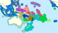
 Sociolinguistic Map of Polynesian Languages in the 21st Century - fr v2.svg 1,246 × 987; 3.89 MB
-
 Sociolinguistic map of Polynesian Languages in the 21st century - fr.svg 1,246 × 987; 3.75 MB
-
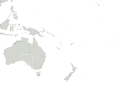
 States and territories of Oceania.svg 1,794 × 1,146; 416 KB
-
 Un-palau-es.svg 580 × 773; 529 KB
-
 Wallis, Futuna, Samoa, Tonga, Niue, Fidji (Polynésie ancestrale) Fr.svg 1,429 × 846; 88 KB
-

-
 Western Polynesia and Polynesian Outliers - fr.svg 1,238 × 939; 4.02 MB
-
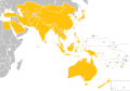
 Wikimedia regions - East, Southeast Asia, & Pacific.svg 800 × 800; 372 KB
-
 Zealandia-Continent map en.svg 789 × 864; 327 KB
-
 Zealandia-Continent map fr.svg 794 × 868; 339 KB
-
 Zealandia-Continent map mk.svg 797 × 871; 381 KB
-
 Карта на Тахити.svg 1,016 × 571; 957 KB


.svg)


_Fr.svg)
_multilingue.svg)


