Category:SVG maps of Honduras
Jump to navigation
Jump to search
Countries of the Americas: Antigua and Barbuda · Argentina · The Bahamas · Barbados · Belize · Bolivia · Brazil · Canada · Chile · Colombia · Costa Rica · Cuba · Dominica · Dominican Republic · Ecuador · El Salvador · Grenada · Guatemala · Guyana · Haiti · Honduras · Jamaica · Mexico · Nicaragua · Panama · Paraguay · Peru · Saint Kitts and Nevis · Saint Lucia · Saint Vincent and the Grenadines · Suriname · Trinidad and Tobago · United States of America · Uruguay · Venezuela
Other areas: Anguilla · Aruba · Bermuda · British Virgin Islands · Cayman Islands · Curaçao · Dutch Caribbean · French Guiana · Greenland · Guadeloupe · Martinique · Puerto Rico · Saint Barthélemy · Saint-Martin · Saint Pierre and Miquelon · Sint Maarten
Other areas: Anguilla · Aruba · Bermuda · British Virgin Islands · Cayman Islands · Curaçao · Dutch Caribbean · French Guiana · Greenland · Guadeloupe · Martinique · Puerto Rico · Saint Barthélemy · Saint-Martin · Saint Pierre and Miquelon · Sint Maarten
Subcategories
This category has the following 6 subcategories, out of 6 total.
Media in category "SVG maps of Honduras"
The following 12 files are in this category, out of 12 total.
-
 Caribbean maritime boundaries map zh.svg 3,561 × 2,221; 2.87 MB
-
 Caribbean maritime boundaries map.svg 3,561 × 2,221; 2.78 MB
-
 Caribbean maritime boundaries map mk.svg 3,561 × 2,221; 5.52 MB
-
 Mapa das Caraíbas (fronteiras marítimas).svg 3,561 × 2,221; 2.86 MB
-
 Mapa del Caribe (límites marinos).svg 5,340 × 3,660; 3.02 MB
-
 Mapa del Mar Caribe (límites marinos)-fr.svg 3,587 × 2,221; 1.91 MB
-
 Mapa del Mar Caribe (límites marinos).svg 3,587 × 2,221; 1.98 MB
-
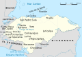
 Honduras Regions map-es.svg 803 × 591; 1.7 MB
-
 HondurasBásicoV1.svg 999 × 687; 668 KB
-
 HondurasHidrografía.svg 971 × 652; 388 KB
-
 HondurasHidrografía2.svg 803 × 591; 1.07 MB
-
 HondurasMapaGeneral-es.svg 803 × 591; 1.66 MB


.svg)
.svg)
-fr.svg)
.svg)


