Category:SVG maps of Goa
Jump to navigation
Jump to search
States of India: Andhra Pradesh · Arunachal Pradesh · Assam · Bihar · Chhattisgarh · Goa · Gujarat · Haryana · Himachal Pradesh · Jharkhand · Karnataka · Kerala · Madhya Pradesh · Maharashtra · Manipur · Meghalaya · Mizoram · Nagaland · Odisha · Punjab · Rajasthan · Sikkim · Tamil Nadu · Telangana · Tripura · Uttar Pradesh · Uttarakhand · West Bengal
Union territories: Andaman and Nicobar Islands · Chandigarh · Dadra and Nagar Haveli and Daman and Diu · Delhi · Jammu and Kashmir · Ladakh · Lakshadweep · Puducherry
Former states of India: Jammu and Kashmir ·
Former union territories:
Union territories: Andaman and Nicobar Islands · Chandigarh · Dadra and Nagar Haveli and Daman and Diu · Delhi · Jammu and Kashmir · Ladakh · Lakshadweep · Puducherry
Former states of India: Jammu and Kashmir ·
Former union territories:
Subcategories
This category has only the following subcategory.
!
Media in category "SVG maps of Goa"
The following 14 files are in this category, out of 14 total.
-
 Badami-chalukya-empire-map.svg 1,510 × 1,753; 339 KB
-
 Bahamani-sultanate-map.svg 1,521 × 1,761; 334 KB
-
 Bijapur-sultanate-map.svg 1,651 × 1,753; 432 KB
-
 Goa administrative de.svg 500 × 729; 215 KB
-
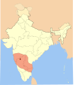
 Goa locator map.svg 274 × 331; 93 KB
-
 Goa map for WLM-IN.svg 595 × 839; 340 KB
-
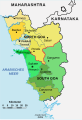
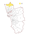
 Goa Wahlkreise Lok Sabha.svg 600 × 680; 185 KB
-
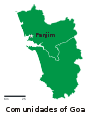 GoaCom.svg 744 × 1,052; 302 KB
-
 India Goa location map.svg 794 × 960; 219 KB
-
 IndiaCom.svg 744 × 1,052; 365 KB
-
 Vijayanagara-empire-map.svg 1,585 × 1,850; 372 KB
-
 Wahlkreise zur Vidhan Sabha von Goa.svg 600 × 680; 642 KB
-
 Western-chalukya-empire-map.svg 1,510 × 1,753; 426 KB
-
 গোয়ার লোকসভা কেন্দ্র.svg 600 × 680; 185 KB


