Category:SVG maps of East Kalimantan
Jump to navigation
Jump to search
| NO WIKIDATA ID FOUND! Search for SVG maps of East Kalimantan on Wikidata | |
| Upload media |

Media in category "SVG maps of East Kalimantan"
The following 17 files are in this category, out of 17 total.
-
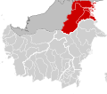
 64.00.00 KalimantanTimur.svg 179 × 158; 863 KB
-
 64.01.00 KalimantanTimur Paser.svg 179 × 158; 863 KB
-
 64.02.00 KalimantanTimur Kutai Kartanegara.svg 179 × 158; 863 KB
-
 64.03.00 KalimantanTimur Berau.svg 179 × 158; 863 KB
-
 64.07.00 KalimantanTimur Kutai Barat.svg 179 × 158; 863 KB
-
 64.08.00 KalimantanTimur Kutai Timur.svg 179 × 158; 863 KB
-
 64.09.00 KalimantanTimur Penajam Paser Utara.svg 179 × 158; 863 KB
-
 64.12.00 KalimantanTimur Mahakam Ulu.svg 179 × 158; 863 KB
-
 64.71.00 KalimantanTimur Balikpapan.svg 179 × 158; 863 KB
-
 64.72.00 KalimantanTimur Samarinda.svg 179 × 158; 863 KB
-
 64.74.00 KalimantanTimur Bontang.svg 179 × 158; 863 KB
-
 65.00.00 KalimantanUtara.svg 179 × 158; 863 KB
-
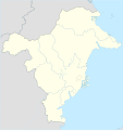
 East Kalimantan in Indonesia.svg 982 × 450; 792 KB
-
 East kalimantan location map.svg 2,215 × 2,353; 133 KB
-
 Map of 2018 East Kalimantan Gubernatorial Election - Cities and Regencies.svg 2,215 × 2,353; 132 KB
-
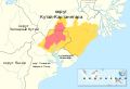 Nusantara planned area - ru.svg 1,500 × 1,022; 177 KB
-
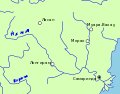 Махакам.svg 277 × 218; 27 KB


