Category:SVG locator maps of regions in Somalia (location map scheme)
Jump to navigation
Jump to search

|
SVG maps in this category are part of a locator map series applying the (de) widespread location map scheme. Please see root category to browse for more. |
.svg)
.svg)
.svg)
.svg)
.svg)
.svg)
.svg)
Locator maps design recommendations ▼ | |
|---|---|
Principles
Design Guidelines are based on ▸location map design of the German map shop (in German). It's preferable to derive new locator maps from existing location maps. Please keep both size and ratio in this case. Thus the new locator maps may still be applied as location map (▸Guide). Marker color is supposed to be darkred. Waterbodies may be transparent, to show other objects better. Please be aware that this guide is only a recommendation. It’s not an inevitable law!
Highlight small areas
“Remote” areas and mini maps
Mini maps show where the depicted area actually is situated. Check out ▸Vorlage:Positionskarte+ (in German) and ▸Modèle:Carte en coin (in French) of how to insert a mini map in virtually every map.
Disputed areas
Greyed special objects
Backgrounds
|

-en.svg)

.svg)
.svg)
.svg)

_(US48).svg)
_(small_islands_magnified)_(-mini_map_-rivers).svg)
.svg)
_(extra_close)_(US48).svg)
.svg)
_(zoom).svg)

.svg)


_(UNMIK).svg)
.svg)
_(disputed_hatched).svg)
_(claimed_and_disputed_hatched).svg)
.svg)
.svg)
_(%2Ball_claims_hatched).svg)

.svg)
_(shade).svg)
_(shade)_(special_marker).svg)
_(-mini_map).svg)
_(-mini_map).svg)
_(-mini_map).svg)


.svg)

.svg)
Media in category "SVG locator maps of regions in Somalia (location map scheme)"
The following 21 files are in this category, out of 21 total.
-
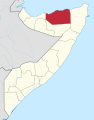
 Awdal in Somalia.svg 1,051 × 1,338; 324 KB
-
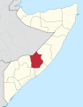
 Bakool in Somalia.svg 1,051 × 1,338; 323 KB
-
 Banaadir in Somalia (special marker).svg 1,051 × 1,338; 325 KB
-
 Banaadir in Somalia.svg 1,051 × 1,338; 324 KB
-
 Bari in Somalia.svg 1,051 × 1,338; 324 KB
-
 Bay in Somalia.svg 1,051 × 1,338; 324 KB
-
 Galguduud in Somalia.svg 1,051 × 1,338; 324 KB
-
 Gedo in Somalia.svg 1,051 × 1,338; 324 KB
-
 Hiiraan in Somalia.svg 1,051 × 1,338; 324 KB
-
 Jubaland State of Somalia.svg 1,051 × 1,338; 173 KB
-
 Lower Juba in Somalia.svg 1,051 × 1,338; 324 KB
-
 Lower Shabele in Somalia.svg 1,051 × 1,338; 324 KB
-
 Middle Juba in Somalia.svg 1,051 × 1,338; 324 KB
-
 Middle Shabele in Somalia.svg 1,051 × 1,338; 324 KB
-
 Mudug in Somalia.svg 1,051 × 1,338; 324 KB
-
 Nugaal in Somalia.svg 1,051 × 1,338; 324 KB
-
 Puntland State of Somalia.svg 1,051 × 1,338; 173 KB
-
 Sanaag in Somalia.svg 1,051 × 1,338; 324 KB
-
 Sool in Somalia.svg 1,051 × 1,338; 324 KB
-
 Togdheer in Somalia.svg 1,051 × 1,338; 324 KB
-
 Woqooyi Galbeed in Somalia.svg 1,051 × 1,338; 324 KB


.svg)


