Category:SVG locator maps of former countries of Europe (gray scheme)
Jump to navigation
Jump to search
Subcategories
This category has the following 2 subcategories, out of 2 total.
Media in category "SVG locator maps of former countries of Europe (gray scheme)"
The following 6 files are in this category, out of 6 total.
-
 First French Empire 1812.svg 450 × 456; 464 KB
-
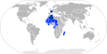 French Community 1959.svg 940 × 477; 630 KB
-
 French Community 1961.svg 940 × 477; 821 KB
-
 French Union.svg 940 × 477; 675 KB
-
 Fürstentum Erfurt 1812.svg 450 × 456; 445 KB
-
 Localisation Duché de Bretagne.svg 650 × 500; 376 KB


