Category:SVG locator maps of districts in Bhutan (location map scheme)
Jump to navigation
Jump to search

|
SVG maps in this category are part of a locator map series applying the (de) widespread location map scheme. Please see root category to browse for more. |
.svg)
.svg)
.svg)
.svg)
.svg)
.svg)
.svg)
Locator maps design recommendations ▼ | |
|---|---|
Principles
Design Guidelines are based on ▸location map design of the German map shop (in German). It's preferable to derive new locator maps from existing location maps. Please keep both size and ratio in this case. Thus the new locator maps may still be applied as location map (▸Guide). Marker color is supposed to be darkred. Waterbodies may be transparent, to show other objects better. Please be aware that this guide is only a recommendation. It’s not an inevitable law!
Highlight small areas
“Remote” areas and mini maps
Mini maps show where the depicted area actually is situated. Check out ▸Vorlage:Positionskarte+ (in German) and ▸Modèle:Carte en coin (in French) of how to insert a mini map in virtually every map.
Disputed areas
Greyed special objects
Backgrounds
|

-en.svg)

.svg)
.svg)
.svg)

_(US48).svg)
_(small_islands_magnified)_(-mini_map_-rivers).svg)
.svg)
_(extra_close)_(US48).svg)
.svg)
_(zoom).svg)

.svg)


_(UNMIK).svg)
.svg)
_(disputed_hatched).svg)
_(claimed_and_disputed_hatched).svg)
.svg)
.svg)
_(%2Ball_claims_hatched).svg)

.svg)
_(shade).svg)
_(shade)_(special_marker).svg)
_(-mini_map).svg)
_(-mini_map).svg)
_(-mini_map).svg)


.svg)

.svg)
Media in category "SVG locator maps of districts in Bhutan (location map scheme)"
The following 24 files are in this category, out of 24 total.
-
 Bumthang in Bhutan.svg 874 × 570; 175 KB
-
 Central Dsongdey in Bhutan.svg 874 × 570; 175 KB
-
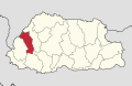
 Chukha in Bhutan.svg 874 × 570; 175 KB
-
 Dagana in Bhutan.svg 874 × 570; 175 KB
-
 Eastern Dsongdey in Bhutan.svg 874 × 570; 175 KB
-
 Gasa in Bhutan.svg 874 × 570; 175 KB
-
 Haa in Bhutan.svg 874 × 570; 175 KB
-
 Lhuntse in Bhutan.svg 874 × 570; 175 KB
-
 Mongar in Bhutan.svg 874 × 570; 175 KB
-
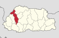
 Paro in Bhutan.svg 874 × 570; 175 KB
-
 Pemagatshel in Bhutan.svg 874 × 570; 175 KB
-
 Punakha in Bhutan.svg 874 × 570; 175 KB
-
 Samdrup Jongkhar in Bhutan.svg 874 × 570; 175 KB
-
 Samtse in Bhutan.svg 874 × 570; 176 KB
-
 Sarpang in Bhutan.svg 874 × 570; 175 KB
-
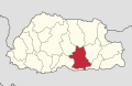
 Southern Dsongdey in Bhutan.svg 874 × 570; 176 KB
-
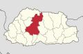
 Thimphu in Bhutan.svg 874 × 570; 175 KB
-
 Trashigang in Bhutan.svg 874 × 570; 175 KB
-
 Trashiyangtse in Bhutan.svg 874 × 570; 175 KB
-
 Trongsa in Bhutan.svg 874 × 570; 176 KB
-
 Tsirang in Bhutan.svg 874 × 570; 175 KB
-
 Wangdue Phodrang in Bhutan.svg 874 × 570; 175 KB
-
 Western Dsongdey in Bhutan.svg 874 × 570; 175 KB
-
 Zhemgang in Bhutan.svg 874 × 570; 176 KB


