Category:SVG locator maps of departments in Paraguay (location map scheme)
Jump to navigation
Jump to search

|
SVG maps in this category are part of a locator map series applying the (de) widespread location map scheme. Please see root category to browse for more. |
.svg)
.svg)
.svg)
.svg)
.svg)
.svg)
.svg)
Locator maps design recommendations ▼ | |
|---|---|
Principles
Design Guidelines are based on ▸location map design of the German map shop (in German). It's preferable to derive new locator maps from existing location maps. Please keep both size and ratio in this case. Thus the new locator maps may still be applied as location map (▸Guide). Marker color is supposed to be darkred. Waterbodies may be transparent, to show other objects better. Please be aware that this guide is only a recommendation. It’s not an inevitable law!
Highlight small areas
“Remote” areas and mini maps
Mini maps show where the depicted area actually is situated. Check out ▸Vorlage:Positionskarte+ (in German) and ▸Modèle:Carte en coin (in French) of how to insert a mini map in virtually every map.
Disputed areas
Greyed special objects
Backgrounds
|

-en.svg)

.svg)
.svg)
.svg)

_(US48).svg)
_(small_islands_magnified)_(-mini_map_-rivers).svg)
.svg)
_(extra_close)_(US48).svg)
.svg)
_(zoom).svg)

.svg)


_(UNMIK).svg)
.svg)
_(disputed_hatched).svg)
_(claimed_and_disputed_hatched).svg)
.svg)
.svg)
_(%2Ball_claims_hatched).svg)

.svg)
_(shade).svg)
_(shade)_(special_marker).svg)
_(-mini_map).svg)
_(-mini_map).svg)
_(-mini_map).svg)


.svg)

.svg)
Media in category "SVG locator maps of departments in Paraguay (location map scheme)"
The following 19 files are in this category, out of 19 total.
-
 Alto Paraguay in Paraguay.svg 1,262 × 1,388; 456 KB
-
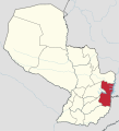 Alto Parana in Paraguay.svg 1,262 × 1,388; 455 KB
-
 Amambay in Paraguay.svg 1,262 × 1,388; 456 KB
-
 Asuncion Capital District in Paraguay (special marker).svg 1,262 × 1,388; 456 KB
-
 Asuncion Capital District in Paraguay.svg 1,262 × 1,388; 456 KB
-
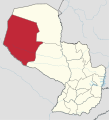 Boqueron in Paraguay.svg 1,262 × 1,388; 455 KB
-
 Caaguazu in Paraguay.svg 1,262 × 1,388; 455 KB
-
 Caazapa in Paraguay.svg 1,262 × 1,388; 455 KB
-
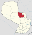
 Canindeyu in Paraguay.svg 1,262 × 1,388; 456 KB
-
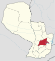
 Central in Paraguay.svg 1,262 × 1,388; 456 KB
-
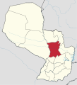
 Concepcion in Paraguay.svg 1,262 × 1,388; 456 KB
-
 Cordillera in Paraguay.svg 1,262 × 1,388; 456 KB
-
 Guaira in Paraguay.svg 1,262 × 1,388; 456 KB
-
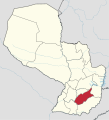
 Itapua in Paraguay.svg 1,262 × 1,388; 455 KB
-
 Misiones in Paraguay.svg 1,262 × 1,388; 456 KB
-
 Neembucu in Paraguay.svg 1,262 × 1,388; 456 KB
-
 Paraguari in Paraguay.svg 1,262 × 1,388; 456 KB
-
 Presidente Hayes in Paraguay.svg 1,262 × 1,388; 456 KB
-
 San Pedro in Paraguay.svg 1,262 × 1,388; 456 KB


.svg)


