Category:SVG location maps of the districts of Tongatapu
Jump to navigation
Jump to search
Media in category "SVG location maps of the districts of Tongatapu"
The following 10 files are in this category, out of 10 total.
-
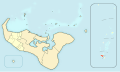
 'AtaLoc.svg 1,358 × 811; 642 KB
-
 Districts of Tongatapu.svg 1,358 × 811; 642 KB
-
 Hereditary Estates and Crown Lands of tongatapu.svg 1,358 × 811; 594 KB
-
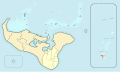
 Kolofo'ouLoc.svg 1,358 × 811; 642 KB
-
 Kolomatu'aLoc.svg 1,358 × 811; 642 KB
-
 KolovaiLoc.svg 1,358 × 811; 642 KB
-
 LapahaLoc.svg 1,358 × 811; 642 KB
-
 NukunukuLoc.svg 1,358 × 811; 642 KB
-
 TatakamotongaLoc.svg 1,358 × 811; 642 KB
-
 VainiLoc.svg 1,358 × 811; 642 KB


