Category:SVG labeled maps of administrative divisions of the Kingdom of Denmark (location map scheme)
Jump to navigation
Jump to search


.svg)


_(Paris_zoom).svg)
.svg)
,_administrative_divisions_-_de_-_colored_(multizoom).svg)
_-_colored.svg)
.svg)
,_administrative_divisions_-_Nmbrs_(multizoom).svg)
,_administrative_divisions_-_de_-_colored.svg)
_-_de_-_colored.svg)

.svg)

.svg)
Subcategories
This category has the following 3 subcategories, out of 3 total.
Media in category "SVG labeled maps of administrative divisions of the Kingdom of Denmark (location map scheme)"
The following 15 files are in this category, out of 15 total.
-

-
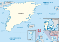
 Kingdom of Denmark, administrative divisions - de (Faroer special).svg 485 × 345; 4.29 MB
-
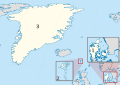
 Kingdom of Denmark, administrative divisions - de (zoom).svg 485 × 345; 4.65 MB
-
 Kingdom of Denmark, administrative divisions - de - colored (zoom).svg 485 × 345; 4.65 MB
-
 Kingdom of Denmark, administrative divisions - de - colored.svg 485 × 345; 4.25 MB
-
 Kingdom of Denmark, administrative divisions - de.svg 485 × 345; 4.29 MB
-
 Kingdom of Denmark, administrative divisions - en (zoom).svg 485 × 345; 4.63 MB
-
 Kingdom of Denmark, administrative divisions - en - colored (zoom).svg 485 × 345; 4.63 MB
-

-
 Kingdom of Denmark, administrative divisions - Nmbrs (Faroer special).svg 485 × 345; 4.17 MB
-
 Kingdom of Denmark, administrative divisions - Nmbrs (zoom).svg 485 × 345; 4.53 MB
-
 Kingdom of Denmark, administrative divisions - Nmbrs - colored (zoom).svg 485 × 345; 4.53 MB
-
 Kingdom of Denmark, administrative divisions - Nmbrs - colored.svg 485 × 345; 4.13 MB
-
 Kingdom of Denmark, administrative divisions - Nmbrs.svg 485 × 345; 4.17 MB
-
 Kingdom of Denmark, administrative divisions - russian (zoom).svg 3,187 × 1,948; 4.76 MB
_-_colored.svg)
.svg)
.svg)
.svg)


.svg)
.svg)
_-_colored.svg)
.svg)
.svg)
.svg)


.svg)