Category:SVG labeled maps of administrative divisions of countries of Europe (location map scheme) (numbers only)
Jump to navigation
Jump to search
Temperate regions: North America · South America · Africa · Europe · Asia · Oceania – Polar regions: – Other regions:
| NO WIKIDATA ID FOUND! Create new Wikidata item | |
| Upload media |


.svg)


_(Paris_zoom).svg)
.svg)
,_administrative_divisions_-_de_-_colored_(multizoom).svg)
_-_colored.svg)
.svg)
,_administrative_divisions_-_Nmbrs_(multizoom).svg)
,_administrative_divisions_-_de_-_colored.svg)
_-_de_-_colored.svg)

.svg)

.svg)

Subcategories
This category has the following 6 subcategories, out of 6 total.
A
D
F
G
I
Media in category "SVG labeled maps of administrative divisions of countries of Europe (location map scheme) (numbers only)"
The following 200 files are in this category, out of 288 total.
(previous page) (next page)-
 Abkhazia (no secession), administrative divisions - Nmbrs - colored.svg 3,058 × 2,552; 322 KB
-
 Abkhazia (no secession), administrative divisions - Nmbrs.svg 3,058 × 2,552; 259 KB
-
 Abkhazia (semi-secession), administrative divisions - Nmbrs - colored.svg 3,058 × 2,552; 333 KB
-
 Abkhazia (semi-secession), administrative divisions - Nmbrs.svg 3,058 × 2,552; 268 KB
-
 Abkhazia, administrative divisions - Nmbrs - colored.svg 3,058 × 2,552; 319 KB
-
 Abkhazia, administrative divisions - Nmbrs.svg 3,058 × 2,552; 257 KB
-
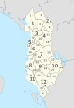
 Albania, administrative divisions (counties+districts) - Nmbrs - colored.svg 683 × 1,002; 597 KB
-
 Albania, administrative divisions (counties+districts) - Nmbrs - monochrome.svg 683 × 1,002; 580 KB
-
 Albania, administrative divisions - Nmbrs (districts) - colored.svg 688 × 1,002; 390 KB
-
 Albania, administrative divisions - Nmbrs (districts).svg 688 × 1,002; 344 KB
-
 Albania, administrative divisions - Nmbrs - colored.svg 688 × 1,002; 229 KB
-
 Albania, administrative divisions - Nmbrs.svg 685 × 1,002; 241 KB
-
 Andorra, administrative divisions - Nmbrs (geosort) - colored.svg 1,161 × 1,019; 354 KB
-
 Andorra, administrative divisions - Nmbrs (geosort).svg 1,161 × 1,019; 298 KB
-
 Andorra, administrative divisions - Nmbrs - colored.svg 1,161 × 1,019; 354 KB
-
 Andorra, administrative divisions - Nmbrs.svg 1,161 × 1,019; 298 KB
-
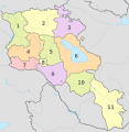 Armenia, administrative divisions - Nmbrs - colored.svg 1,169 × 1,198; 283 KB
-
 Armenia, administrative divisions - Nmbrs.svg 1,169 × 1,198; 225 KB
-
 Azerbaijan (semi-secession), administrative divisions - Nmbrs - colored.svg 1,200 × 919; 354 KB
-
 Azerbaijan (semi-secession), administrative divisions - Nmbrs.svg 1,200 × 919; 282 KB
-
 Azerbaijan, administrative divisions - Nmbrs - colored.svg 1,200 × 919; 340 KB
-
 Azerbaijan, administrative divisions - Nmbrs.svg 1,200 × 919; 257 KB
-
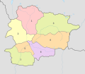
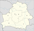
 Belarus, administrative divisions - Nmbrs - colored.svg 1,628 × 1,454; 345 KB
-
 Belarus, administrative divisions - Nmbrs.svg 1,628 × 1,454; 240 KB
-
 Belgium, administrative divisions (communities) - Nmbrs - colored.svg 1,136 × 988; 170 KB
-
 Belgium, administrative divisions (communities) - Nmbrs.svg 1,136 × 988; 134 KB
-
 Belgium, administrative divisions (provinces) - Nmbrs - colored.svg 1,136 × 988; 326 KB
-
 Belgium, administrative divisions (provinces) - Nmbrs.svg 1,136 × 988; 227 KB
-
 Belgium, administrative divisions (provinces+regions) - Nmbrs - colored.svg 1,136 × 988; 331 KB
-
 Belgium, administrative divisions (provinces+regions) - Nmbrs - monochrome.svg 1,136 × 988; 335 KB
-
 Belgium, administrative divisions - Nmbrs - colored.svg 1,136 × 988; 360 KB
-
 Belgium, administrative divisions - Nmbrs.svg 1,136 × 988; 360 KB
-
 Bosnia and Herzegovina, administrative divisions - Nmbrs (cantons) - colored.svg 1,063 × 1,014; 251 KB
-
 Bosnia and Herzegovina, administrative divisions - Nmbrs (cantons).svg 1,063 × 1,014; 218 KB
-
 Bosnia and Herzegovina, administrative divisions - Nmbrs (entities) - colored.svg 1,063 × 1,014; 286 KB
-
 Bosnia and Herzegovina, administrative divisions - Nmbrs (entities).svg 1,063 × 1,014; 241 KB
-
 Bulgaria, administrative divisions - Nmbrs - colored.svg 1,642 × 1,036; 1.22 MB
-
 Bulgaria, administrative divisions - Nmbrs.svg 1,642 × 1,036; 738 KB
-
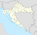
 Croatia, administrative divisions - Nmbrs (geosort) - colored.svg 1,097 × 1,062; 567 KB
-
 Croatia, administrative divisions - Nmbrs (geosort).svg 1,097 × 1,062; 441 KB
-
 Croatia, administrative divisions - Nmbrs - colored.svg 1,097 × 1,062; 565 KB
-
 Croatia, administrative divisions - Nmbrs.svg 1,097 × 1,062; 440 KB
-

-

-
 Cyprus (secession), administrative divisions - Nmbrs - colored.svg 1,276 × 761; 106 KB
-
 Cyprus (secession), administrative divisions - Nmbrs.svg 1,276 × 761; 89 KB
-

-
 Cyprus (semi-secession) (disputed hatched), administrative divisions - Nmbrs.svg 1,276 × 761; 104 KB
-
 Cyprus, administrative divisions - Nmbrs - colored.svg 1,276 × 761; 95 KB
-
 Cyprus, administrative divisions - Nmbrs.svg 1,276 × 761; 67 KB
-
 Czech Republic, administrative divisions - Nmbrs - colored.svg 1,004 × 611; 606 KB
-
 Czech Republic, administrative divisions - Nmbrs.svg 1,004 × 611; 611 KB
-
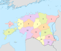 Estonia, administrative divisions - Nmbrs - colored.svg 1,668 × 1,393; 552 KB
-
 Estonia, administrative divisions - Nmbrs.svg 1,668 × 1,393; 451 KB
-
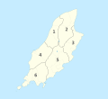
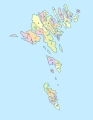 Faroe Islands, administrative divisions - Nmbrs (municipalities) - colored.svg 775 × 1,000; 196 KB
-
 Faroe Islands, administrative divisions - Nmbrs (municipalities).svg 775 × 1,000; 153 KB
-
 Faroe Islands, administrative divisions - Nmbrs (regions) - colored.svg 775 × 1,000; 113 KB
-
 Faroe Islands, administrative divisions - Nmbrs (regions).svg 775 × 1,000; 112 KB
-

-

-
 Finland, administrative divisions - Nmbrs - colored.svg 872 × 1,536; 1.96 MB
-
 Finland, administrative divisions - Nmbrs.svg 872 × 1,536; 1.6 MB
-
 Georgia (Georgian view), administrative divisions - Nmbrs - colored.svg 1,715 × 913; 479 KB
-
 Georgia (Georgian view), administrative divisions - Nmbrs.svg 1,715 × 913; 308 KB
-
 Georgia (secession), administrative divisions - Nmbrs - colored.svg 1,715 × 913; 452 KB
-
 Georgia (secession), administrative divisions - Nmbrs.svg 1,715 × 913; 304 KB
-
 Georgia (semi-secession), administrative divisions - Nmbrs - colored.svg 1,715 × 913; 502 KB
-
 Georgia (semi-secession), administrative divisions - Nmbrs.svg 1,715 × 913; 301 KB
-
 Georgia, administrative divisions - Nmbrs - colored.svg 1,715 × 913; 474 KB
-
 Georgia, administrative divisions - Nmbrs.svg 1,715 × 913; 305 KB
-
 Greece, administrative divisions - Nmbrs - colored.svg 1,003 × 825; 684 KB
-
 Greece, administrative divisions - Nmbrs.svg 1,003 × 825; 675 KB
-
 Greenland, administrative divisions - Nmbrs - colored.svg 1,181 × 1,669; 955 KB
-
 Greenland, administrative divisions - Nmbrs.svg 1,181 × 1,669; 941 KB
-
 Guernsey (zoom), administrative divisions - Nmbrs - colored.svg 522 × 356; 421 KB
-
 Guernsey (zoom), administrative divisions - Nmbrs.svg 522 × 356; 343 KB
-
 Guernsey, administrative divisions - Nmbrs - colored.svg 721 × 711; 418 KB
-
 Guernsey, administrative divisions - Nmbrs.svg 721 × 711; 344 KB
-
 Hungary, administrative divisions - Nmbrs - colored.svg 1,210 × 746; 275 KB
-
 Hungary, administrative divisions - Nmbrs.svg 1,210 × 746; 184 KB
-
 Iceland, administrative divisions - Nmbrs - colored.svg 1,186 × 841; 317 KB
-
 Iceland, administrative divisions - Nmbrs.svg 1,186 × 841; 233 KB
-
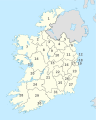
 Ireland, administrative divisions (provinces+counties)- Nmbrs - colored.svg 1,450 × 1,807; 1.15 MB
-
 Ireland, administrative divisions (provinces+counties)- Nmbrs - monochrome.svg 1,450 × 1,807; 1.16 MB
-
 Ireland, administrative divisions - Nmbrs (provinces) - colored.svg 1,450 × 1,807; 673 KB
-
 Ireland, administrative divisions - Nmbrs (provinces).svg 1,450 × 1,807; 670 KB
-
 Ireland, administrative divisions - Nmbrs - colored.svg 1,450 × 1,807; 1.1 MB
-
 Ireland, administrative divisions - Nmbrs.svg 1,450 × 1,807; 1.1 MB
-
 Isle of Man, administrative divisions (1st+2nd-tier) - Nmbrs - colored.svg 1,200 × 1,100; 270 KB
-
 Isle of Man, administrative divisions (1st+2nd-tier) - Nmbrs - monochrome.svg 1,200 × 1,100; 270 KB
-
 Isle of Man, administrative divisions (sheadings) - Nmbrs - colored.svg 1,200 × 1,100; 127 KB
-
 Isle of Man, administrative divisions (sheadings) - Nmbrs.svg 1,200 × 1,100; 86 KB
-
 Isle of Man, administrative divisions - Nmbrs - colored.svg 1,200 × 1,100; 108 KB
-
 Isle of Man, administrative divisions - Nmbrs.svg 1,200 × 1,100; 105 KB
-
 Jersey, administrative divisions - Nmbrs - colored.svg 397 × 310; 383 KB
-
 Jersey, administrative divisions - Nmbrs.svg 397 × 310; 385 KB
-
 Kazakhstan, administrative divisions - Nmbrs - colored.svg 2,646 × 1,512; 902 KB
-
 Kazakhstan, administrative divisions - Nmbrs.svg 512 × 293; 629 KB
-

-
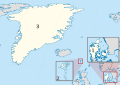
 Kingdom of Denmark, administrative divisions - Nmbrs (Faroer special).svg 485 × 345; 4.17 MB
-
 Kingdom of Denmark, administrative divisions - Nmbrs (zoom).svg 485 × 345; 4.53 MB
-
 Kingdom of Denmark, administrative divisions - Nmbrs - colored (zoom).svg 485 × 345; 4.53 MB
-
 Kingdom of Denmark, administrative divisions - Nmbrs - colored.svg 485 × 345; 4.13 MB
-
 Kingdom of Denmark, administrative divisions - Nmbrs.svg 485 × 345; 4.17 MB
-
 Kingdom of the Netherlands. administrative divisions - Nmbrs (1x zoom).svg 822 × 532; 4.42 MB
-
 Kingdom of the Netherlands. administrative divisions - Nmbrs (3x zoom).svg 822 × 532; 4.42 MB
-
 Kingdom of the Netherlands. administrative divisions - Nmbrs (marker).svg 822 × 532; 4.42 MB
-
 Koppen-Geiger Map TUR present with provinces.svg 1,816 × 850; 1.45 MB
-
 Kosovo (Kosovo independent), administrative divisions - Nmbrs - colored.svg 1,015 × 1,150; 691 KB
-
 Kosovo (Kosovo independent), administrative divisions - Nmbrs.svg 1,015 × 1,150; 670 KB
-
 Kosovo (Kosovo semi-independent) (UNMIK), administrative divisions - Nmbrs - colored.svg 1,015 × 1,150; 789 KB
-
 Kosovo (Kosovo semi-independent) (UNMIK), administrative divisions - Nmbrs.svg 1,015 × 1,150; 674 KB
-
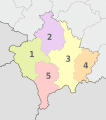 Kosovo (Kosovo semi-independent), administrative divisions - Nmbrs - colored.svg 1,015 × 1,150; 814 KB
-
 Kosovo (Kosovo semi-independent), administrative divisions - Nmbrs.svg 1,015 × 1,150; 700 KB
-
 Kosovo, administrative divisions (municipalities) - Nmbrs abc-sort - colored.svg 1,015 × 1,150; 537 KB
-
 Kosovo, administrative divisions (municipalities) - Nmbrs abc-sort - monochrome.svg 1,015 × 1,150; 537 KB
-
 Kosovo, administrative divisions (municipalities) - Nmbrs geo-sort - colored.svg 1,015 × 1,150; 537 KB
-
 Kosovo, administrative divisions (municipalities) - Nmbrs geo-sort - monochrome.svg 1,015 × 1,150; 537 KB
-
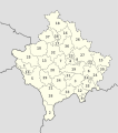
 Kosovo, administrative divisions - Nmbrs - colored.svg 1,015 × 1,150; 469 KB
-
 Kosovo, administrative divisions - Nmbrs.svg 1,015 × 1,150; 444 KB
-
 Latvia, administrative divisions - de+Nmbrs - colored.svg 1,304 × 821; 536 KB
-
 Latvia, administrative divisions - de+Nmbrs.svg 1,304 × 821; 533 KB
-
 Latvia, administrative divisions - Nmbrs - colored.svg 1,304 × 821; 669 KB
-
 Latvia, administrative divisions - Nmbrs.svg 1,304 × 821; 506 KB
-
 Liechtenstein, administrative divisions - Nmbrs - colored.svg 568 × 603; 142 KB
-
 Liechtenstein, administrative divisions - Nmbrs.svg 568 × 603; 143 KB
-

-
-
 Lithuania, administrative divisions - Nmbrs (districts) - colored.svg 1,095 × 821; 294 KB
-
 Lithuania, administrative divisions - Nmbrs (districts).svg 1,095 × 821; 291 KB
-
 Lithuania, administrative divisions - Nmbrs - colored.svg 1,095 × 821; 356 KB
-
 Lithuania, administrative divisions - Nmbrs.svg 1,095 × 821; 356 KB
-
 Luxembourg, administrative divisions - Nmbrs - colored.svg 746 × 1,032; 217 KB
-
 Luxembourg, administrative divisions - Nmbrs.svg 746 × 1,032; 217 KB
-
 Malta, administrative divisions - Nmbrs - colored.svg 773 × 719; 264 KB
-
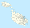 Malta, administrative divisions - Nmbrs.svg 773 × 719; 194 KB
-
 Moldova (semi-secession), administrative divisions - Nmbrs - colored.svg 990 × 1,217; 289 KB
-
 Moldova (semi-secession), administrative divisions - Nmbrs.svg 990 × 1,217; 222 KB
-
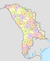
 Moldova, administrative divisions - Nmbrs - colored.svg 990 × 1,217; 297 KB
-
 Moldova, administrative divisions - Nmbrs.svg 990 × 1,217; 222 KB
-
 Monaco, administrative divisions - Nmbrs (geosort) - colored.svg 822 × 1,026; 109 KB
-
 Monaco, administrative divisions - Nmbrs (geosort).svg 822 × 1,026; 109 KB
-
 Monaco, administrative divisions - Nmbrs - colored.svg 822 × 1,026; 241 KB
-
 Monaco, administrative divisions - Nmbrs.svg 822 × 1,026; 242 KB
-
 Montenegro, administrative divisions - Nmbrs - colored.svg 1,063 × 1,285; 180 KB
-
 Montenegro, administrative divisions - Nmbrs.svg 1,063 × 1,285; 140 KB
-
 Netherlands (+BES), administrative divisions - Nmbrs - colored.svg 888 × 1,001; 277 KB
-
 Netherlands (+BES), administrative divisions - Nmbrs.svg 888 × 1,001; 279 KB
-
 Netherlands (+BES). administrative divisions - Nmbrs (1x zoom).svg 822 × 532; 4.42 MB
-
 Netherlands (+BES). administrative divisions - Nmbrs (3x zoom).svg 822 × 532; 4.42 MB
-
 Netherlands (+BES). administrative divisions - Nmbrs (marker).svg 822 × 532; 4.42 MB
-
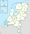
 Netherlands, administrative divisions - Nmbrs - colored.svg 888 × 1,001; 688 KB
-
 Netherlands, administrative divisions - Nmbrs.svg 888 × 1,001; 494 KB
-
 North Macedonia, administrative divisions - Nmbrs - colored.svg 1,368 × 1,133; 220 KB
-
 North Macedonia, administrative divisions - Nmbrs - monochrome.svg 1,368 × 1,133; 158 KB
-
 Northern Cyprus (de-facto), administrative divisions - Nmbrs - colored.svg 1,276 × 761; 84 KB
-
 Northern Cyprus (de-facto), administrative divisions - Nmbrs.svg 1,276 × 761; 63 KB
-

-
 Northern Cyprus in Cyprus (secession), administrative divisions - Nmbrs.svg 1,276 × 761; 63 KB
-

-

-
 Norway (+overseas), administrative divisions - Nmbrs (marker) (crop).svg 1,217 × 1,799; 3.66 MB
-
 Norway (+overseas), administrative divisions - Nmbrs (marker).svg 3,188 × 1,948; 3.66 MB
-
 Norway (+overseas), administrative divisions - Nmbrs (zoom) (crop).svg 1,217 × 1,799; 3.66 MB
-
 Norway (+overseas), administrative divisions - Nmbrs (zoom).svg 3,188 × 1,948; 3.66 MB
-
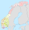
 Norway (full), administrative divisions - Nmbrs (regions) - colored.svg 948 × 948; 4.32 MB
-
 Norway (full), administrative divisions - Nmbrs (regions).svg 948 × 948; 4.26 MB
-
 Norway (plus), administrative divisions - Nmbrs (provinces) - colored.svg 2,215 × 2,353; 3.04 MB
-
 Norway (plus), administrative divisions - Nmbrs (provinces).svg 2,215 × 2,353; 2.29 MB
-
 Norway (plus), administrative divisions - Nmbrs (provinces+regions) - colored.svg 2,215 × 2,353; 3.27 MB
-
 Norway (plus), administrative divisions - Nmbrs (provinces+regions) - monochrome.svg 2,215 × 2,353; 3.29 MB
-
 Norway (plus), administrative divisions - Nmbrs (regions) - colored.svg 2,215 × 2,353; 2.9 MB
-
 Norway (plus), administrative divisions - Nmbrs (regions).svg 2,215 × 2,353; 2.19 MB
-
 Norway, administrative divisions - Nmbrs (provinces) - colored.svg 2,215 × 2,353; 2.78 MB
-
 Norway, administrative divisions - Nmbrs (provinces).svg 2,215 × 2,353; 2.04 MB
-
 Norway, administrative divisions - Nmbrs (provinces+regions) - colored.svg 2,215 × 2,353; 3.03 MB
-
 Norway, administrative divisions - Nmbrs (provinces+regions) - monochrome.svg 2,215 × 2,353; 3.05 MB
-
 Norway, administrative divisions - Nmbrs (regions) - colored.svg 2,215 × 2,353; 2.65 MB
-
 Norway, administrative divisions - Nmbrs (regions).svg 2,215 × 2,353; 1.94 MB
-
 Poland, administrative divisions - Nmbrs - colored.svg 861 × 837; 636 KB
-
 Poland, administrative divisions - Nmbrs.svg 861 × 837; 476 KB
-
 Portugal (complete), administrative divisions - Nmbrs - colored.svg 2,280 × 1,256; 592 KB
-
 Portugal (complete), administrative divisions - Nmbrs.svg 2,280 × 1,256; 616 KB
-

-

-
 Portugal (plus all islands real area), administrative divisions - Nmbrs - colored.svg 1,701 × 1,173; 468 KB
-
 Portugal (plus all islands real area), administrative divisions - Nmbrs - monochrome.svg 1,701 × 1,173; 470 KB
-
 Portugal (plus mini area), administrative divisions - Nmbrs - colored.svg 612 × 1,173; 326 KB
-
 Portugal (plus mini area), administrative divisions - Nmbrs.svg 612 × 1,173; 362 KB
-
 Portugal (plus real area), administrative divisions - Nmbrs - colored.svg 1,191 × 1,173; 401 KB
-
 Portugal (plus real area), administrative divisions - Nmbrs.svg 1,191 × 1,173; 367 KB
-
 Portugal, administrative divisions - Nmbrs - colored.svg 612 × 1,173; 315 KB
-
 Portugal, administrative divisions - Nmbrs.svg 612 × 1,173; 335 KB
-
 Romania, administrative divisions - Nmbrs - colored.svg 1,611 × 1,152; 722 KB
-
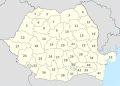 Romania, administrative divisions - Nmbrs.svg 1,611 × 1,152; 518 KB
-
 Romania, administrative divisions - XY - colored.svg 1,611 × 1,152; 512 KB
-
 Romania, administrative divisions - XY.svg 1,611 × 1,152; 508 KB
-
 Russia, administrative divisions - Nmbrs (federal districts) - colored.svg 1,181 × 637; 5.56 MB
-
 Russia, administrative divisions - Nmbrs (federal districts).svg 1,181 × 637; 4.87 MB
-

,_administrative_divisions_-_Nmbrs_-_colored.svg)
,_administrative_divisions_-_Nmbrs.svg)
,_administrative_divisions_-_Nmbrs_-_colored.svg)
,_administrative_divisions_-_Nmbrs.svg)


_-_Nmbrs_-_colored.svg)
_-_Nmbrs_-_monochrome.svg)
_-_colored.svg)
.svg)


_-_colored.svg)
.svg)


,_administrative_divisions_-_Nmbrs_-_colored.svg)
,_administrative_divisions_-_Nmbrs.svg)


_-_Nmbrs_-_colored.svg)
_-_Nmbrs.svg)
_-_Nmbrs_-_colored.svg)
_-_Nmbrs.svg)
_-_Nmbrs_-_colored.svg)
_-_Nmbrs_-_monochrome.svg)


_-_colored.svg)
.svg)
_-_colored.svg)
.svg)


_-_colored.svg)
.svg)


_(Buffer_Zone_hatched),_administrative_divisions_-_Nmbrs_-_colored.svg)
_(Buffer_Zone_hatched),_administrative_divisions_-_Nmbrs.svg)
,_administrative_divisions_-_Nmbrs_-_colored.svg)
,_administrative_divisions_-_Nmbrs.svg)
_(disputed_hatched),_administrative_divisions_-_Nmbrs_-_colored.svg)
_(disputed_hatched),_administrative_divisions_-_Nmbrs.svg)


_-_colored.svg)
.svg)
_-_colored.svg)
.svg)
_-_colored.svg)
_-_monochrome.svg)


,_administrative_divisions_-_Nmbrs_-_colored.svg)
,_administrative_divisions_-_Nmbrs.svg)
,_administrative_divisions_-_Nmbrs_-_colored.svg)
,_administrative_divisions_-_Nmbrs.svg)
,_administrative_divisions_-_Nmbrs_-_colored.svg)
,_administrative_divisions_-_Nmbrs.svg)


,_administrative_divisions_-_Nmbrs_-_colored.svg)
,_administrative_divisions_-_Nmbrs.svg)


-_Nmbrs_-_colored.svg)
-_Nmbrs_-_monochrome.svg)
_-_colored.svg)
.svg)


_-_Nmbrs_-_colored.svg)
_-_Nmbrs_-_monochrome.svg)
_-_Nmbrs_-_colored.svg)
_-_Nmbrs.svg)


_-_colored.svg)
.svg)
.svg)
.svg)


.svg)
.svg)
.svg)

,_administrative_divisions_-_Nmbrs_-_colored.svg)
,_administrative_divisions_-_Nmbrs.svg)
_(UNMIK),_administrative_divisions_-_Nmbrs_-_colored.svg)
_(UNMIK),_administrative_divisions_-_Nmbrs.svg)
,_administrative_divisions_-_Nmbrs_-_colored.svg)
,_administrative_divisions_-_Nmbrs.svg)
_-_Nmbrs_abc-sort_-_colored.svg)
_-_Nmbrs_abc-sort_-_monochrome.svg)
_-_Nmbrs_geo-sort_-_colored.svg)
_-_Nmbrs_geo-sort_-_monochrome.svg)


_-_Nmbrs_-_colored.svg)
_-_Nmbrs_-_monochrome.svg)
_-_colored.svg)
.svg)


,_administrative_divisions_-_Nmbrs_-_colored.svg)
,_administrative_divisions_-_Nmbrs.svg)


_-_colored.svg)
.svg)


,_administrative_divisions_-_Nmbrs_-_colored.svg)
,_administrative_divisions_-_Nmbrs.svg)
._administrative_divisions_-_Nmbrs_(1x_zoom).svg)
._administrative_divisions_-_Nmbrs_(3x_zoom).svg)
._administrative_divisions_-_Nmbrs_(marker).svg)


,_administrative_divisions_-_Nmbrs_-_colored.svg)
,_administrative_divisions_-_Nmbrs.svg)
,_administrative_divisions_-_Nmbrs_-_colored.svg)
,_administrative_divisions_-_Nmbrs.svg)
,_administrative_divisions_-_Nmbrs_-_colored.svg)
,_administrative_divisions_-_Nmbrs.svg)
,_administrative_divisions_-_Nmbrs_(marker)_(crop).svg)
,_administrative_divisions_-_Nmbrs_(marker).svg)
,_administrative_divisions_-_Nmbrs_(zoom)_(crop).svg)
,_administrative_divisions_-_Nmbrs_(zoom).svg)
,_administrative_divisions_-_Nmbrs_(regions)_-_colored.svg)
,_administrative_divisions_-_Nmbrs_(regions).svg)
,_administrative_divisions_-_Nmbrs_(provinces)_-_colored.svg)
,_administrative_divisions_-_Nmbrs_(provinces).svg)
,_administrative_divisions_-_Nmbrs_(provinces%2Bregions)_-_colored.svg)
,_administrative_divisions_-_Nmbrs_(provinces%2Bregions)_-_monochrome.svg)
,_administrative_divisions_-_Nmbrs_(regions)_-_colored.svg)
,_administrative_divisions_-_Nmbrs_(regions).svg)
_-_colored.svg)
.svg)
_-_colored.svg)
_-_monochrome.svg)
_-_colored.svg)
.svg)

,_administrative_divisions_-_Nmbrs_-_colored.svg)
,_administrative_divisions_-_Nmbrs.svg)
,_administrative_divisions_-_Nmbrs_-_colored.svg)
,_administrative_divisions_-_Nmbrs_-_monochrome.svg)
,_administrative_divisions_-_Nmbrs_-_colored.svg)
,_administrative_divisions_-_Nmbrs_-_monochrome.svg)
,_administrative_divisions_-_Nmbrs_-_colored.svg)
,_administrative_divisions_-_Nmbrs.svg)
,_administrative_divisions_-_Nmbrs_-_colored.svg)
,_administrative_divisions_-_Nmbrs.svg)


_-_colored.svg)
.svg)
_(geosort)_-_colored.svg)
_(numbers_only)&filefrom=Russia%2C+administrative+divisions+-+Nmbrs+%28federal+districts%2Bsubjects%29+%28geosort%29+-+monochrome.svg#mw-category-media)