Category:SVG labeled maps of administrative divisions of France (location map scheme) (french)
Jump to navigation
Jump to search


.svg)


_(Paris_zoom).svg)
.svg)
,_administrative_divisions_-_de_-_colored_(multizoom).svg)
_-_colored.svg)
.svg)
,_administrative_divisions_-_Nmbrs_(multizoom).svg)
,_administrative_divisions_-_de_-_colored.svg)
_-_de_-_colored.svg)

.svg)

.svg)
Media in category "SVG labeled maps of administrative divisions of France (location map scheme) (french)"
The following 18 files are in this category, out of 18 total.
-
 Départements et régions de France - Noname-2014.svg 588 × 550; 437 KB
-
 Départements et régions de France - Noname-2016.svg 588 × 550; 405 KB
-
 Départements et régions de France.svg 588 × 550; 362 KB
-
 Départements+régions (France)-2016.svg 677 × 618; 431 KB
-
 Départements+régions (France).svg 588 × 550; 480 KB
-
 Départements+régions (France)bleu.svg 588 × 550; 477 KB
-
 Départements+régions (France)jaune.svg 588 × 550; 477 KB
-
 Départements+régions (France)rouge.svg 588 × 550; 477 KB
-
 Départements+régions (France)vert.svg 588 × 550; 477 KB
-
 Départements+régions+capitales(France).svg 588 × 550; 488 KB
-
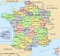
 France (+overseas), administrative divisions - fr (multizoom).svg 3,188 × 1,949; 5.84 MB
-

-

-
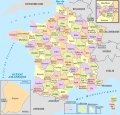
 France, administrative divisions - fr (+overseas) - colored 2016.svg 2,000 × 1,922; 2.04 MB
-
 France, administrative divisions - fr (departments+overseas) - colored (Paris zoom).svg 2,000 × 1,922; 3.8 MB
-
 France, administrative divisions until 2015 - fr (+overseas) - colored.svg 1,040 × 996; 2.34 MB
-
 Préfectures de France 2016.svg 588 × 550; 436 KB
-
 Préfectures de France.svg 588 × 550; 497 KB


-2016.svg)
.svg)
bleu.svg)
jaune.svg)
rouge.svg)
vert.svg)
.svg)
,_administrative_divisions_-_fr_(multizoom).svg)
,_administrative_divisions_-_en_-_colored_(multizoom).svg)
,_administrative_divisions_-_fr_-_colored_(multizoom).svg)
_-_colored_2016.svg)
_-_colored_(Paris_zoom).svg)
_-_colored.svg)

