Category:Rusthoven
Jump to navigation
Jump to search
| Object location | | View all coordinates using: OpenStreetMap |
|---|
 | |||||
| Upload media | |||||
| Instance of | |||||
|---|---|---|---|---|---|
| Part of | |||||
| Location | Wirdum, Groningen, Eemsdelta, Groningen, Netherlands | ||||
| Heritage designation |
| ||||
 | |||||
|
This is a category about rijksmonumentcomplex number 515519
|
Landhuis:
|
This is a category about rijksmonument number 515520
|
Historische aanleg:
|
This is a category about rijksmonument number 515525
|
Theekoepel:
|
This is a category about rijksmonument number 515556
|
Brug:
|
This is a category about rijksmonument number 515557
|
Hek:
|
This is a category about rijksmonument number 515558
|
| Address |
|
See also Category:Tichelwerk Rusthoven
Subcategories
This category has only the following subcategory.
U
Media in category "Rusthoven"
The following 45 files are in this category, out of 45 total.
-
 "Opterborg", linkerzijde - Wirdum - 20215496 - RCE.jpg 1,200 × 812; 303 KB
-
 "Opterborg", rechterzijde - Wirdum - 20215497 - RCE.jpg 1,200 × 805; 376 KB
-
 Rusthoven vanaf de Stadsweg gezien (32849968201).jpg 1,536 × 1,024; 1.57 MB
-
 Borg Rusthoven 01.JPG 4,000 × 3,000; 4.81 MB
-
 Borg Rusthoven 02.JPG 3,000 × 4,000; 3.99 MB
-
 Borg Rusthoven 03.JPG 4,000 × 3,000; 4.12 MB
-
 Borg Rusthoven 04.JPG 4,000 × 3,000; 3.73 MB
-
 Exterieur ACHTERGEVEL, KAPVERBINDING, TIJDENS RESTAURATIE - Wirdum - 20269456 - RCE.jpg 1,200 × 1,200; 426 KB
-
 Exterieur ACHTERGEVEL,DETAIL, TIJDENS RESTAURATIE - Wirdum - 20269451 - RCE.jpg 1,190 × 1,200; 501 KB
-

-
 Exterieur KAP, DETAIL, TIJDENS RESTAURATIE - Wirdum - 20269459 - RCE.jpg 1,193 × 1,200; 372 KB
-
 Exterieur OVERZICHT, ACHTERGEVEL, TIJDENS RESTAURATIE - Wirdum - 20269450 - RCE.jpg 1,200 × 1,195; 495 KB
-
 Exterieur OVERZICHT, BIJGEBOUW - Wirdum - 20268806 - RCE.jpg 1,200 × 813; 234 KB
-
 Exterieur OVERZICHT, KAP, TIJDENS RESTAURATIE - Wirdum - 20269458 - RCE.jpg 1,200 × 1,197; 363 KB
-
 Exterieur OVERZICHT, LINKER ZIJGEVEL, TIJDENS RESTAURATIE - Wirdum - 20269449 - RCE.jpg 1,184 × 1,200; 464 KB
-
 Exterieur OVERZICHT, RECHTER ZIJGEVEL, TIJDENS RESTAURATIE - Wirdum - 20269448 - RCE.jpg 1,193 × 1,200; 458 KB
-
 Exterieur OVERZICHT, TIJDENS RESTAURATIE - Wirdum - 20269447 - RCE.jpg 1,197 × 1,200; 491 KB
-
 Exterieur OVERZICHT, VOORGEVEL - Wirdum - 20268805 - RCE.jpg 1,200 × 806; 257 KB
-
 Exterieur OVERZICHT, VOORGEVEL, TIJDENS RESTAURATIE - Wirdum - 20269454 - RCE.jpg 1,200 × 1,192; 471 KB
-
 Exterieur RECHTER ZIJGEVEL, DETAIL, TIJDENS RESTAURATIE - Wirdum - 20269452 - RCE.jpg 1,197 × 1,200; 448 KB
-
 Exterieur RECHTER ZIJGEVEL, DETAIL, TIJDENS RESTAURATIE - Wirdum - 20269457 - RCE.jpg 1,200 × 1,195; 462 KB
-
 Exterieur VOORGEVEL, KAP, TIJDENS RESTAURATIE - Wirdum - 20269455 - RCE.jpg 1,200 × 1,188; 434 KB
-
 Hek Vredenhoven, aanzicht - Eekstra - 20067153 - RCE.jpg 1,200 × 806; 213 KB
-
 Overzicht oprijlaan - Wirdum - 20429871 - RCE.jpg 1,200 × 900; 329 KB
-
 Overzicht voorgevel met hekpijlers op de voorgrond - Wirdum - 20364712 - RCE.jpg 1,185 × 1,200; 456 KB
-
 Rusthoven - borg - schuin van achteren.jpg 4,000 × 3,000; 4.07 MB
-
 Rusthoven - borg - zijaanzicht.jpg 3,470 × 2,603; 3.18 MB
-
 Rusthoven - brug (2).jpg 4,000 × 3,000; 4.07 MB
-
 Rusthoven - brug.jpg 3,337 × 2,503; 2.75 MB
-
 Rusthoven - fabrieksgebouw.jpg 3,494 × 2,496; 7.84 MB
-
 Rusthoven - gebouw.jpg 3,264 × 3,264; 10.69 MB
-
 Rusthoven - ingang.jpg 2,912 × 2,184; 2.35 MB
-
 Rusthoven - oprijlaan.jpg 2,624 × 1,968; 2.05 MB
-
 Rusthoven - theekoepel.jpg 4,000 × 3,000; 4.02 MB
-
 Rusthoven - tichelborg ca. 1895.jpg 2,780 × 2,108; 743 KB
-
 Rusthoven - toegang.jpg 3,912 × 2,608; 8.2 MB
-
 Rusthoven - Vredenhoven.jpg 3,566 × 2,675; 3.21 MB
-
 Rusthoven", theekoepel - Eekwerderdraai - 20067156 - RCE.jpg 1,200 × 808; 356 KB
-
 Rusthoven.JPG 1,840 × 1,232; 1.26 MB
-
 Theehuisje - Wirdum - 20215504 - RCE.jpg 1,181 × 1,200; 435 KB
-
 Theehuisje - Wirdum - 20215505 - RCE.jpg 1,194 × 1,200; 409 KB
-
 Theehuisje - Wirdum - 20215506 - RCE.jpg 1,186 × 1,200; 455 KB
-
 Voor- en zijgevel "Rusthoven" - Eekwerderdraai - 20067154 - RCE.jpg 1,200 × 806; 305 KB
-
 Voor- en zijgevel "Rusthoven" - Eekwerderdraai - 20067155 - RCE.jpg 1,200 × 808; 343 KB
-
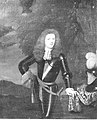 Wigbold Aldringa.jpg 3,957 × 4,906; 2.98 MB


.jpg)


.jpg)


