Category:Rusthall
Jump to navigation
Jump to search
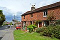
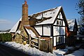
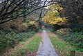
English: Rusthall is a village located approximately 2 miles to the west of the spa town of Tunbridge Wells in Kent. The village grew up around a large property called "Rusthall" located on the Rusthall Common en route to the neighbouring village of Langton Green.
village in United Kingdom  | |||||
| Upload media | |||||
| Instance of | |||||
|---|---|---|---|---|---|
| Location | Tunbridge Wells, Kent, South East England, England | ||||
 | |||||
Subcategories
This category has the following 6 subcategories, out of 6 total.
A
- Ashley Park Close (2 F)
- Ashley Park, Rusthall (3 F)
H
- Hurst Wood, Kent (82 F)
O
- Oasts in Rusthall (1 F)
P
R
Media in category "Rusthall"
The following 200 files are in this category, out of 461 total.
(previous page) (next page)-
 101 steps, Happy Valley - geograph.org.uk - 3542065.jpg 640 × 430; 128 KB
-
 101 steps, Happy Valley - geograph.org.uk - 3542093.jpg 640 × 430; 119 KB
-
 55 - 63, Lower Green Rd (geograph 6729074).jpg 1,024 × 684; 201 KB
-
 55 - 63, Lower Green Rd - geograph.org.uk - 3690870.jpg 640 × 430; 73 KB
-
 55 - 63, Lower Green Rd - geograph.org.uk - 3690873.jpg 640 × 430; 63 KB
-

-
 A row of terraced houses, Upper St - geograph.org.uk - 1958828.jpg 640 × 430; 155 KB
-
 Allotments near Rusthall - geograph.org.uk - 1047574.jpg 640 × 430; 111 KB
-
 An outcrop of Tunbridge Wells Sandstone - geograph.org.uk - 1958832.jpg 640 × 430; 187 KB
-
 Approaching Toad Rocks - geograph.org.uk - 5564592.jpg 640 × 426; 110 KB
-
 Apsley Street, Rusthall - geograph.org.uk - 4856004.jpg 3,264 × 2,448; 2.16 MB
-
 Ashley Gardens, Rusthall - geograph.org.uk - 6408500.jpg 1,024 × 768; 150 KB
-
 Ashley Park - geograph.org.uk - 5116634.jpg 640 × 426; 70 KB
-
 Ashley Park - geograph.org.uk - 5116641.jpg 640 × 426; 76 KB
-
 Ashley Park - geograph.org.uk - 5883401.jpg 1,024 × 681; 198 KB
-
 Ashley Park Close - geograph.org.uk - 3690876.jpg 640 × 430; 58 KB
-
 Ashley Park Close - geograph.org.uk - 5116642.jpg 640 × 426; 70 KB
-
 Ashley Park, Rusthall - geograph.org.uk - 4853104.jpg 3,264 × 2,448; 1.74 MB
-
 Bend on Farnham Lane - geograph.org.uk - 1546885.jpg 640 × 430; 206 KB
-
 Between the rock outcrops - geograph.org.uk - 3539816.jpg 640 × 430; 100 KB
-
 Beware SATNAV - geograph.org.uk - 3539823.jpg 640 × 430; 131 KB
-
 Bishops Down Park Road, Tunbridge Wells - geograph.org.uk - 4856423.jpg 3,264 × 2,448; 1.92 MB
-
 Blossom entering Rusthall - geograph.org.uk - 3539812.jpg 640 × 430; 99 KB
-
 Blossom in Rusthall - geograph.org.uk - 3539814.jpg 640 × 430; 93 KB
-
 Bluebells, Happy Valley - geograph.org.uk - 3542087.jpg 640 × 430; 146 KB
-
 Bluebells, Hurst Wood - geograph.org.uk - 5441123.jpg 640 × 426; 127 KB
-
 Bowen Road, Rusthall - geograph.org.uk - 4855642.jpg 3,264 × 2,448; 1.65 MB
-
 Bowen Road, Rusthall - geograph.org.uk - 4855648.jpg 3,264 × 2,448; 1.79 MB
-
 Bretland Rd - geograph.org.uk - 3697136.jpg 640 × 430; 74 KB
-
 Bretland Rd - geograph.org.uk - 5889220.jpg 1,024 × 681; 237 KB
-
 Bretland Road, Rusthall - geograph.org.uk - 4855968.jpg 3,057 × 1,952; 1.12 MB
-
 Broomhill Road, near Rusthall - geograph.org.uk - 4853093.jpg 3,264 × 2,448; 2.47 MB
-
 Bunker, Tunbridge Wells Golf Course - geograph.org.uk - 3539806.jpg 640 × 430; 90 KB
-
 Burdett Road, Rusthall - geograph.org.uk - 4853119.jpg 3,264 × 2,448; 1.65 MB
-
 Bus Stop, Rusthall Rd - geograph.org.uk - 1227353.jpg 640 × 430; 71 KB
-
 Bus Stop, Rusthall Rd - geograph.org.uk - 1608110.jpg 409 × 640; 116 KB
-
 Cat on an outcrop of sandstone on Rusthall Common - geograph.org.uk - 5341550.jpg 4,000 × 3,000; 4.63 MB
-
 Cat on Rusthall Common - geograph.org.uk - 5341557.jpg 4,000 × 3,000; 4.67 MB
-
 Cemetery, Nellington Rd - geograph.org.uk - 1547263.jpg 640 × 430; 141 KB
-
 Chestnut tree - geograph.org.uk - 5122625.jpg 640 × 426; 92 KB
-
 Coach Rd - geograph.org.uk - 3697091.jpg 640 × 430; 72 KB
-
 Coach Road, Rusthall - geograph.org.uk - 4855916.jpg 3,264 × 2,448; 2.35 MB
-
 Common View, Rusthall - geograph.org.uk - 4853138.jpg 3,264 × 2,448; 1.62 MB
-
 Coniston Avenue - geograph.org.uk - 3539803.jpg 640 × 430; 102 KB
-
 Coniston Avenue - geograph.org.uk - 3539804.jpg 640 × 430; 99 KB
-
 Coniston Avenue - geograph.org.uk - 4630481.jpg 640 × 426; 88 KB
-
 Coniston Avenue - geograph.org.uk - 5564506.jpg 640 × 426; 107 KB
-
 Coppiced woodland - geograph.org.uk - 5869058.jpg 1,024 × 681; 372 KB
-

-
 Cottage, Rusthall - geograph.org.uk - 5122535.jpg 640 × 426; 76 KB
-
 Cottages, Rusthall - geograph.org.uk - 5122537.jpg 640 × 426; 75 KB
-
 Cottages, Rusthall - geograph.org.uk - 6208196.jpg 1,024 × 768; 396 KB
-
 Cranwell Rd - geograph.org.uk - 3690879.jpg 640 × 430; 69 KB
-
 Cranwell Rd - geograph.org.uk - 5117070.jpg 640 × 413; 60 KB
-
 Cranwell Rd - geograph.org.uk - 5883410.jpg 1,024 × 681; 208 KB
-
 Cranwell Road, Rusthall - geograph.org.uk - 4855958.jpg 3,264 × 2,448; 1.44 MB
-
 Crossing Rusthall Common - geograph.org.uk - 4630517.jpg 640 × 426; 112 KB
-
 Crossing Spa Golf Course - geograph.org.uk - 4630485.jpg 640 × 426; 83 KB
-
 Crossway - geograph.org.uk - 3542797.jpg 640 × 430; 94 KB
-
 Denney Bottom - geograph.org.uk - 3023171.jpg 640 × 430; 93 KB
-
 Dog's Head, Rusthall Common - geograph.org.uk - 5341582.jpg 4,000 × 3,000; 4.74 MB
-
 Dog's Head, Rusthall Common - geograph.org.uk - 5341590.jpg 4,000 × 3,000; 4.66 MB
-
 Drinking Fountain - geograph.org.uk - 3697080.jpg 640 × 430; 105 KB
-
 Drinking Fountain - geograph.org.uk - 6046166.jpg 681 × 1,024; 264 KB
-
 Drinking Fountain, Rusthall - geograph.org.uk - 5883420.jpg 1,024 × 681; 252 KB
-
 Edward St - geograph.org.uk - 5116651.jpg 640 × 426; 68 KB
-
 Edward Street, Rusthall - geograph.org.uk - 4853122.jpg 3,264 × 2,448; 1.56 MB
-
 Edwardian House - geograph.org.uk - 3697192.jpg 640 × 430; 95 KB
-

-
 Elephant Rock - geograph.org.uk - 3697152.jpg 640 × 430; 144 KB
-
 Elephant Rock, Toad Rocks - geograph.org.uk - 2715407.jpg 640 × 430; 136 KB
-
 Elephant Rock, Toad Rocks - geograph.org.uk - 5116612.jpg 640 × 426; 125 KB
-
 Elephant Rock, Toad Rocks - geograph.org.uk - 5564595.jpg 640 × 426; 137 KB
-
 Entering Rusthall - geograph.org.uk - 4630492.jpg 640 × 426; 89 KB
-
 Entering Rusthall - geograph.org.uk - 5128230.jpg 640 × 426; 88 KB
-
 Entering Rusthall - geograph.org.uk - 5441165.jpg 640 × 426; 92 KB
-
 Entering Rusthall - geograph.org.uk - 5883378.jpg 1,024 × 681; 218 KB
-
 Entrance Gate, Hurst Wood, Tunbridge Wells, Kent - 150918 - geograph.org.uk - 5907411.jpg 3,840 × 2,160; 4.12 MB
-
 Entrance to The Cemetery, Nellington Rd - geograph.org.uk - 1547264.jpg 640 × 430; 154 KB
-
 Erskine Park Rd - geograph.org.uk - 5116644.jpg 640 × 426; 91 KB
-
 Erskine Park Rd - geograph.org.uk - 5116645.jpg 640 × 426; 86 KB
-
 Erskine Park Rd, Rusthall - geograph.org.uk - 1547613.jpg 640 × 430; 124 KB
-
 Erskine Park Road, Rusthall - geograph.org.uk - 4853105.jpg 3,264 × 2,448; 1.63 MB
-
 Erskine Park Road, Rusthall - geograph.org.uk - 4853112.jpg 3,264 × 2,448; 1.74 MB
-
 Rusthall Evangelical Church - geograph.org.uk - 1732031.jpg 3,072 × 2,304; 1.57 MB
-
 Flats on Nellington Rd - geograph.org.uk - 1547397.jpg 640 × 430; 138 KB
-

-
 Footpath across Rusthall Common - geograph.org.uk - 1548107.jpg 640 × 430; 188 KB
-
 Footpath across Rusthall Common - geograph.org.uk - 1958857.jpg 640 × 430; 202 KB
-

-
 Footpath and gate, Hurst Wood - geograph.org.uk - 6046062.jpg 1,024 × 681; 312 KB
-
 Footpath cut through sandstone, Rusthall - geograph.org.uk - 1047613.jpg 640 × 430; 135 KB
-
 Footpath from Rusthall - geograph.org.uk - 1516319.jpg 640 × 430; 198 KB
-
 Footpath from Rusthall - geograph.org.uk - 3697196.jpg 640 × 430; 134 KB
-
 Footpath heading South to Rusthall - geograph.org.uk - 1227270.jpg 640 × 430; 118 KB
-
 Footpath in Happy Valley - geograph.org.uk - 3542052.jpg 640 × 430; 147 KB
-
 Footpath junction - geograph.org.uk - 5108777.jpg 640 × 426; 131 KB
-
 Footpath junction - geograph.org.uk - 6046067.jpg 1,024 × 681; 254 KB
-
 Footpath off Woodside Rd - geograph.org.uk - 1516323.jpg 640 × 430; 148 KB
-
 Footpath south to Rusthall - geograph.org.uk - 1958690.jpg 640 × 430; 192 KB
-
 Footpath south to Rusthall - geograph.org.uk - 2713017.jpg 640 × 430; 142 KB
-
 Footpath through Still Green - geograph.org.uk - 1731920.jpg 3,072 × 2,304; 2.35 MB
-

-
 Footpath to Hurst Wood - geograph.org.uk - 3697211.jpg 640 × 430; 145 KB
-
 Footpath to Rusthall - geograph.org.uk - 2713014.jpg 640 × 430; 146 KB
-
 Footpath to Rusthall - geograph.org.uk - 6046068.jpg 1,024 × 681; 211 KB
-
 Footpath, Happy Valley - geograph.org.uk - 3542084.jpg 640 × 430; 130 KB
-
 Footpath, Hurst Wood - geograph.org.uk - 5441122.jpg 640 × 426; 125 KB
-
 Footpath, Hurst Wood - geograph.org.uk - 5441124.jpg 640 × 426; 125 KB
-
 Footpath, Hurst Wood - geograph.org.uk - 5441126.jpg 640 × 426; 102 KB
-
 Footpath, Hurst Wood - geograph.org.uk - 6039317.jpg 1,024 × 681; 322 KB
-
 Footpath, Hurst Wood - geograph.org.uk - 6039320.jpg 1,024 × 681; 308 KB
-
 Footpath, Hurst Wood - geograph.org.uk - 6039322.jpg 1,024 × 681; 289 KB
-
 Footpath, Hurst Wood - geograph.org.uk - 6046052.jpg 1,024 × 681; 336 KB
-
 Footpath, Hurst Wood - geograph.org.uk - 6046058.jpg 1,024 × 681; 321 KB
-
 Footpath, Rusthall Common - geograph.org.uk - 3023176.jpg 640 × 430; 120 KB
-
 Footpath, Rusthall Common - geograph.org.uk - 3697097.jpg 640 × 430; 122 KB
-
 Footpath, Rusthall Common - geograph.org.uk - 4042623.jpg 640 × 430; 118 KB
-
 Footpath, Rusthall Common - geograph.org.uk - 5116615.jpg 640 × 426; 107 KB
-
 Fountain, Rusthall - geograph.org.uk - 5122627.jpg 640 × 426; 108 KB
-
 Fremlin Close, Rusthall - geograph.org.uk - 4855655.jpg 3,264 × 2,448; 1.94 MB
-
 Gated road - geograph.org.uk - 4367698.jpg 640 × 480; 132 KB
-
 Gladstone Road, Rusthall - geograph.org.uk - 4853118.jpg 3,264 × 2,448; 1.63 MB
-
 Grange Rd - geograph.org.uk - 6046119.jpg 1,024 × 681; 189 KB
-
 Grange Road, Rusthall - geograph.org.uk - 4855986.jpg 3,264 × 2,448; 1.7 MB
-
 Happy Valley - geograph.org.uk - 3542059.jpg 640 × 430; 101 KB
-
 Happy Valley - geograph.org.uk - 3542067.jpg 640 × 430; 108 KB
-
 Happy Valley - geograph.org.uk - 3542091.jpg 640 × 430; 141 KB
-
 Harmony St - geograph.org.uk - 3697175.jpg 640 × 430; 82 KB
-
 Harmony St - geograph.org.uk - 4042131.jpg 640 × 430; 95 KB
-
 Harmony St - geograph.org.uk - 4630506.jpg 640 × 426; 90 KB
-
 Harmony St - geograph.org.uk - 5889266.jpg 1,024 × 681; 273 KB
-
 Harmony St - geograph.org.uk - 6046126.jpg 1,024 × 681; 153 KB
-
 Harmony St, Rusthall - geograph.org.uk - 1958773.jpg 640 × 430; 151 KB
-
 Harmony Street - geograph.org.uk - 5116617.jpg 640 × 426; 94 KB
-
 Harmony Street, Rusthall - geograph.org.uk - 4856013.jpg 3,264 × 2,448; 1.77 MB
-
 Harmony Street, Rusthall - geograph.org.uk - 4856038.jpg 3,264 × 2,448; 1.98 MB
-
 High Street, Rusthall - geograph.org.uk - 4853125.jpg 3,264 × 2,448; 1.57 MB
-
 High Street, Rusthall - geograph.org.uk - 4855659.jpg 3,264 × 2,448; 1.59 MB
-
 Hill View Road, Rusthall - geograph.org.uk - 4853128.jpg 3,264 × 2,448; 1.82 MB
-
 Hillview Rd - geograph.org.uk - 5116652.jpg 640 × 426; 76 KB
-
 Hole Farm - geograph.org.uk - 1733786.jpg 3,072 × 1,728; 1.71 MB
-
 Holly tree near Toad Rock - geograph.org.uk - 2715410.jpg 640 × 430; 144 KB
-

-
 House on Langton Rd - geograph.org.uk - 5441366.jpg 640 × 426; 58 KB
-
 House on Lower Green Rd - geograph.org.uk - 3690861.jpg 640 × 430; 61 KB
-
 House, Ashley Gardens - geograph.org.uk - 5117073.jpg 640 × 395; 55 KB
-
 House, Bull's Hollow - geograph.org.uk - 693613.jpg 479 × 640; 153 KB
-
 Houses and rock outcrops - geograph.org.uk - 3539836.jpg 640 × 430; 117 KB
-
 Houses in Rusthall - geograph.org.uk - 5116628.jpg 640 × 426; 95 KB
-
 Houses in Upper Street, Rusthall Common - geograph.org.uk - 3027372.jpg 4,000 × 3,000; 4.08 MB
-
 Houses on Rusthall Common - geograph.org.uk - 3027430.jpg 4,000 × 3,000; 4.12 MB
-
 Houses on Upper Street seen from Rusthall Common - geograph.org.uk - 5341471.jpg 4,000 × 3,000; 4.85 MB
-
 Houses on Woodside Rd, Rusthall - geograph.org.uk - 1958798.jpg 640 × 430; 176 KB
-
 Houses, Rusthall Rd - geograph.org.uk - 3697133.jpg 640 × 430; 77 KB
-
 Hurst Wood - geograph.org.uk - 5441112.jpg 640 × 426; 132 KB
-
 Hurst Wood - geograph.org.uk - 5441118.jpg 640 × 426; 130 KB
-
 Hurst Wood - geograph.org.uk - 6046048.jpg 1,024 × 681; 331 KB
-
 Hurst Wood - geograph.org.uk - 6046064.jpg 1,024 × 681; 332 KB
-
 Jockey Farm, Nellington Rd - geograph.org.uk - 1547267.jpg 640 × 430; 130 KB
-

-
 Lion Rock - geograph.org.uk - 3539818.jpg 640 × 430; 135 KB
-
 Little Bracken - geograph.org.uk - 3690887.jpg 640 × 430; 87 KB
-
 Little Garth Cottage, Lower Green Rd - geograph.org.uk - 1047416.jpg 640 × 430; 98 KB
-
 Little Garth, Lower Green Rd - geograph.org.uk - 1150613.jpg 640 × 430; 81 KB
-
 Long Meads, Rusthall - geograph.org.uk - 1547456.jpg 640 × 430; 82 KB
-
 Long Meads, Rusthall - geograph.org.uk - 4855664.jpg 3,264 × 2,448; 1.62 MB
-
 Looking across Rusthall Common - geograph.org.uk - 5341610.jpg 4,000 × 3,000; 4.75 MB
-
 Lower Green Rd - geograph.org.uk - 3690874.jpg 640 × 430; 101 KB
-
 Lower Green Rd - geograph.org.uk - 3690880.jpg 640 × 430; 75 KB
-
 Lower Green Rd - geograph.org.uk - 5116632.jpg 640 × 426; 92 KB
-
 Lower Green Rd - geograph.org.uk - 5116635.jpg 640 × 426; 86 KB
-
 Lower Green Rd - geograph.org.uk - 5883394.jpg 1,024 × 681; 159 KB
-
 Lower Green Rd - geograph.org.uk - 5883397.jpg 1,024 × 681; 202 KB
-
 Lower Green Road, Rusthall - geograph.org.uk - 4853094.jpg 3,264 × 2,448; 1.78 MB
-
 Lower Green Road, Rusthall - geograph.org.uk - 6408489.jpg 1,024 × 768; 274 KB
-
 Lower Green Road, Rusthall - geograph.org.uk - 6408505.jpg 1,024 × 768; 192 KB
-
 Manor Rd - geograph.org.uk - 5122486.jpg 640 × 426; 86 KB
-
 Manor Road, Rusthall - geograph.org.uk - 4853135.jpg 3,264 × 2,448; 1.78 MB
-
 Meadow Rd - geograph.org.uk - 5116646.jpg 640 × 426; 78 KB
-
 Meadow Rd - geograph.org.uk - 5116647.jpg 640 × 426; 74 KB
-
 Meadow Rd - geograph.org.uk - 5116656.jpg 640 × 426; 76 KB
-
 Meadow Road, Rusthall - geograph.org.uk - 4853107.jpg 2,739 × 2,053; 1.22 MB
-

-
 Nellington Rd - geograph.org.uk - 1546890.jpg 640 × 430; 177 KB
-
 Nellington Rd - geograph.org.uk - 1547265.jpg 640 × 430; 170 KB
-
 Old St Paul's School - geograph.org.uk - 3542042.jpg 640 × 430; 61 KB
-
 On Rusthall Common - geograph.org.uk - 2715422.jpg 640 × 430; 84 KB
-
 On Rusthall Common - geograph.org.uk - 5341607.jpg 4,000 × 3,000; 4.9 MB
-
 On the edge of Rusthall - geograph.org.uk - 5883371.jpg 1,024 × 681; 126 KB
-
 One Stop - geograph.org.uk - 5116654.jpg 640 × 426; 79 KB
-
 One Stop - geograph.org.uk - 5122536.jpg 640 × 426; 85 KB
-
 Open woodland - geograph.org.uk - 3022474.jpg 640 × 430; 153 KB
-
 Open woodland by footpath - geograph.org.uk - 5869060.jpg 1,024 × 681; 345 KB
-
 Outcrop in the trees - geograph.org.uk - 3539831.jpg 640 × 430; 132 KB
-
 Outcrop of sandstone on Rusthall Common - geograph.org.uk - 3027447.jpg 4,000 × 3,000; 4.36 MB
-
 Outcrop of sandstone on Rusthall Common - geograph.org.uk - 3027994.jpg 4,000 × 3,000; 3.96 MB
-
 Outcrop on Rusthall Common - geograph.org.uk - 3027445.jpg 4,000 × 3,000; 4 MB
-

-
 Path across Rusthall Common. - geograph.org.uk - 1047604.jpg 640 × 430; 110 KB


.jpg)


