Category:Ruspidge and Soudley
Jump to navigation
Jump to search
English: Ruspidge and Soudley is a civil parish in the Forest of Dean district, in the county of Gloucestershire, England.
civil parish in Forest of Dean, Gloucestershire, England | |||||
| Upload media | |||||
| Instance of | |||||
|---|---|---|---|---|---|
| Location | Forest of Dean, Gloucestershire, South West England, England | ||||
 | |||||
Subcategories
This category has the following 2 subcategories, out of 2 total.
Media in category "Ruspidge and Soudley"
The following 200 files are in this category, out of 302 total.
(previous page) (next page)-
 'Herbert ^ Young Coleford Glos' Sluice Valve cover - geograph.org.uk - 6183285.jpg 1,191 × 1,600; 1.03 MB
-
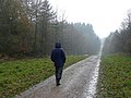 A lovely day for a walk in the forest - geograph.org.uk - 1591488.jpg 640 × 481; 241 KB
-

-
 Autumnal forest floor - geograph.org.uk - 1576541.jpg 640 × 542; 347 KB
-
 Beech and oak forest - geograph.org.uk - 1746502.jpg 640 × 480; 244 KB
-
 Beech trees and bluebells - geograph.org.uk - 1865324.jpg 3,200 × 2,133; 2.5 MB
-

-
 Beeches at Soudley Ponds - geograph.org.uk - 6312578.jpg 1,024 × 768; 491 KB
-
 Beeches, Staple-edge Wood - geograph.org.uk - 4220462.jpg 800 × 600; 550 KB
-
 Beetles on the forest track - geograph.org.uk - 3110780.jpg 640 × 480; 106 KB
-
 Bench mark in Upper Soudley, Forest of Dean - geograph.org.uk - 6182260.jpg 1,201 × 1,600; 1,012 KB
-
 Berries in the Quarry - geograph.org.uk - 6277070.jpg 3,648 × 5,472; 5.8 MB
-
 Blakeney Walk - geograph.org.uk - 4220490.jpg 800 × 600; 600 KB
-
 Blakeney Walk - geograph.org.uk - 4221662.jpg 800 × 600; 536 KB
-
 Blakeney Walk - geograph.org.uk - 4221667.jpg 800 × 600; 542 KB
-
 Blakeney Walk - geograph.org.uk - 4221671.jpg 800 × 600; 526 KB
-
 Blakeney Walk - geograph.org.uk - 4660705.jpg 800 × 600; 453 KB
-
 Blue Rock Trail - Forest of Dean - geograph.org.uk - 1026031.jpg 640 × 480; 119 KB
-
 Blue Rock tunnel, Forest of Dean - geograph.org.uk - 1035862.jpg 640 × 428; 87 KB
-
 Blue Rock Tunnel, Forest of Dean - geograph.org.uk - 1036472.jpg 428 × 640; 122 KB
-
 Bluebell carpet - geograph.org.uk - 1865345.jpg 3,200 × 2,133; 1.9 MB
-
 Bluebell carpet and mossy boulder - geograph.org.uk - 1865415.jpg 1,600 × 1,080; 2.18 MB
-
 Bluebells lining a narrow gully - geograph.org.uk - 1864354.jpg 2,133 × 3,200; 2.06 MB
-
 Bluebells on the east facing slopes - geograph.org.uk - 1865406.jpg 1,600 × 1,067; 2.64 MB
-
 Boulders and bluebells - geograph.org.uk - 1864332.jpg 1,024 × 683; 1.37 MB
-
 Bradley Hill Tunnel - geograph.org.uk - 2795052.jpg 1,024 × 693; 246 KB
-
 Bradley Hill, Upper Soudley - geograph.org.uk - 6279242.jpg 4,952 × 3,235; 3.92 MB
-

-
 Bridge carrying Speech House Road - geograph.org.uk - 3954607.jpg 1,024 × 680; 304 KB
-
 Bridge over Blackpool Brook - geograph.org.uk - 3955199.jpg 800 × 531; 174 KB
-
 Bridge over the Soudley Brook - geograph.org.uk - 3029490.jpg 640 × 480; 105 KB
-
 Brook approaching Speech House Lake - geograph.org.uk - 1234736.jpg 480 × 640; 215 KB
-
 Buckshaft pumping station - geograph.org.uk - 1605878.jpg 640 × 480; 240 KB
-
 Buckshaft Road (the lower section) - geograph.org.uk - 2565759.jpg 640 × 428; 72 KB
-
 Buildings at Dean Heritage Centre - geograph.org.uk - 5845636.jpg 1,024 × 683; 292 KB
-
 Bungalow in Sharp Edge Wood - geograph.org.uk - 1558654.jpg 640 × 426; 82 KB
-
 Camp Mill, Dean Heritage Centre - geograph.org.uk - 6284957.jpg 3,386 × 2,736; 1.48 MB
-
 Cauliflowers and Cider Press - geograph.org.uk - 2803999.jpg 1,024 × 802; 297 KB
-
 Caution runners crossing - geograph.org.uk - 1607540.jpg 640 × 426; 198 KB
-
 Central Bridge - geograph.org.uk - 4358760.jpg 1,600 × 1,067; 717 KB
-
 Charcoal Burning Site - geograph.org.uk - 2795144.jpg 1,024 × 745; 307 KB
-
 Chestnuts - geograph.org.uk - 4220273.jpg 800 × 600; 480 KB
-
 Child Labour Carving - geograph.org.uk - 6277012.jpg 5,154 × 3,275; 5.25 MB
-

-
 Church Road, Upper Soudley - geograph.org.uk - 5228183.jpg 1,280 × 960; 462 KB
-
-
 Cinderford Brook Path, Forest of Dean - geograph.org.uk - 1236573.jpg 599 × 448; 203 KB
-
 Coal mine entrance - geograph.org.uk - 4341767.jpg 800 × 531; 165 KB
-
 Commercial woodland - geograph.org.uk - 1607260.jpg 640 × 426; 186 KB
-
 Conifer block, Staple-edge Wood - geograph.org.uk - 4660701.jpg 800 × 600; 499 KB
-
 Cottages in the Soudley Valley - geograph.org.uk - 2257696.jpg 800 × 600; 408 KB
-
 Country road below Sneyd Wood - geograph.org.uk - 3827219.jpg 1,024 × 680; 211 KB
-
 Crossroads above Ruspidge - geograph.org.uk - 4220268.jpg 800 × 600; 565 KB
-
 Cycle track at Great Saintlow - geograph.org.uk - 3954612.jpg 1,024 × 680; 306 KB
-
 Cycle Track crossing Spruce Ride - geograph.org.uk - 94544.jpg 640 × 480; 89 KB
-
 Cycleway near Ruspidge - geograph.org.uk - 1564784.jpg 640 × 426; 83 KB
-
 Cypress, Staple-edge Wood - geograph.org.uk - 4220412.jpg 800 × 600; 515 KB
-
 Datestone, Stapledge Bungalows - geograph.org.uk - 1865236.jpg 640 × 499; 87 KB
-
 Dead shrew on forest path - geograph.org.uk - 1865303.jpg 800 × 530; 625 KB
-
 Dean Heritage Centre - geograph.org.uk - 4659142.jpg 1,741 × 1,174; 492 KB
-
 Dean Heritage Centre - geograph.org.uk - 5229989.jpg 1,280 × 960; 525 KB
-
 Deciduous area of the Forest of Dean - geograph.org.uk - 1864225.jpg 3,200 × 2,133; 2.11 MB
-
 Derelict building, Lightmoor Colliery - geograph.org.uk - 3954610.jpg 1,024 × 680; 189 KB
-
 Dilke Bridge - geograph.org.uk - 4220199.jpg 800 × 600; 426 KB
-
 Disused quarry - geograph.org.uk - 1092076.jpg 640 × 480; 134 KB
-
 Disused RAC garage - geograph.org.uk - 2565780.jpg 640 × 428; 77 KB
-

-
 Ducks and Dragons - geograph.org.uk - 3253586.jpg 2,972 × 2,736; 1.86 MB
-

-
 Edge of the forest - geograph.org.uk - 6093410.jpg 1,600 × 901; 777 KB
-
 Edge of the woodland - geograph.org.uk - 1607280.jpg 640 × 427; 237 KB
-
 Entrance to Soudley Ponds - geograph.org.uk - 5526799.jpg 3,184 × 2,123; 2.78 MB
-
 Entrance to Speech House Lake - geograph.org.uk - 1234726.jpg 640 × 480; 171 KB
-
 Entrance to the Yew Tree Brake Cemetery, Forest of Dean - geograph.org.uk - 5694278.jpg 2,592 × 1,944; 1.4 MB
-
 Evidence of forestry work - geograph.org.uk - 3827749.jpg 1,024 × 680; 287 KB
-
 Expecting Rain, Ruspidge Road - geograph.org.uk - 6277042.jpg 5,472 × 3,648; 2.09 MB
-
 Exposed ribs of dolomite - geograph.org.uk - 4744322.jpg 3,648 × 2,048; 2.64 MB
-

-
 Felled tree, Mallards Pike - geograph.org.uk - 815056.jpg 480 × 640; 231 KB
-
 Findall Chimney - Forest of Dean - geograph.org.uk - 1019376.jpg 420 × 640; 102 KB
-
 Findall chimney-well hidden in extensive beech woods - geograph.org.uk - 4744352.jpg 2,048 × 3,648; 2.64 MB
-

-
 Fire crew heading along Spruce Ride - geograph.org.uk - 1234694.jpg 640 × 442; 111 KB
-

-
 Footpath gate near the trig point - geograph.org.uk - 2528116.jpg 2,304 × 1,704; 1.8 MB
-
 Forest and bracken - geograph.org.uk - 1629471.jpg 640 × 480; 205 KB
-
 Forest clearing - geograph.org.uk - 1629462.jpg 640 × 480; 258 KB
-
 Forest in Spring sunshine - geograph.org.uk - 1865253.jpg 683 × 1,024; 1.34 MB
-
 Forest log pile - geograph.org.uk - 1865082.jpg 1,600 × 1,067; 751 KB
-
 Forest near Central Bridge - geograph.org.uk - 4370053.jpg 4,000 × 3,000; 3.9 MB
-
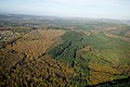 Forest of Dean - geograph.org.uk - 3763266.jpg 1,600 × 1,071; 389 KB
-
 Forest of Dean at Broom Hill - geograph.org.uk - 4340464.jpg 1,024 × 680; 354 KB
-
 Forest of Dean Crematorium - geograph.org.uk - 5631558.jpg 1,600 × 1,003; 801 KB
-
 Forest of Dean Crematorium, Glos - geograph.org.uk - 5694263.jpg 2,592 × 1,944; 1.35 MB
-
 Forest of Dean wild boar - geograph.org.uk - 3110811.jpg 640 × 480; 64 KB
-
 Forest path along Staple Edge - geograph.org.uk - 1865287.jpg 1,015 × 1,024; 1.74 MB
-
 Forest path in Staple-edge Wood - geograph.org.uk - 3079261.jpg 640 × 480; 123 KB
-
 Forest path near Staple-edge Hill - geograph.org.uk - 3079265.jpg 640 × 480; 127 KB
-
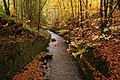
 Forest pool - geograph.org.uk - 1865084.jpg 1,024 × 683; 395 KB
-
 Forest Road 2 - geograph.org.uk - 1576534.jpg 640 × 480; 284 KB
-
 Forest road in springtime - geograph.org.uk - 1864194.jpg 1,024 × 697; 425 KB
-
 Forest road near Cinderford - geograph.org.uk - 4660014.jpg 800 × 600; 551 KB
-
 Forest road, Dean - geograph.org.uk - 4660698.jpg 800 × 600; 496 KB
-
 Forest track - geograph.org.uk - 1629469.jpg 640 × 480; 234 KB
-
 Forest track - geograph.org.uk - 1629473.jpg 640 × 480; 247 KB
-
 Forest track - geograph.org.uk - 3074825.jpg 900 × 1,200; 560 KB
-
 Forest track above Blackpool Brook - geograph.org.uk - 4341721.jpg 1,024 × 680; 351 KB
-
 Forest track with barrier - geograph.org.uk - 1864187.jpg 1,024 × 683; 1.16 MB
-
 Forest track, Forest of Dean - geograph.org.uk - 1053450.jpg 640 × 428; 104 KB
-
 Forest track, Howbeech Slade - geograph.org.uk - 4341734.jpg 531 × 800; 164 KB
-
 Forest track, Sharp Edge Wood - geograph.org.uk - 1558657.jpg 426 × 640; 130 KB
-
 Forest walk through Brandrick's Green - geograph.org.uk - 1865292.jpg 1,024 × 683; 1.44 MB
-
 Forestry Commission Road - geograph.org.uk - 1864201.jpg 1,024 × 683; 1.18 MB
-
 Forestry road, Forest of Dean - geograph.org.uk - 1053459.jpg 417 × 640; 94 KB
-
 Forestry track near Mallard's Pike Lake - geograph.org.uk - 3079275.jpg 640 × 480; 125 KB
-
 Former railway - geograph.org.uk - 3954626.jpg 1,024 × 680; 294 KB
-
 Former railway bridge support in Upper Soudley - geograph.org.uk - 6182266.jpg 1,200 × 1,600; 1,021 KB
-
 Gate on forest track - geograph.org.uk - 3827743.jpg 1,024 × 680; 271 KB
-
 Gloomy Green Forest - geograph.org.uk - 6358161.jpg 4,000 × 2,667; 3.53 MB
-
 Great Saintlow - geograph.org.uk - 4389632.jpg 4,000 × 3,000; 4.04 MB
-
 Greater Palescot - geograph.org.uk - 4220259.jpg 800 × 600; 464 KB
-
 Gruffalo at The Dean Heritage Centre - geograph.org.uk - 4447680.jpg 2,560 × 1,920; 2.73 MB
-
 Haie Hill Tunnel - geograph.org.uk - 1466335.jpg 426 × 640; 124 KB
-
 Heading North from Staple-edge Bungalows - geograph.org.uk - 1865224.jpg 427 × 640; 143 KB
-
 Heading South to Brandrick's Green - geograph.org.uk - 1865271.jpg 1,067 × 1,600; 3.01 MB
-
 Hedge-side path near Cinderford - geograph.org.uk - 5193299.jpg 4,000 × 3,000; 4.25 MB
-

-
 Hiding in the bushes - geograph.org.uk - 2528133.jpg 2,304 × 1,704; 1.63 MB
-
 Holly Berries in the Forest - geograph.org.uk - 6360878.jpg 5,124 × 3,380; 3.31 MB
-
 Houses on Ruspidge Road - geograph.org.uk - 6277474.jpg 5,472 × 3,648; 1.93 MB
-
 How interesting is bracken^ - geograph.org.uk - 1607274.jpg 640 × 427; 207 KB
-
 Industrial dereliction - geograph.org.uk - 1607243.jpg 640 × 428; 152 KB
-
 Into the woodland - geograph.org.uk - 1607283.jpg 640 × 427; 223 KB
-

-
 Junction in the forest - geograph.org.uk - 4340471.jpg 800 × 531; 149 KB
-

-
 Junk at an Old Mine - geograph.org.uk - 2797585.jpg 1,024 × 604; 252 KB
-
 Just you walking the dog - geograph.org.uk - 6312591.jpg 1,024 × 769; 517 KB
-
 Keeping the way ahead clear - geograph.org.uk - 2528103.jpg 2,304 × 1,704; 1.26 MB
-
 Kids' play camp in woods, Forest of Dean - geograph.org.uk - 1053468.jpg 640 × 428; 119 KB
-
 Knee-deep in bracken - geograph.org.uk - 815823.jpg 480 × 640; 215 KB
-
 Lane at Brains Green - geograph.org.uk - 4222321.jpg 800 × 560; 148 KB
-
 Last of the bluebells - geograph.org.uk - 815169.jpg 436 × 640; 116 KB
-
 Lightmoor Colliery - geograph.org.uk - 4355186.jpg 3,776 × 2,656; 1.22 MB
-
 Lightmoor Colliery - geograph.org.uk - 4660009.jpg 800 × 600; 337 KB
-

-
 Logpile in the Forest - geograph.org.uk - 6277082.jpg 5,472 × 2,762; 5.23 MB
-
 Looking up Granny Weavings Lane - geograph.org.uk - 2565793.jpg 640 × 428; 83 KB
-

-
 Mallard extended family - geograph.org.uk - 6312585.jpg 1,600 × 900; 921 KB
-
 Mallard's Pike exit - geograph.org.uk - 4221716.jpg 800 × 600; 492 KB
-
 Mallard's Pike, 1 - geograph.org.uk - 4244668.jpg 800 × 598; 266 KB
-
 Mallard's Pike, 2 - geograph.org.uk - 4244670.jpg 800 × 450; 152 KB
-
 Mallard's Pike, 3 - geograph.org.uk - 4244672.jpg 800 × 600; 304 KB
-
 Mallards Pike - geograph.org.uk - 3414620.jpg 1,247 × 696; 68 KB
-
 Mallards Pike - geograph.org.uk - 3861847.jpg 1,600 × 1,063; 486 KB
-
 Mature conifers, Blakeney Walk - geograph.org.uk - 4660709.jpg 800 × 600; 547 KB
-
 Mermaid and her Frog - geograph.org.uk - 1018714.jpg 414 × 640; 61 KB
-
 Mill and Pond, Dean Heritage Centre - geograph.org.uk - 6276882.jpg 4,882 × 3,576; 4.01 MB
-
 Mill wheel turning - geograph.org.uk - 816895.jpg 480 × 640; 229 KB
-
 Millpond overflow - geograph.org.uk - 816900.jpg 480 × 640; 201 KB
-
 Morning glory at Ruspidge - geograph.org.uk - 5178617.jpg 640 × 480; 251 KB
-
 Mossy boulder with bluebell backdrop - geograph.org.uk - 1864349.jpg 1,024 × 683; 1.37 MB
-
 Mossy tree stump, Forest of Dean - geograph.org.uk - 1865336.jpg 1,600 × 1,038; 2.8 MB
-
 Muddy track, Blakeney Walk - geograph.org.uk - 4660707.jpg 800 × 508; 416 KB
-
 Off the beaten track - geograph.org.uk - 1607252.jpg 640 × 426; 260 KB
-
 Old Birch amid rocks, Forest of Dean - geograph.org.uk - 1029833.jpg 640 × 480; 137 KB
-
 Old Eastern United Colliery buildings - geograph.org.uk - 1236624.jpg 599 × 448; 120 KB
-

-

-
 Outlook from Blaize Bailey viewpoint - geograph.org.uk - 3029067.jpg 640 × 480; 128 KB
-
 Overflow and stream, Soudley Ponds - geograph.org.uk - 6310759.jpg 1,600 × 1,200; 911 KB
-
 Part of the Soudley Brook - geograph.org.uk - 3029482.jpg 640 × 480; 136 KB
-
 Path and weir at Soudley Ponds - geograph.org.uk - 5526817.jpg 3,184 × 2,123; 3.03 MB
-
 Path crosses a forest track - geograph.org.uk - 3110747.jpg 640 × 480; 132 KB
-
 Path near Mallards Pike - geograph.org.uk - 3079258.jpg 640 × 480; 90 KB
-
 Path through bluebell woods near Soudley - geograph.org.uk - 3906746.jpg 800 × 539; 211 KB
-
 Path through the Forest of Dean - geograph.org.uk - 1864340.jpg 1,024 × 756; 1.39 MB
-
 Path towards Rushy Lawn - geograph.org.uk - 6360880.jpg 5,472 × 3,648; 5.23 MB
-
 Path, Mallard's Pike - geograph.org.uk - 4221703.jpg 800 × 600; 578 KB
-
 Path, Staple-edge Wood - geograph.org.uk - 4220423.jpg 800 × 600; 494 KB
-
 Paths at Dean Heritage Centre - geograph.org.uk - 4010083.jpg 800 × 558; 143 KB
-
 Phone Box, Ruspidge Road - geograph.org.uk - 6279246.jpg 3,930 × 3,031; 1.55 MB
-
 Phone Box, Top Road, Upper Soudley - geograph.org.uk - 6276977.jpg 4,933 × 3,648; 3.24 MB
-

-
 Pull in at Bullock's Beech - geograph.org.uk - 3110762.jpg 640 × 480; 99 KB
-
 Quiet Corner, Cinderford - geograph.org.uk - 4428286.jpg 800 × 582; 136 KB
-
 Railway Road, Ruspidge - geograph.org.uk - 6276880.jpg 4,137 × 3,324; 4.12 MB
-
-
 Reconstruction of a forester's cottage - geograph.org.uk - 816908.jpg 640 × 480; 177 KB
-
 Red, Gold and Green - geograph.org.uk - 1629466.jpg 640 × 640; 398 KB
-
 Remains at Shakemantle Quarry - geograph.org.uk - 6277058.jpg 4,501 × 3,642; 5.12 MB
-
 Remains of limestone extraction workings - geograph.org.uk - 4744316.jpg 2,048 × 3,648; 2.86 MB
-
 Ride, Blakeney Walk - geograph.org.uk - 4220471.jpg 800 × 600; 530 KB
-
 Road and track in the Forest of Dean - geograph.org.uk - 1746508.jpg 640 × 480; 207 KB
-
 Road exit - geograph.org.uk - 4221711.jpg 800 × 600; 584 KB
-
 Road junction above Mallard's Pike - geograph.org.uk - 4221698.jpg 800 × 600; 565 KB
-
 Rough grazing at St. White's Farm - geograph.org.uk - 5155927.jpg 1,500 × 830; 1.08 MB
-

-


_-_geograph.org.uk_-_2565759.jpg)


