Category:Ruhland 650 Jahre
Jump to navigation
Jump to search
| Object location | | View all coordinates using: OpenStreetMap |
|---|
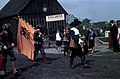
Diese Kategorie erfasst die Vorbereitung und Ereignisse zur 650-Jahr-Feier der Stadt Ruhland (1967).
Media in category "Ruhland 650 Jahre"
The following 3 files are in this category, out of 3 total.
-
 Ruhland, Hartwigstraße, beim Schulgarten, Umzug zum Stadtfest, 01.jpg 5,433 × 3,560; 4.12 MB
-
 Ruhland, Hartwigstraße, beim Schulgarten, Umzug zum Stadtfest, Junge Imker.jpg 5,433 × 3,542; 3.79 MB
-
 Ruhland, Werbung für Schulgartenprodukte bei Ausstellung Stadtfeier 1967.jpg 1,619 × 1,037; 217 KB


