Category:Rowlestone
Jump to navigation
Jump to search
village and civil parish in Herefordshire, United Kingdom | |||||
| Upload media | |||||
| Instance of | |||||
|---|---|---|---|---|---|
| Location | Herefordshire, West Midlands, England | ||||
 | |||||
Cymraeg: Pentref yn Swydd Henffordd, Gorllewin Canolbarth Lloegr, Lloegr ydy Rowlestone. (→Rowlestone)
Polski: Rowlestone lub Rowlstone – wieś i civil parish w Anglii, w hrabstwie Herefordshire. Leży 19 km na południowy zachód od miasta Hereford i 197 km na zachód od Londynu. W 2011 roku civil parish liczyła 180 mieszkańców. (→Rowlestone)

Media in category "Rowlestone"
The following 140 files are in this category, out of 140 total.
-

-
 A fine country property - geograph.org.uk - 2779480.jpg 1,024 × 768; 424 KB
-

-

-
 Buttercup meadow, east of Ruthland Farm - geograph.org.uk - 5425745.jpg 1,024 × 768; 121 KB
-
 Carvings, St Peter's Church, Rowlestone - geograph.org.uk - 6086793.jpg 2,577 × 2,206; 417 KB
-
 Centre of communications in Rowlestone^ - geograph.org.uk - 5426660.jpg 1,023 × 768; 173 KB
-
 Church Farm, Rowlestone - geograph.org.uk - 5607354.jpg 800 × 610; 104 KB
-
 Churchyard path, Rowlestone - geograph.org.uk - 5426671.jpg 1,024 × 768; 165 KB
-
 Construction work in Rowlestone - geograph.org.uk - 5671854.jpg 800 × 723; 218 KB
-
 Country Road near Rowlestone - geograph.org.uk - 1187649.jpg 640 × 425; 186 KB
-
 Country Road near Rowlestone - geograph.org.uk - 1187653.jpg 640 × 425; 133 KB
-
 Country road, Rowlestone - geograph.org.uk - 1187625.jpg 640 × 425; 156 KB
-
 Eastern boundary of Rowlestone - geograph.org.uk - 5604251.jpg 800 × 555; 130 KB
-
 Edge of Paradise Wood - geograph.org.uk - 4703798.jpg 800 × 451; 210 KB
-
 Entrance to Rowlestone Court, Rowlestone - geograph.org.uk - 5671859.jpg 800 × 484; 197 KB
-
 Farmland east of Ruthland Farm - geograph.org.uk - 5426595.jpg 1,024 × 768; 144 KB
-
 Farmland near Rowlestone - geograph.org.uk - 1187643.jpg 640 × 425; 124 KB
-
 Farmland north of Lower House Farm - geograph.org.uk - 5425765.jpg 1,024 × 768; 126 KB
-
 Farmland to the south-east of Rowlestone - geograph.org.uk - 278575.jpg 640 × 480; 132 KB
-
 Fedw Wood, along Cwm Brook - geograph.org.uk - 5426642.jpg 1,024 × 768; 131 KB
-
 Field entrance, south of Wigga - geograph.org.uk - 5426630.jpg 1,024 × 768; 158 KB
-
 Gated track to Bethel and other sites - geograph.org.uk - 5426900.jpg 1,024 × 768; 205 KB
-

-

-
 Grazing land in Rowlestone - geograph.org.uk - 5604278.jpg 800 × 570; 102 KB
-
 Green Party election poster on Lower House Road - geograph.org.uk - 5426590.jpg 1,024 × 768; 180 KB
-

-
 Herefordshire Farmland - geograph.org.uk - 1187618.jpg 640 × 425; 135 KB
-
 Lane heading south-east from Wigga to Rowlestone - geograph.org.uk - 5426624.jpg 1,024 × 768; 133 KB
-
 Lane to Pwll-yr-Hunt - geograph.org.uk - 2779459.jpg 1,024 × 768; 437 KB
-
 Looking east across the valley of Cwm Brook - geograph.org.uk - 5426681.jpg 1,024 × 768; 195 KB
-

-
 Lower House Road, heading east to Ball's Cross - geograph.org.uk - 5425722.jpg 1,024 × 614; 151 KB
-

-
 New Bilbo, 2015 - geograph.org.uk - 4708758.jpg 800 × 451; 213 KB
-
 New gate - geograph.org.uk - 2779453.jpg 1,024 × 768; 401 KB
-
 New homes at Penyworlod - geograph.org.uk - 5426903.jpg 1,024 × 768; 174 KB
-
 New infrastructure - geograph.org.uk - 4708640.jpg 800 × 600; 274 KB
-

-
 Old buildings at New Bilbo - geograph.org.uk - 2772905.jpg 1,024 × 768; 494 KB
-
 Penyworlod - geograph.org.uk - 2773016.jpg 1,024 × 641; 328 KB
-
 Perthi-bach Lane - geograph.org.uk - 2778855.jpg 1,024 × 768; 392 KB
-
 Pudding Street, Rowlestone - geograph.org.uk - 5604354.jpg 800 × 676; 160 KB
-

-
 Red phonebox, Rowlestone - geograph.org.uk - 5607290.jpg 800 × 574; 173 KB
-
 River Monnow near Llangua - geograph.org.uk - 2005138.jpg 640 × 480; 108 KB
-

-

-
 Road heading south-west to Pool Farm - geograph.org.uk - 5426685.jpg 1,024 × 768; 182 KB
-

-
 Road west from Rowlestone, Herefordshire - geograph.org.uk - 5671856.jpg 800 × 600; 162 KB
-
 Rowlestone Court - geograph.org.uk - 2779474.jpg 1,024 × 642; 344 KB
-
 Rowlestone Mill - apple crusher - geograph.org.uk - 2408672.jpg 640 × 427; 73 KB
-
 Rowlestone Mill - geograph.org.uk - 2408639.jpg 640 × 427; 106 KB
-
 Rowlestone Mill - geograph.org.uk - 2408651.jpg 640 × 427; 101 KB
-
 Rowlestone Mill - the machinery - geograph.org.uk - 2408680.jpg 640 × 427; 77 KB
-
 Rowlestone viewed from the south - geograph.org.uk - 2854456.jpg 1,024 × 680; 159 KB
-
 Rowlestone Village Hall, Herefordshire - geograph.org.uk - 5607313.jpg 800 × 628; 153 KB
-
 Rowlestone, St. Peter's Church - geograph.org.uk - 4624721.jpg 3,679 × 2,456; 5.24 MB
-
 Rowlestone, St. Peter's Church - geograph.org.uk - 4624728.jpg 3,553 × 3,202; 7.07 MB
-
 Rowlestone, St. Peter's Church - geograph.org.uk - 4624735.jpg 4,231 × 2,897; 5.88 MB
-

-
 Rowlestone, St. Peter's Church, Birds set in foliage - geograph.org.uk - 4637792.jpg 4,839 × 2,315; 6.48 MB
-
 Rowlestone, St. Peter's Church, Detail of the c16th tower - geograph.org.uk - 4637763.jpg 3,679 × 2,455; 7.34 MB
-

-

-

-

-

-

-

-

-

-
 Rowlestone, St. Peter's Church, The altar - geograph.org.uk - 4637758.jpg 3,672 × 3,323; 6 MB
-

-

-

-

-

-
 Rowlestone, St. Peter's Church, The modern stone pulpit - geograph.org.uk - 4637592.jpg 3,781 × 3,678; 6.99 MB
-

-
 Rowlestone, St. Peter's Church, The Norman chancel arch - geograph.org.uk - 4624743.jpg 3,695 × 3,673; 6.58 MB
-
 Rowlestone, St. Peter's Church, The Norman chancel arch - geograph.org.uk - 4637782.jpg 3,661 × 2,422; 4.51 MB
-
 Rowlestone, St. Peter's Church, The Norman chancel arch - geograph.org.uk - 4637830.jpg 4,175 × 2,553; 6.97 MB
-

-
-

-

-

-

-
 Rowlestone, St. Peter's Church, The William Prosser memorial - geograph.org.uk - 4637597.jpg 3,028 × 3,648; 7.52 MB
-
 Sheep grazing, south of Wigga - geograph.org.uk - 5426650.jpg 1,024 × 615; 120 KB
-

-
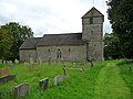 St Peter's Church, Rowlestone, from the north - geograph.org.uk - 5426667.jpg 1,024 × 768; 132 KB
-
 St Peter, Rowlestone - geograph.org.uk - 5054379.jpg 3,248 × 2,160; 1.62 MB
-
 St Peter, Rowlestone - geograph.org.uk - 5054388.jpg 3,293 × 2,189; 1.55 MB
-
 St Peter, Rowlestone - geograph.org.uk - 5054403.jpg 3,276 × 2,178; 2.02 MB
-
 St Peter, Rowlestone - geograph.org.uk - 5055540.jpg 3,248 × 2,160; 1.59 MB
-
 St Peter, Rowlestone - geograph.org.uk - 5055728.jpg 3,248 × 2,160; 2.61 MB
-
 St Peter, Rowlestone - geograph.org.uk - 5055737.jpg 3,307 × 2,206; 1.85 MB
-
 St Peter, Rowlestone - geograph.org.uk - 5055750.jpg 3,289 × 2,186; 2.09 MB
-
 St Peter, Rowlestone - geograph.org.uk - 5055760.jpg 3,248 × 2,160; 1.39 MB
-
 St Peter, Rowlestone - geograph.org.uk - 5056854.jpg 3,248 × 2,160; 1.54 MB
-
 St Peter, Rowlestone - geograph.org.uk - 5056863.jpg 3,254 × 1,990; 1.55 MB
-
 St Peter, Rowlestone - geograph.org.uk - 5057297.jpg 3,300 × 2,062; 1.43 MB
-
 St Peter, Rowlestone - geograph.org.uk - 5057303.jpg 3,300 × 1,957; 1.32 MB
-
 St Peter, Rowlestone - geograph.org.uk - 5057312.jpg 3,248 × 2,160; 1.52 MB
-
 St Peter, Rowlestone - geograph.org.uk - 5057360.jpg 3,248 × 2,160; 1.64 MB
-
 St Peter, Rowlestone - geograph.org.uk - 5057367.jpg 3,293 × 2,268; 1.8 MB
-
 St Peter, Rowlestone - geograph.org.uk - 5057393.jpg 2,195 × 3,301; 1.4 MB
-
 St Peter, Rowlestone - geograph.org.uk - 5057410.jpg 2,525 × 2,810; 1.68 MB
-
 St Peter, Rowlestone - the chancel - geograph.org.uk - 5057380.jpg 2,160 × 3,248; 1.49 MB
-
 St. Peter's church, Rowlestone - geograph.org.uk - 2779469.jpg 1,024 × 768; 430 KB
-

-
 Steps up to St Peter's, Rowlestone - geograph.org.uk - 5671850.jpg 550 × 800; 125 KB
-
 Straight on for Balls Cross and Longtown - geograph.org.uk - 5425782.jpg 1,024 × 768; 199 KB
-
 The Cwm Brook - geograph.org.uk - 2773009.jpg 768 × 1,024; 395 KB
-
 The Marches Line - geograph.org.uk - 1286129.jpg 640 × 426; 163 KB
-

-
 The Wigga, heading south-east to Rowlestone - geograph.org.uk - 5426607.jpg 1,024 × 768; 122 KB
-
 The Wigga, Rowlestone - geograph.org.uk - 5607322.jpg 800 × 744; 188 KB
-
 Tower of St Peter's Church, Rowlestone - geograph.org.uk - 5671849.jpg 641 × 800; 112 KB
-

-
 Track to Rowlestone Park Farm - geograph.org.uk - 4708555.jpg 800 × 451; 207 KB
-

-
 Trees around a small pond, east of Ruthland Farm - geograph.org.uk - 5426592.jpg 1,024 × 768; 140 KB
-
 Trees around a well, south of Wigga - geograph.org.uk - 5426636.jpg 1,024 × 768; 145 KB
-
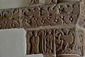
 Tympanum, St Peter's Church, Rowlestone - geograph.org.uk - 6086789.jpg 2,670 × 1,935; 304 KB
-
 View to Garway Hill - geograph.org.uk - 2854443.jpg 1,024 × 680; 231 KB
-
 Waterfall, Rowlestone - geograph.org.uk - 2408662.jpg 427 × 640; 130 KB
-
 Wernddu Lane - geograph.org.uk - 2775470.jpg 1,024 × 768; 415 KB
-
 Yellow hydrant marker in Rowlestone - geograph.org.uk - 5671857.jpg 800 × 698; 144 KB
-
 Barn at New Bilbo - geograph.org.uk - 276949.jpg 640 × 480; 184 KB
-
 Buttercup Meadow - geograph.org.uk - 448897.jpg 640 × 427; 253 KB
-
 Country road near Wigga, Rowlestone - geograph.org.uk - 278577.jpg 640 × 480; 123 KB
-

-
 Looking down into Pontrilas - geograph.org.uk - 278583.jpg 640 × 480; 113 KB
-
 Meadows to Newhouse Wood - geograph.org.uk - 448702.jpg 640 × 385; 229 KB
-
 Perthi-bach Lane - geograph.org.uk - 448646.jpg 640 × 427; 308 KB


