Category:Rotherfield Peppard
Jump to navigation
Jump to search
English: Media related to Rotherfield Peppard, locally commonly abbreviated to Peppard, a village and civil parish in the Chiltern Hills in South Oxfordshire
village and civil parish in South Oxfordshire district, Oxfordshire, England  | |||||
| Upload media | |||||
| Instance of | |||||
|---|---|---|---|---|---|
| Location | South Oxfordshire, Oxfordshire, South East England, England | ||||
| Area |
| ||||
| Said to be the same as | Rotherfield Peppard (Wikimedia duplicated page, civil parish) | ||||
| official website | |||||
 | |||||
Subcategories
This category has the following 3 subcategories, out of 3 total.
R
W
- Wyfold Court (3 F)
Media in category "Rotherfield Peppard"
The following 194 files are in this category, out of 194 total.
-
 "Howards End" - geograph.org.uk - 558062.jpg 640 × 477; 114 KB
-
 'Orchards', Colmore Lane - geograph.org.uk - 5333616.jpg 1,024 × 670; 233 KB
-
 A Bit Bent - geograph.org.uk - 3281426.jpg 2,592 × 3,888; 4.55 MB
-
 A former Pub - geograph.org.uk - 3313875.jpg 1,024 × 683; 163 KB
-
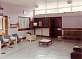
 A rest area on Lilacs Ward, Borocourt Hospital - geograph.org.uk - 6007575.jpg 4,024 × 2,920; 7.49 MB
-
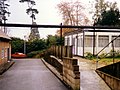
 A Side entrance in Lilacs Ward, Borocourt Hospital - geograph.org.uk - 6007560.jpg 4,112 × 2,984; 1.58 MB
-

-
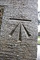
 All Saints Benchmark - geograph.org.uk - 3314831.jpg 533 × 800; 155 KB
-
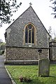
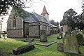
 All Saints Church - geograph.org.uk - 3314905.jpg 1,024 × 683; 195 KB
-
 All Saints Church - geograph.org.uk - 3512820.jpg 3,536 × 2,638; 2.39 MB
-
 All Saints Churchyard - geograph.org.uk - 3314904.jpg 1,024 × 683; 255 KB
-
 Along Wyfold Lane - geograph.org.uk - 3295802.jpg 1,600 × 1,095; 850 KB
-
 Avenue of young oaks - geograph.org.uk - 556612.jpg 640 × 477; 158 KB
-
 B481 at Bolt's Cross - geograph.org.uk - 2819835.jpg 3,117 × 2,509; 1.57 MB
-
 B481 crosses Peppard Common - geograph.org.uk - 2819942.jpg 3,648 × 2,388; 1.51 MB
-
 Beechwood - geograph.org.uk - 38840.jpg 640 × 481; 76 KB
-
 Bell tower of All Saints - geograph.org.uk - 3314829.jpg 533 × 800; 104 KB
-
 Benchmark on 'Orchards', Colmore Lane - geograph.org.uk - 5333605.jpg 656 × 1,024; 252 KB
-
 Benchmark on All Saints - geograph.org.uk - 3314833.jpg 533 × 800; 209 KB
-
-
 Bolt's Cross - geograph.org.uk - 3295782.jpg 1,955 × 1,246; 659 KB
-
 Bolt's Cross at the B481 junction - geograph.org.uk - 4606556.jpg 2,304 × 1,728; 804 KB
-
 Borocourt Hospital. - geograph.org.uk - 1293376.jpg 640 × 480; 56 KB
-
 Boundary of Kingswood Common - geograph.org.uk - 1048866.jpg 640 × 427; 206 KB
-
 Burnt Plattypus^^^^ - geograph.org.uk - 4070136.jpg 1,280 × 960; 328 KB
-
 Chancel end - geograph.org.uk - 3314914.jpg 533 × 800; 205 KB
-
 Chapel in All Saints - geograph.org.uk - 3320780.jpg 1,024 × 683; 130 KB
-
 Church Car Park - geograph.org.uk - 3313973.jpg 1,024 × 683; 242 KB
-
 Church Lane - geograph.org.uk - 3313876.jpg 1,024 × 683; 134 KB
-
 Church Lane - geograph.org.uk - 3313968.jpg 1,024 × 683; 173 KB
-
 Church Yard from the back - geograph.org.uk - 3314909.jpg 1,024 × 683; 250 KB
-
 Coldmoor Wood - geograph.org.uk - 1049207.jpg 640 × 427; 219 KB
-
 Coldmoor Wood, Peppard - geograph.org.uk - 2818772.jpg 640 × 480; 257 KB
-
 Colmore Lane, Peppard Hill - geograph.org.uk - 3281437.jpg 640 × 480; 77 KB
-
 Completing a round - geograph.org.uk - 1049832.jpg 640 × 427; 160 KB
-
 Crosslanes after rain - geograph.org.uk - 5203698.jpg 5,013 × 2,968; 5.26 MB
-
 Deer in woodland on north side of Stoke Row Road - geograph.org.uk - 5326575.jpg 1,024 × 683; 305 KB
-
 Edge of New Copse - geograph.org.uk - 1048834.jpg 427 × 640; 216 KB
-
 Entering Rotherfield Peppard on Gravel Hill - geograph.org.uk - 4609229.jpg 2,190 × 1,564; 1.83 MB
-
 Entrance driveway to Bearwood House - geograph.org.uk - 5326561.jpg 1,024 × 683; 212 KB
-
 Entrance to All Saints - geograph.org.uk - 3313971.jpg 1,024 × 683; 224 KB
-

-
 Entrance to Wyfold Grange - geograph.org.uk - 1048843.jpg 640 × 427; 192 KB
-
-
 Farmland, Peppard - geograph.org.uk - 2229844.jpg 640 × 480; 129 KB
-
 Farmland, Rotherfield Peppard - geograph.org.uk - 6081519.jpg 1,024 × 768; 256 KB
-
 Flower Meadow, Rotherfield Greys - geograph.org.uk - 2495047.jpg 1,600 × 969; 549 KB
-
 Font in the nave - geograph.org.uk - 3320777.jpg 1,024 × 683; 127 KB
-
 Footpath near Neal's Farm, Rotherfield Peppard, Oxfordshire.jpg 640 × 477; 127 KB
-
 Golf course, Peppard - geograph.org.uk - 1776080.jpg 640 × 480; 128 KB
-
 Great David's Lodge at Greyhone - geograph.org.uk - 5582705.jpg 1,024 × 683; 295 KB
-

-

-
 Henley natural burial ground - geograph.org.uk - 5203702.jpg 3,465 × 5,202; 2.47 MB
-
 Home Farm Cottage - geograph.org.uk - 2671669.jpg 3,648 × 2,736; 1.17 MB
-
 Horsepond Road beside Bishop's Wood Camp - geograph.org.uk - 2819986.jpg 3,149 × 2,372; 1.61 MB
-
 House at Crosslanes - geograph.org.uk - 3523005.jpg 640 × 427; 183 KB
-
 House at the back - geograph.org.uk - 3314991.jpg 1,024 × 683; 199 KB
-
 House in Shiplake Bottom - geograph.org.uk - 4879986.jpg 640 × 480; 97 KB
-
 In the Dog House again - geograph.org.uk - 556593.jpg 640 × 477; 109 KB
-
 Kingswood Common - geograph.org.uk - 1048860.jpg 640 × 427; 218 KB
-
 House - geograph.org.uk - 38835.jpg 640 × 481; 54 KB
-
 Kingwood Kennels - geograph.org.uk - 5144598.jpg 1,600 × 1,200; 396 KB
-
 Lane through Kingswood Common - geograph.org.uk - 1048868.jpg 640 × 427; 203 KB
-
 Lilacs Ward, Borocourt Hospital - geograph.org.uk - 6007558.jpg 3,339 × 2,984; 6.67 MB
-
 Lilacs ward, Borocourt Hospital. - geograph.org.uk - 1293305.jpg 640 × 480; 84 KB
-
 Lilacs ward, Borocourt Hospital. - geograph.org.uk - 1293322.jpg 640 × 480; 72 KB
-
 Lime Avenue in Hazel Grove - geograph.org.uk - 3523537.jpg 1,600 × 1,059; 517 KB
-
-
 List of the fallen - geograph.org.uk - 3314827.jpg 1,024 × 683; 227 KB
-
 Looking East - geograph.org.uk - 3314997.jpg 1,024 × 683; 233 KB
-
 Lots of Crosses - geograph.org.uk - 3314911.jpg 1,024 × 683; 219 KB
-
 Mossy beech trunks - geograph.org.uk - 4253355.jpg 1,024 × 681; 205 KB
-
 New houses at Wyfold Court - geograph.org.uk - 593862.jpg 640 × 477; 114 KB
-
 Old Iron Bus Stop - geograph.org.uk - 2670665.jpg 2,736 × 3,648; 1.32 MB
-
 One of three dormitories on Lilacs Ward, Borocourt Hospital - geograph.org.uk - 6007571.jpg 4,074 × 2,932; 1.31 MB
-
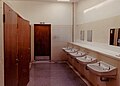
 One of two baths on Lilacs Ward, Borocourt Hospital - geograph.org.uk - 6007569.jpg 2,984 × 4,112; 1.13 MB
-
 Parkland, Peppard - geograph.org.uk - 2229857.jpg 640 × 480; 126 KB
-
-
 Pasture, Peppard - geograph.org.uk - 2229950.jpg 640 × 480; 138 KB
-
 Path in the Open - geograph.org.uk - 5144594.jpg 1,600 × 1,200; 657 KB
-
 Peppard Common - geograph.org.uk - 1049839.jpg 640 × 427; 193 KB
-
 Peppard Common - geograph.org.uk - 1049852.jpg 640 × 427; 152 KB
-
-
 Peppard Farm - geograph.org.uk - 556585.jpg 640 × 477; 135 KB
-
 Peppard Hill - geograph.org.uk - 3313874.jpg 1,024 × 683; 130 KB
-
 Peppard Hill on Peppard Common - geograph.org.uk - 4610438.jpg 2,304 × 1,728; 1.03 MB
-
 Peppard Hospital Staff Quarters - geograph.org.uk - 727729.jpg 640 × 427; 61 KB
-
 Peppard Primary School - geograph.org.uk - 3313966.jpg 1,024 × 683; 158 KB
-
 Phone box on Church Lane - geograph.org.uk - 3313893.jpg 1,024 × 683; 183 KB
-
 Plaque on the lych gate - geograph.org.uk - 3314819.jpg 533 × 800; 122 KB
-
 Plaque on the post - geograph.org.uk - 3315002.jpg 533 × 800; 133 KB
-
 Plaques on the Chancel Arch - geograph.org.uk - 3320776.jpg 1,024 × 683; 145 KB
-

-
 Chalkhouse Green - geograph.org.uk - 9191.jpg 640 × 389; 89 KB
-
 Line of trees - geograph.org.uk - 1048850.jpg 640 × 427; 189 KB
-
 Peppard Common postbox - geograph.org.uk - 1049842.jpg 427 × 640; 220 KB
-
 Peppard Primary School - geograph.org.uk - 1049847.jpg 640 × 427; 175 KB
-
 Rotherfield Peppard Congregational Chapel - geograph.org.uk - 3662742.jpg 3,568 × 2,551; 2 MB
-
 RotherfieldPeppard LittleGableCottage.jpg 1,280 × 719; 574 KB
-
 School and house - geograph.org.uk - 3313969.jpg 1,024 × 683; 175 KB
-
 School ^ Phone Box, Rotherfield Peppard - geograph.org.uk - 3512809.jpg 3,972 × 2,790; 2.82 MB
-
 School, Rotherfield Peppard - geograph.org.uk - 36302.jpg 640 × 481; 56 KB
-
 Second Lych Gate - geograph.org.uk - 3314999.jpg 1,024 × 683; 247 KB
-
 Sedgehill Spring - geograph.org.uk - 1049871.jpg 640 × 427; 208 KB
-
 Sedgehill Spring - geograph.org.uk - 1049875.jpg 640 × 427; 220 KB
-
 Shiplake Bottom - geograph.org.uk - 4879995.jpg 640 × 480; 91 KB
-
 Snow covered Lych Gate - geograph.org.uk - 3313970.jpg 533 × 800; 140 KB
-
 Snow on approach to Wyfold RDA, Rotherfield Peppard, Oxfordshire.jpg 640 × 480; 86 KB
-
 Some of the older headstones - geograph.org.uk - 3314912.jpg 1,024 × 683; 256 KB
-
 Springwater Churchyard - geograph.org.uk - 3503362.jpg 3,968 × 2,232; 2.53 MB
-
 Springwater Congregational Church - geograph.org.uk - 3503360.jpg 3,796 × 2,080; 1.83 MB
-
 Springwood Lane - geograph.org.uk - 1049856.jpg 640 × 427; 202 KB
-
 Stone plaque on the chancel - geograph.org.uk - 3314987.jpg 1,024 × 683; 203 KB
-
 Stony Bottom - geograph.org.uk - 1049864.jpg 640 × 427; 125 KB
-
 Stormy Light on The Unicorn - geograph.org.uk - 3737762.jpg 1,600 × 906; 254 KB
-
 Sunset over Blounts Court - geograph.org.uk - 1049881.jpg 640 × 427; 140 KB
-
 The B481 at Bolt's Cross - geograph.org.uk - 4780284.jpg 1,500 × 1,125; 145 KB
-
 The B481 in Rotherfield Peppard - geograph.org.uk - 4780286.jpg 1,500 × 1,125; 145 KB
-
 The B481 through Rotherfield Peppard - geograph.org.uk - 4780289.jpg 1,500 × 1,125; 139 KB
-
 The dinning room on Lilacs Ward, Borocourt Hospital - geograph.org.uk - 6007565.jpg 4,112 × 2,984; 1.18 MB
-
 The Dog, Rotherfield Peppard - geograph.org.uk - 1049837.jpg 640 × 427; 164 KB
-
 The Dog, Rotherfield Peppard - geograph.org.uk - 556601.jpg 640 × 477; 112 KB
-
-
 The entrance to Green Trees Farm, Peppard Common - geograph.org.uk - 4610579.jpg 2,304 × 1,728; 1.52 MB
-
 The Greyhound - geograph.org.uk - 2819953.jpg 3,648 × 2,736; 2.04 MB
-
 The Greyhound, Rotherfield Peppard, Oxfordshire - geograph.org.uk - 4571365.jpg 5,355 × 3,559; 2.89 MB
-
 The kitchen on Lilacs Ward, Borocourt Hospital - geograph.org.uk - 6007564.jpg 4,112 × 2,984; 1.07 MB
-
 The Nave - geograph.org.uk - 3320775.jpg 1,024 × 683; 120 KB
-
 The North Church Yard - geograph.org.uk - 3314993.jpg 1,024 × 683; 209 KB
-
 The office on Lilacs Ward, Borocourt Hospital - geograph.org.uk - 6007579.jpg 4,024 × 2,920; 1.17 MB
-
 The Old Grouse ^ Claret - geograph.org.uk - 3495942.jpg 3,536 × 2,140; 1.63 MB
-
 The Red Lion - geograph.org.uk - 3313872.jpg 1,024 × 683; 149 KB
-
 The Red Lion - geograph.org.uk - 3395392.jpg 4,320 × 3,240; 4.22 MB
-
 The Red Lion pub, Rotherfield Peppard - geograph.org.uk - 6095283.jpg 2,876 × 1,623; 2.16 MB
-
 The roof fell in - geograph.org.uk - 1049204.jpg 640 × 426; 202 KB
-
-
-
-
 The Unicorn PH, Peppard Hill - geograph.org.uk - 377828.jpg 640 × 425; 188 KB
-
 To the Glory of God - geograph.org.uk - 3314826.jpg 533 × 800; 148 KB
-
 Towards Bolts Cross - geograph.org.uk - 3313891.jpg 1,024 × 683; 143 KB
-
 Towards Colliers Lane - geograph.org.uk - 3313873.jpg 1,024 × 683; 202 KB
-
 Towards the Lych Gate - geograph.org.uk - 3314907.jpg 1,024 × 683; 269 KB
-
 Track by Greyhone Wood - geograph.org.uk - 3286005.jpg 1,024 × 681; 423 KB
-
 Track on Kingswood Common - geograph.org.uk - 1048857.jpg 640 × 427; 193 KB
-
 Tracks on Kingswood Common - geograph.org.uk - 1048865.jpg 640 × 427; 211 KB
-
 Triangle at Dove Lane - Stoke Row junction - geograph.org.uk - 5326572.jpg 1,024 × 683; 164 KB
-
 War Memorial at All Saints - geograph.org.uk - 3314823.jpg 533 × 800; 155 KB
-
 Well^ Dog gone - geograph.org.uk - 2819912.jpg 3,430 × 2,471; 1.35 MB
-
-
 Willow Herb on the Golf Course - geograph.org.uk - 2495146.jpg 1,600 × 1,062; 683 KB
-
 Wooden Barn, Wyfold Lane - geograph.org.uk - 3295814.jpg 1,600 × 1,200; 529 KB
-
 Wyfold Court drive. - geograph.org.uk - 1381186.jpg 640 × 427; 86 KB
-
 Across Peppard Common - geograph.org.uk - 558022.jpg 640 × 477; 100 KB
-
 Across Peppard Common - geograph.org.uk - 558025.jpg 640 × 477; 113 KB
-
 Approaching Wyfold Road - geograph.org.uk - 593770.jpg 640 × 477; 115 KB
-
 Ash trees in New Copse - geograph.org.uk - 593743.jpg 477 × 640; 124 KB
-
 Bridleway in New Copse - geograph.org.uk - 593591.jpg 640 × 477; 151 KB
-
 Bridleway into New Copse - geograph.org.uk - 593587.jpg 640 × 477; 130 KB
-
 Bridleway near Highland Wood - geograph.org.uk - 349329.jpg 640 × 477; 152 KB
-
 Bur Wood - geograph.org.uk - 9159.jpg 640 × 418; 127 KB
-
 Cattle near Kingswood Common - geograph.org.uk - 595834.jpg 640 × 477; 75 KB
-
 Clear markings in the New Copse - geograph.org.uk - 595855.jpg 477 × 640; 81 KB
-
 Exit to Gallowstree Common - geograph.org.uk - 593717.jpg 640 × 471; 105 KB
-
 Fallen firs - geograph.org.uk - 593598.jpg 640 × 477; 159 KB
-
 Farmland with New Copse in the background - geograph.org.uk - 37087.jpg 640 × 481; 217 KB
-
 Fields north of Wyfold Lane - geograph.org.uk - 377838.jpg 640 × 425; 161 KB
-
 Footpath south of Wyfold Lane - geograph.org.uk - 595845.jpg 640 × 477; 68 KB
-
 Footpath to Kidmore End - geograph.org.uk - 349321.jpg 640 × 477; 110 KB
-
 Harvest over. - geograph.org.uk - 34867.jpg 640 × 480; 72 KB
-
 Horse near Littlebottom Wood - geograph.org.uk - 558019.jpg 640 × 477; 152 KB
-
 Horses above Littlebottom Wood - geograph.org.uk - 111208.jpg 640 × 480; 91 KB
-
 Horses at Crowsley - geograph.org.uk - 641121.jpg 640 × 480; 106 KB
-
 House on Wyfold Road - geograph.org.uk - 593782.jpg 640 × 477; 86 KB
-
 Is the path open^ - geograph.org.uk - 595841.jpg 640 × 477; 81 KB
-
 Kidmore End - geograph.org.uk - 9178.jpg 640 × 417; 91 KB
-
 Looking North East - geograph.org.uk - 87547.jpg 640 × 481; 73 KB
-
 Looking towards Bishops Wood - geograph.org.uk - 38832.jpg 640 × 481; 38 KB
-
 Men not at work - geograph.org.uk - 595820.jpg 640 × 477; 94 KB
-
 New Copse - geograph.org.uk - 38834.jpg 640 × 481; 59 KB
-
 Peeking out of the woods - geograph.org.uk - 593755.jpg 640 × 477; 153 KB
-
 Peppard Common - geograph.org.uk - 36301.jpg 640 × 481; 35 KB
-
 Rotherfield Peppard recreation ground - geograph.org.uk - 556606.jpg 640 × 477; 123 KB
-
 Silver Birch trees in New Copse - geograph.org.uk - 593747.jpg 477 × 640; 150 KB
-
 The bridleway in Littlebottom Wood - geograph.org.uk - 111206.jpg 640 × 480; 78 KB
-
 The Edge of Kingwood Common - geograph.org.uk - 38837.jpg 640 × 481; 60 KB
-
 The Entrance to Frieze Farm - geograph.org.uk - 66271.jpg 640 × 481; 65 KB
-
 The north end of Stony Bottom - geograph.org.uk - 36300.jpg 640 × 481; 56 KB
-
 The Old Chapel, Gallowstree Common - geograph.org.uk - 37088.jpg 640 × 481; 219 KB
-
 The valley north of Peppard - geograph.org.uk - 111204.jpg 640 × 480; 80 KB
-
 Towards Wyfold Grange - geograph.org.uk - 595851.jpg 640 × 477; 79 KB
-
 Track in New Copse - geograph.org.uk - 595860.jpg 640 × 477; 118 KB
-
 Village Green, Peppard Hill - geograph.org.uk - 377829.jpg 640 × 425; 210 KB


