Category:Rotherfield
Jump to navigation
Jump to search
village and civil parish in the Wealden District of East Sussex, England  | |||||
| Upload media | |||||
| Instance of | |||||
|---|---|---|---|---|---|
| Location | Wealden, East Sussex, South East England, England | ||||
| Area |
| ||||
| official website | |||||
 | |||||
English: Rotherfield is a village and civil parish in East Sussex, England. The civil parish also contains the villages of Mark Cross and Eridge.
Subcategories
This category has the following 11 subcategories, out of 11 total.
B
- Bowles Rocks (7 F)
E
M
O
- Oasts in Rotherfield (27 F)
R
- St Denys' Church, Rotherfield (92 F)
- Rotherfield Methodist Chapel (4 F)
T
- Town Row (1 F)
Media in category "Rotherfield"
The following 200 files are in this category, out of 860 total.
(previous page) (next page)-
 'The Barn', Rotherfield - geograph.org.uk - 3298586.jpg 1,600 × 1,245; 358 KB
-
 A bit of autumn colour - geograph.org.uk - 2195598.jpg 640 × 430; 134 KB
-
 A field of Winter wheat - geograph.org.uk - 2195585.jpg 640 × 430; 111 KB
-
 A glimpse of the pond - geograph.org.uk - 5767905.jpg 1,024 × 688; 313 KB
-
 A large stack of wood - geograph.org.uk - 2385956.jpg 640 × 428; 114 KB
-
 A Sheep on the edge of Roughets Wood - geograph.org.uk - 2182735.jpg 640 × 430; 175 KB
-
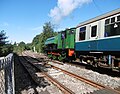
 A train leaves Eridge station - geograph.org.uk - 3145015.jpg 4,000 × 3,000; 4.28 MB
-

-
 A train on the Spa Valley Railway passes Harrison's Rocks - geograph.org.uk - 5124318.jpg 4,293 × 3,349; 2.59 MB
-
 A train waits outside Eridge station - geograph.org.uk - 3145022.jpg 4,000 × 3,000; 3.87 MB
-
 A26 ascending from Eridge - geograph.org.uk - 3508278.jpg 640 × 430; 70 KB
-
 A26 at Boarshead Roundabout - geograph.org.uk - 3012927.jpg 640 × 430; 30 KB
-
 A26 climbing out of Eridge (2) - geograph.org.uk - 1840812.jpg 640 × 430; 59 KB
-
 A26 climbing out of Eridge - geograph.org.uk - 1840810.jpg 640 × 430; 49 KB
-
 A26 descending to Eridge - geograph.org.uk - 5024254.jpg 640 × 426; 62 KB
-
 A26 heading north - geograph.org.uk - 2195500.jpg 640 × 430; 119 KB
-
 A26 near Boarshead - geograph.org.uk - 3508269.jpg 640 × 430; 91 KB
-
 A26 north of Boarshead - geograph.org.uk - 3508272.jpg 640 × 430; 74 KB
-
 A26 south of Boarshead Roundabout - geograph.org.uk - 1840689.jpg 640 × 430; 74 KB
-
 A26 south of Eridge - geograph.org.uk - 1840766.jpg 640 × 430; 69 KB
-
 A26, Boarshead - geograph.org.uk - 2186968.jpg 640 × 430; 118 KB
-
 A26, Boarshead bypass - geograph.org.uk - 2186911.jpg 640 × 430; 144 KB
-
 A26, descending to Eridge - geograph.org.uk - 3508276.jpg 640 × 430; 81 KB
-
 A26, Eridge bypass - geograph.org.uk - 1834167.jpg 640 × 465; 66 KB
-
 A26, southbound - geograph.org.uk - 5024256.jpg 640 × 426; 47 KB
-
 A26, southbound - geograph.org.uk - 5027206.jpg 640 × 426; 56 KB
-
 A267 (Mayfield Rd) - geograph.org.uk - 2361129.jpg 640 × 476; 42 KB
-

-
 A267 - B2100 junction, Mark Cross - geograph.org.uk - 2361139.jpg 640 × 534; 69 KB
-
 A267 - geograph.org.uk - 2393937.jpg 640 × 350; 39 KB
-
 A267 heading north to Nap Wood - geograph.org.uk - 2393945.jpg 640 × 595; 70 KB
-
 A267 in Nap Wood - geograph.org.uk - 2393946.jpg 640 × 432; 72 KB
-
 A267 near Frenches Farm - geograph.org.uk - 4183192.jpg 3,696 × 2,448; 2.3 MB
-
 A267 near Saxonbury Farm - geograph.org.uk - 4786708.jpg 640 × 426; 83 KB
-
 A267 south of Mark Cross - geograph.org.uk - 2361144.jpg 640 × 419; 57 KB
-
 A267 towards Mark Cross - geograph.org.uk - 3685395.jpg 3,696 × 2,448; 2.27 MB
-
 A267 towards Mayfield - geograph.org.uk - 4183189.jpg 3,696 × 2,448; 2.34 MB
-
 A267, Mark Cross - geograph.org.uk - 2361134.jpg 640 × 392; 40 KB
-
 A267, Mark Cross - geograph.org.uk - 2393938.jpg 640 × 321; 52 KB
-
 A267, Mark Cross - geograph.org.uk - 4786667.jpg 640 × 426; 63 KB
-
 A267, Mark Cross - geograph.org.uk - 4786706.jpg 640 × 536; 86 KB
-
 A267, northbound - geograph.org.uk - 4786665.jpg 640 × 426; 61 KB
-
 A267, northbound - geograph.org.uk - 4786707.jpg 640 × 426; 80 KB
-
 A267, Tunbridge Wells Rd - geograph.org.uk - 2393927.jpg 640 × 416; 57 KB
-
 Alder Wood on the hill top - geograph.org.uk - 2195617.jpg 640 × 430; 110 KB
-
 Aldwick Cottage - geograph.org.uk - 2186869.jpg 640 × 430; 130 KB
-
 Aldwick Cottage - geograph.org.uk - 2186871.jpg 640 × 430; 144 KB
-
 Allfreys Lane junction with Redbridge Lane - geograph.org.uk - 1949164.jpg 1,600 × 1,200; 570 KB
-

-
 An Autumnal tree near Bullfinches - geograph.org.uk - 2195599.jpg 640 × 430; 144 KB
-

-
 An old chapel, Boarshead - geograph.org.uk - 2186953.jpg 640 × 430; 91 KB
-
 Approaching Birchden Junction - geograph.org.uk - 2707456.jpg 1,024 × 684; 342 KB
-
 Approaching Castle Hill - geograph.org.uk - 5767999.jpg 1,600 × 1,047; 635 KB
-
 Approaching Eridge Triangle - geograph.org.uk - 2181641.jpg 640 × 430; 186 KB
-
 Approaching Rotherfield - geograph.org.uk - 5767733.jpg 1,024 × 657; 200 KB
-
 Approaching Sheriff’s Lane - geograph.org.uk - 5767651.jpg 1,024 × 611; 145 KB
-
 Approaching the Mayfield Road - geograph.org.uk - 5767729.jpg 1,024 × 656; 271 KB
-
 As the sign says, horse riders in the middle of the road - geograph.org.uk - 2042893.jpg 2,592 × 1,944; 1.77 MB
-
 Autumn, Hollybridge Wood - geograph.org.uk - 2195579.jpg 640 × 430; 125 KB
-
 Avenue of trees on Coe's Farm - geograph.org.uk - 1998070.jpg 1,600 × 1,200; 692 KB
-
 B2100 - geograph.org.uk - 4710779.jpg 640 × 426; 91 KB
-
 B2100 - geograph.org.uk - 4710840.jpg 640 × 426; 82 KB
-
 B2100 - geograph.org.uk - 4710849.jpg 640 × 426; 89 KB
-
 B2100 - geograph.org.uk - 4710853.jpg 640 × 426; 72 KB
-
 B2100 descending to Jarvis Brook - geograph.org.uk - 4710847.jpg 640 × 426; 74 KB
-
 B2100 leaving Rotherfield - geograph.org.uk - 4710843.jpg 640 × 426; 68 KB
-
 B2100 to Rotherfield - geograph.org.uk - 4710784.jpg 640 × 426; 99 KB
-
 B2100, Rotherfield - geograph.org.uk - 4710820.jpg 640 × 426; 62 KB
-
 B2100, Town Row - geograph.org.uk - 4710759.jpg 640 × 426; 72 KB
-
 B2100, Town Row - geograph.org.uk - 4710760.jpg 640 × 426; 69 KB
-
 B2100, Town Row - geograph.org.uk - 4710762.jpg 640 × 426; 74 KB
-
 B2100, westbound - geograph.org.uk - 4710764.jpg 640 × 426; 84 KB
-
 B2100, westbound - geograph.org.uk - 4710768.jpg 640 × 426; 69 KB
-
 B2100, westbound - geograph.org.uk - 4710837.jpg 640 × 426; 90 KB
-
 B2100, westbound - geograph.org.uk - 4710845.jpg 640 × 426; 58 KB
-
 B2101 towards Rotherfield - geograph.org.uk - 2830726.jpg 640 × 428; 141 KB
-
 B2101, Bicycle Arms Road junction with Sheriffs Lane - geograph.org.uk - 2039784.jpg 2,592 × 1,944; 1.82 MB
-
 Bale blocking the way - geograph.org.uk - 5768440.jpg 1,600 × 1,111; 492 KB
-
 Barn, Rendlye Farm - geograph.org.uk - 2183833.jpg 640 × 430; 149 KB
-
 Barn, Rocks Farm - geograph.org.uk - 2184529.jpg 640 × 430; 156 KB
-
 Barn, Stitches Farm - geograph.org.uk - 2182527.jpg 640 × 430; 126 KB
-
 Barn, Stitches Farm - geograph.org.uk - 2182529.jpg 640 × 430; 138 KB
-
 Bend, B2100 - geograph.org.uk - 4710773.jpg 640 × 426; 94 KB
-
 Blackdon Hill - geograph.org.uk - 1803114.jpg 1,024 × 768; 224 KB
-
 Bletchingley Ford - geograph.org.uk - 3742982.jpg 3,872 × 2,592; 4.67 MB
-
 Bluebells in Ten Acre Shaw - geograph.org.uk - 5767915.jpg 1,600 × 1,066; 712 KB
-
 Bluebells in Walsted Wood - geograph.org.uk - 5768448.jpg 1,600 × 1,030; 710 KB
-
 Bluebells, Nap Wood - geograph.org.uk - 2386074.jpg 640 × 480; 206 KB
-

-
 Boars Head Golf Course - geograph.org.uk - 4847166.jpg 640 × 426; 50 KB
-
 Boars Head Inn - geograph.org.uk - 2186922.jpg 640 × 344; 87 KB
-
 Boars Head Inn - geograph.org.uk - 4847160.jpg 640 × 426; 54 KB
-
 Boarshead Farm - geograph.org.uk - 2186916.jpg 640 × 415; 109 KB
-
 Boarshead Roundabout - geograph.org.uk - 1840699.jpg 640 × 410; 66 KB
-
 Bowles Outdoor Centre - geograph.org.uk - 2184533.jpg 640 × 430; 147 KB
-
 Bowles Rocks - geograph.org.uk - 2183836.jpg 640 × 430; 165 KB
-
 Bowles Rocks - geograph.org.uk - 2184504.jpg 640 × 430; 183 KB
-
 Bowles Rocks, Bowles Outdoor Centre - geograph.org.uk - 2184500.jpg 640 × 430; 167 KB
-
 Bracken in Rocks Wood - geograph.org.uk - 2174305.jpg 640 × 430; 190 KB
-
 Bracken in the woods - geograph.org.uk - 2174330.jpg 640 × 430; 212 KB
-
 Bracken undergrowth, Rocks Wood - geograph.org.uk - 2174323.jpg 640 × 430; 197 KB
-
 Brickyard Lane through the woods - geograph.org.uk - 3716482.jpg 1,024 × 1,408; 2.01 MB
-
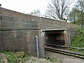
 Bridge carrying Fordbrook Hill over the Uckfield line - geograph.org.uk - 1950296.jpg 1,600 × 1,200; 633 KB
-
 Bridge over a stream - geograph.org.uk - 2382668.jpg 640 × 480; 139 KB
-
 Bridge over Eridge Stream - geograph.org.uk - 2779049.jpg 4,320 × 3,240; 5.62 MB
-
 Bridge over the B2100 at Town Row - geograph.org.uk - 2040214.jpg 2,592 × 1,944; 1.82 MB
-
 Bridge SCU1 1028, Uckfield Line - geograph.org.uk - 2357305.jpg 640 × 480; 130 KB
-
 Bridleway across the Fairway - geograph.org.uk - 5767881.jpg 1,024 × 660; 199 KB
-
 Bridleway beside the Fairway - geograph.org.uk - 5767887.jpg 1,024 × 650; 246 KB
-
 Bridleway Ford at Great Danegate - geograph.org.uk - 3742903.jpg 3,872 × 2,592; 4.8 MB
-
 Bridleway in sunlight - geograph.org.uk - 5767836.jpg 1,024 × 665; 293 KB
-
 Buildings at Chant Lane Farm on Chant Lane - geograph.org.uk - 2040236.jpg 2,592 × 1,944; 1.6 MB
-
 Bus stop, A26, Boarshead - geograph.org.uk - 2186974.jpg 640 × 430; 125 KB
-
 Byway Closure Notice - geograph.org.uk - 5684110.jpg 925 × 1,024; 303 KB
-
 Byway joins Steep Road - geograph.org.uk - 5684313.jpg 1,024 × 613; 164 KB
-
 Byway off Steep Road - geograph.org.uk - 5684117.jpg 1,024 × 664; 284 KB
-
 Byway passing Lumps Wood - geograph.org.uk - 5767623.jpg 1,024 × 647; 248 KB
-
 Byway Rotherfield 29 off Five Ashes Road - geograph.org.uk - 3562591.jpg 3,264 × 2,448; 5.62 MB
-
 Cascade at Forge Farm - geograph.org.uk - 2492807.jpg 1,024 × 768; 537 KB
-
 Castle Hill - geograph.org.uk - 5767989.jpg 1,600 × 1,050; 388 KB
-
 Castle Hill at the junction of Five Ashes Road - geograph.org.uk - 3058856.jpg 1,600 × 1,200; 529 KB
-
 Castle Hill Farm sign on Treblers Road - geograph.org.uk - 1995567.jpg 1,600 × 1,200; 488 KB
-
 Castle Hill road east to Castle Hill - geograph.org.uk - 1995897.jpg 1,600 × 1,200; 659 KB
-
 Castle Wood on the slopes of Castle Hill - geograph.org.uk - 1997167.jpg 1,600 × 1,200; 687 KB
-
 Catt's Hill - geograph.org.uk - 4710774.jpg 640 × 426; 76 KB
-
 Catt's Hill - geograph.org.uk - 4710777.jpg 640 × 426; 64 KB
-
 Catt's Hill at the junction of Padfield Close - geograph.org.uk - 3932138.jpg 2,304 × 1,728; 1.14 MB
-
 Catt's Hill, Mark Cross - geograph.org.uk - 3115156.jpg 2,048 × 1,536; 1.51 MB
-
 Cattle grazing, Bullfinches - geograph.org.uk - 2195607.jpg 640 × 430; 128 KB
-
 Cattle on the run south of Highfields Farm - geograph.org.uk - 2045423.jpg 2,592 × 1,944; 1.37 MB
-

-
 Cattle, Great Danegate - geograph.org.uk - 2181601.jpg 640 × 430; 125 KB
-
 Catts Inn (geograph 6772879).jpg 1,024 × 684; 159 KB
-
 Catts Inn, Rotherfield - geograph.org.uk - 2382639.jpg 1,024 × 768; 235 KB
-
 Chant Lane climbing to Eridge Lane - geograph.org.uk - 2040435.jpg 2,592 × 1,944; 1.95 MB
-
 Chapel Cottages (geograph 6772889).jpg 1,024 × 684; 168 KB
-
 Church conversion on Station Road - geograph.org.uk - 2040224.jpg 2,592 × 1,944; 1.39 MB
-
 Church Cottage (geograph 6772868).jpg 1,024 × 684; 194 KB
-
 Church Cottage (geograph 6772870).jpg 1,024 × 684; 190 KB
-
 Church Road, Jarvis Brook - geograph.org.uk - 3059533.jpg 1,600 × 1,200; 610 KB
-

-

-
 Coe's Farm from the footpath in the valley - geograph.org.uk - 1998273.jpg 1,600 × 1,200; 572 KB
-
 Concessionary footpath from Chant Lane to the B2100 - geograph.org.uk - 2043212.jpg 2,592 × 1,944; 2.23 MB
-
 Concessionary footpath joining the B2100 - geograph.org.uk - 2043219.jpg 2,592 × 1,944; 2.19 MB
-

-

-

-
 Conversion work under way at Hayward's Farm - geograph.org.uk - 1994276.jpg 1,600 × 1,200; 479 KB
-
 Coppiced trees on the edge of Long Wood - geograph.org.uk - 2181589.jpg 640 × 430; 200 KB
-
 Coppiced trees, Forge Wood - geograph.org.uk - 1492427.jpg 640 × 430; 203 KB
-
 Corner on Redbridge Lane - geograph.org.uk - 5681701.jpg 1,024 × 601; 251 KB
-
 Cottage Hill - geograph.org.uk - 5767738.jpg 1,024 × 617; 265 KB
-
 Cottage near Stitches Farm - geograph.org.uk - 2182521.jpg 640 × 430; 148 KB
-
 Cottages at High Cross - geograph.org.uk - 5767656.jpg 1,024 × 654; 201 KB
-
 Cottages by Oaklands Farm - geograph.org.uk - 2830745.jpg 640 × 428; 95 KB
-
 Cottages near Stitches Farm - geograph.org.uk - 2182480.jpg 640 × 430; 128 KB
-
 Cottages on Eridge Road - geograph.org.uk - 2911528.jpg 1,600 × 1,200; 537 KB
-
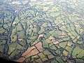 Country southeast of Crowborough, from the air - geograph.org.uk - 5149401.jpg 1,461 × 1,104; 495 KB
-
 Countryside near Boarshead - geograph.org.uk - 2186857.jpg 640 × 430; 123 KB
-
 Countryside near Boarshead - geograph.org.uk - 2186878.jpg 640 × 430; 153 KB
-
 Countryside near Sandhill Farm - geograph.org.uk - 2182738.jpg 640 × 430; 138 KB
-
 Countryside north of Boarshead - geograph.org.uk - 2195512.jpg 640 × 430; 137 KB
-
 Cowford Bridge and lane - geograph.org.uk - 3717147.jpg 1,546 × 1,024; 1.93 MB
-
 Cowford Bridge Lane - geograph.org.uk - 3716493.jpg 1,546 × 1,024; 2.2 MB
-
 Cowl at Orznash Oast - geograph.org.uk - 3967326.jpg 4,320 × 3,240; 5.28 MB
-
 Cows on Railway - geograph.org.uk - 322056.jpg 640 × 428; 106 KB
-
 Crossroads at Burnt Oak - geograph.org.uk - 1950273.jpg 1,600 × 1,200; 716 KB
-
 Crossroads at Cowford Bridge - geograph.org.uk - 3973873.jpg 1,024 × 768; 216 KB
-
 Cuckoo Line Stores on Yew Tree Lane - geograph.org.uk - 2040205.jpg 2,592 × 1,944; 1.67 MB
-

-
 Culvert under Steep Road near Pinehurst Cottage - geograph.org.uk - 1994084.jpg 1,600 × 1,200; 570 KB
-
 Cycle rack at Eridge station - geograph.org.uk - 2497109.jpg 640 × 480; 141 KB
-
 Danegate Lane - geograph.org.uk - 3716432.jpg 3,696 × 2,448; 2.36 MB
-

-
 Decorative wall topping at Carriage House - geograph.org.uk - 1996999.jpg 1,600 × 1,200; 530 KB
-
 Deer by the Sussex Border Path - geograph.org.uk - 2182464.jpg 640 × 430; 138 KB
-
 Deer in a field of Winter wheat - geograph.org.uk - 2182467.jpg 640 × 430; 148 KB
-
 Deer on a headland strip - geograph.org.uk - 2182471.jpg 640 × 430; 157 KB
-

-
 Delvings in wood by Five Ashes Road - geograph.org.uk - 2885518.jpg 640 × 480; 224 KB
-
 Detail, East Window, St Denys church, Rotherfield - geograph.org.uk - 4185565.jpg 720 × 2,102; 1.29 MB
-
 Dewlands Hall - geograph.org.uk - 5768056.jpg 1,600 × 983; 430 KB
-
 Dewlands Hill - geograph.org.uk - 5768346.jpg 1,024 × 645; 236 KB
-
 Dewlands Hill descending to Coe's Farm - geograph.org.uk - 1998050.jpg 1,600 × 1,200; 576 KB
-
 Dewlands Manor Golf Course - geograph.org.uk - 5767866.jpg 1,024 × 678; 139 KB
-
 Diesel haulage from Eridge - geograph.org.uk - 2497101.jpg 1,024 × 768; 408 KB
-
 Disused farm buildings south of Redbridge Farm - geograph.org.uk - 1950116.jpg 1,600 × 1,200; 506 KB
-
 Doggets on Hadlow Down Road - geograph.org.uk - 1950741.jpg 1,600 × 1,200; 442 KB
-
 Driveway to Forest Farm - geograph.org.uk - 3716427.jpg 3,560 × 2,212; 5.54 MB
-
 Dry Ski Slope, Bowles Outdoor Centre - geograph.org.uk - 2184520.jpg 640 × 430; 171 KB
-
 Dry Ski Slope, Bowles Outdoor Centre - geograph.org.uk - 2184526.jpg 640 × 430; 163 KB
-
 Dry stream bed in Walsted Wood - geograph.org.uk - 1998437.jpg 1,600 × 1,200; 713 KB
-
 Duck Pond - geograph.org.uk - 5684330.jpg 1,024 × 634; 284 KB
-
 East Window, St Denys church, Rotherfield - geograph.org.uk - 4185555.jpg 2,454 × 3,258; 5.25 MB
-
 Edge of Hole Wood - geograph.org.uk - 2195569.jpg 640 × 430; 142 KB
-
 Entering Eridge Green on the A26 - geograph.org.uk - 1840833.jpg 640 × 384; 74 KB
-
 Entering Mark Cross, A267 - geograph.org.uk - 4786666.jpg 640 × 482; 99 KB
-
 Entrance to Briar House Farm - geograph.org.uk - 5768383.jpg 1,600 × 1,071; 564 KB


_-_geograph.org.uk_-_1840812.jpg)


_-_geograph.org.uk_-_2361129.jpg)
_and_Brickyard_Lane_junction_-_geograph.org.uk_-_2393943.jpg)


.jpg)


.jpg)

.jpg)
.jpg)


