Category:Roads in the London Borough of Bromley
Jump to navigation
Jump to search
Subcategories
This category has the following 2 subcategories, out of 2 total.
Media in category "Roads in the London Borough of Bromley"
The following 47 files are in this category, out of 47 total.
-

-
 A20 - the wide open road - geograph.org.uk - 2620825.jpg 640 × 428; 77 KB
-
 A20 goes over Hockenden Lane. - geograph.org.uk - 1187885.jpg 640 × 481; 47 KB
-
 A20 past Swanley - geograph.org.uk - 1211074.jpg 640 × 427; 49 KB
-
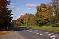
 A21 in Autumn - geograph.org.uk - 870021.jpg 640 × 480; 118 KB
-
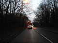
 A21 looking east - geograph.org.uk - 1021760.jpg 640 × 426; 96 KB
-
 A224 Orpington Bypass - geograph.org.uk - 1021778.jpg 640 × 426; 91 KB
-

-
 Bromley Road crossing Chislehurst Common - geograph.org.uk - 5192307.jpg 4,198 × 3,175; 2.92 MB
-
 Bromley Road on Chislehurst Common - geograph.org.uk - 3270290.jpg 2,048 × 1,536; 1.52 MB
-
 Buggins Hill on Hookwood Road - geograph.org.uk - 1575582.jpg 640 × 427; 88 KB
-
 Chapmans Lane, St Paul's Cray - geograph.org.uk - 1580624.jpg 640 × 480; 147 KB
-
 Chislehurst Common - geograph.org.uk - 4715295.jpg 1,447 × 1,080; 367 KB
-
 Downe Road - Steep Hill 25^ - geograph.org.uk - 1427071.jpg 640 × 400; 102 KB
-
 Fishponds Road - geograph.org.uk - 4024963.jpg 4,000 × 3,000; 4.43 MB
-
 Fishponds Road, Keston, BR2 - geograph.org.uk - 2269396.jpg 640 × 480; 136 KB
-
 Footbridge over A20 - geograph.org.uk - 3192019.jpg 640 × 428; 84 KB
-
 Hangrove Hill, Downe BR6 - geograph.org.uk - 67928.jpg 640 × 481; 131 KB
-
 Hockenden Lane - geograph.org.uk - 2512950.jpg 4,000 × 3,000; 4.32 MB
-
 Hockenden Lane - geograph.org.uk - 3238187.jpg 2,048 × 1,536; 1.49 MB
-
 Hockenden Lane approaching the A20 flyover - geograph.org.uk - 3237911.jpg 2,048 × 1,536; 1.49 MB
-
 Jewels Hill, near Biggin Hill - geograph.org.uk - 1718768.jpg 2,048 × 1,536; 1.24 MB
-
 Layhams Road - geograph.org.uk - 1718758.jpg 2,048 × 1,536; 1.03 MB
-
 Layhams Road, near Nash - geograph.org.uk - 1718745.jpg 2,048 × 1,536; 978 KB
-
 Layhams Road, New Addington - geograph.org.uk - 2013203.jpg 640 × 393; 149 KB
-
 Looking along the A20 - geograph.org.uk - 2479518.jpg 4,000 × 3,000; 4 MB
-
 Looking along the A21 (Sevenoaks Road) - geograph.org.uk - 3626351.jpg 4,000 × 3,000; 4.01 MB
-
 Nash Lane, Nash - geograph.org.uk - 1718726.jpg 2,048 × 1,536; 1.13 MB
-
 Nash Lane, Nash - geograph.org.uk - 1718735.jpg 2,048 × 1,536; 1.23 MB
-
 North Pole Lane, Nash - geograph.org.uk - 1718732.jpg 2,048 × 1,536; 1.01 MB
-
 North Pole Lane, near Nash - geograph.org.uk - 1718740.jpg 2,048 × 1,536; 1.08 MB
-
 Oaklands Lane, Biggin Hill - geograph.org.uk - 1718779.jpg 2,048 × 1,536; 1.12 MB
-
 Salt Box Hill. Biggin Hill - geograph.org.uk - 1718777.jpg 2,048 × 1,536; 1.13 MB
-
 Saltbox Hill - geograph.org.uk - 1954913.jpg 1,024 × 683; 227 KB
-
 Sheep Barn Lane - geograph.org.uk - 1718783.jpg 2,048 × 1,536; 1.08 MB
-
 Shire Lane, Farnborough - geograph.org.uk - 1966077.jpg 640 × 480; 259 KB
-
 Skeet Hill Lane - geograph.org.uk - 2536541.jpg 3,072 × 2,304; 2.34 MB
-
 Skeet Hill Lane - geograph.org.uk - 3111329.jpg 640 × 425; 451 KB
-
 Skeet Hill Lane - geograph.org.uk - 3262377.jpg 4,000 × 3,000; 4.15 MB
-
 Skeet Hill Lane - geograph.org.uk - 3334839.jpg 4,000 × 3,000; 4.42 MB
-
 Skeet Hill Lane and Skibbs Lane crossroads - geograph.org.uk - 2536546.jpg 3,072 × 2,304; 2.35 MB
-
 Skeet Hill Lane overlooking Cookham farm - geograph.org.uk - 2801809.jpg 1,600 × 1,200; 580 KB
-
 Skeet Hill Lane, Ramsden - geograph.org.uk - 2801803.jpg 1,600 × 1,200; 685 KB
-
 Skeet Hill Lane, Ramsden - geograph.org.uk - 2801806.jpg 1,600 × 1,200; 577 KB
-
 Skeet Hill Lane, Ramsden - geograph.org.uk - 2801820.jpg 1,600 × 1,200; 540 KB
-
 Skibbs Lane, Chelsfield - geograph.org.uk - 3262388.jpg 4,000 × 3,000; 4.27 MB
-
 Star Lane, near Hockenden, Kent - geograph.org.uk - 154772.jpg 640 × 480; 141 KB


_-_geograph.org.uk_-_3626351.jpg)


